Evolène – Arolla

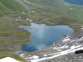
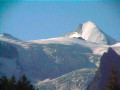
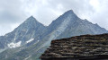
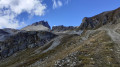
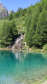
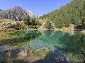
This third stage will take you from Evolène to Arolla. The route begins by crossing through Evolène, passing by its imposing church. After crossing the Borgne, a fairly steep path through the forest climbs to the Mayens de la Giette, then on to the Mayens de la Cretta. You’ll need to pass the Etoile mountain pasture and cross the Maresse torrent to begin the descent towards Les Jutes. After a gentle climb towards Lac Bleu, the final stretch alternates between short ascents and descents before reaching the village of Arolla. During this stage, you’ll enjoy views of Mont Collon (3,637 metres) and the Pigne Arolla (3,790 metres).

Details

n°110762759
Creation:
Last update:
Last review:
–
  • Walking
    Activity: Walking
  • ↔
    Distance: 9.23 mi
  • ◔
    Average duration: 7h 55 
  • ▲
    Difficulty: Difficult

  • ⚐
    Back to start: No
  • ↗
    Ascent: + 4,226 ft
  • ↘
    Descent: - 2,126 ft

  • ▲
    Highest point: 7,523 ft
  • ▼
    Lowest point: 4,403 ft

Waypoints

  1. S : mi 0 - alt. 4,505 ft - Evolène – Hôtel de la Dent Blanche
  2. 1 : mi 0.09 - alt. 4,508 ft - Route de Fonville
  3. 2 : mi 0.19 - alt. 4,446 ft - Sign No. 6
  4. 3 : mi 0.41 - alt. 4,419 ft - Sign No. 6
  5. 4 : mi 0.51 - alt. 4,485 ft - Crossroads
  6. 5 : mi 1.6 - alt. 5,784 ft - La Possession
  7. 6 : mi 1.95 - alt. 5,820 ft - Les Mayens de la Giette
  8. 7 : mi 2.21 - alt. 5,850 ft - Les Darbès
  9. 8 : mi 2.47 - alt. 6,125 ft - Sign No. 6
  10. 9 : mi 2.58 - alt. 6,243 ft - Mayens de la Cretta
  11. 10 : mi 3.11 - alt. 6,818 ft - Sign No. 6
  12. 11 : mi 3.62 - alt. 7,172 ft - Alpage de l’Etoile
  13. 12 : mi 6.28 - alt. 6,506 ft - Les Jutes
  14. 13 : mi 7.15 - alt. 6,886 ft - Lac Bleu (2091 m) - Suisse
  15. 14 : mi 7.56 - alt. 6,759 ft - Sign No. 6
  16. 15 : mi 8.9 - alt. 6,699 ft - Côte 2037
  17. 16 : mi 9.2 - alt. 6,591 ft - Sign No. 6
  18. E : mi 9.23 - alt. 6,578 ft - Arolla – Hôtel du Glacier

Notes

This hiking route follows the Alpine Passes Trail, which is marked on Swiss maps.

Signposting: at every major junction, you will find signposts:
- Sign No. 6 with a No. 6 sticker indicating this trail.
- R sign: Yellow sign with a hiker pictogram

Before setting off, it is advisable to check the Suisse Topo website for any trail closures and diversions. This information is updated in real time.

As well as the Visorando app, you can also download the swisstopo app ( free of charge), where you’ll find this information too.

Transport: Timetables

Weather: before setting off, check the Swiss Weather Service or Météo Blue

Hiking equipment, particularly good walking boots.

Accommodation:

Other walks in the area

For more walks, use our search engine .

The GPS track and description are the property of this route's author. Please do not copy them without permission.