


View the details for each stage.
From Airolo to Grimentz via the Alpine Passes Trail


This first section of the Alpine Passes Trail offers magnificent panoramic views of the peaks of the Ticino and Valais Alps. You’ll enjoy numerous vantage points overlooking peaks such as the Dom and the Mischabel massif, the Weisshorn, the Matterhorn and the Dent Blanche.
Details
Creation:
Last update:
Last review:
–
–
-
 Activity: Walking
-
 Distance: 126.79 mi
-
 Average duration: 11 days
-
 Difficulty: Very difficult
-
-
 Back to start: No
-
 Ascent: + 43,140 ft
-
 Descent: - 41,673 ft
-
-
 Highest point: 9,469 ft
-
 Lowest point: 3,586 ft
-
 Country:
Switzerland
-
 Area: Alps
-
 City:
Airolo
-
 Start: N 46.527732° / E 8.608818°
-
 End: N 46.176337° / E 7.57438°
-


 Hour-by-hour weather
Stages of the route
This route needs several days, find the details below:
Notes
Worth a visit
View the details for each stage.
Other walks in the area
Airolo – Capanna Corno-Gries
 Visorando Member16.21 mi
+5,709 ft
-1,844 ft
12h 25
Very difficult
Departure from Airolo (Ticino)
This first long stage will take you from Airolo to the Capanna Corno-Gries. The route passes through larch forests and offers numerous panoramic views all the way to the Corno-Gries hut. You’ll look out over the River Ticino and the villages of the Val Bedretto: Ossasco, Villa, Bedretto and Ronco.
Airolo - Gottardo Passo
 4.10 mi
+3,136 ft
-39 ft
4h 35
 Difficult
Departure from Airolo (Ticino)
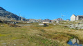
This first stage will take you to the St Gotthard Pass. The village of Airolo is located at the foot of two major Swiss passes: the Nufenen Pass and the Gottardo Passo. The climb to St Gotthard is challenging, with an elevation gain of nearly 1,000 metres over less than seven kilometres. At times, the trail follows the old St Gotthard road, which is entirely paved all the way to the pass.
From Airolo to Andermatt via the Via Gottardo
 12.12 mi
+3,245 ft
-2,267 ft
2 days
Difficult
Departure from Airolo (Ticino)
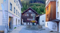
A superb route that crosses the famous St Gotthard Pass. You will set off from Airolo, a pretty Italian-speaking village, and arrive at the famous German-speaking resort of Andermatt. You will spend a night at the Ospizio del San Gottardo. This pass, which is very busy during the day with numerous tourists, quickly returns to calm and tranquillity in the evening.
Ospizio del San Gottardo – Capanna Piansecco
 12.17 mi
+4,423 ft
-4,921 ft
9h 25
Difficult
Departure from Airolo (Ticino)
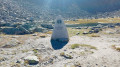
This third stage of the Vier Quellen Weg will take you from the Hospice da Saint Gothard to Capanna Piansecco. During the day, you’ll walk alongside the stunning Lake Lucendro. As you approach the Col de Lucendro, you’ll discover one of the sources of the Reuss (Gothardreuss). The final stretch of the route leading to Capanna Piansecco overlooks the Ticino.
Gottardo Passo - Andermatt
 8.02 mi
+108 ft
-2,228 ft
3h 45
 Moderate
Departure from Airolo (Ticino)
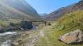
This second stage will take you to the charming village of Andermatt. Descending from the Passo Gottardo, you will follow the Gotthardreuss to Hospental, which joins the Furkareuss to form the Reuss. You will quickly leave theItalian-speaking canton of Ticinoand enter the German-speaking canton of Uri. Andermatt is a renowned winter sports resort.
Vermigel Hütte – Ospizio Gottardo
 7.32 mi
+2,746 ft
-2,539 ft
5h 45
Difficult
Departure from Andermatt (Canton of Uri)
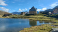
This second stage of the Vier Quellen Weg will take you from Cappana Vermigel to the Hospice da Saint Gothard. Although this route does not take you to a spring, reaching the Saint Gothard Pass serves as a reminder that the eponymous massif is home to the four sources featured on the route: the Rhine, the Reuss, the Ticino and the Rhône.
Capanna Piansecco – Obergesteln
 11.78 mi
+2,028 ft
-4,055 ft
7h 10
Difficult
Departure from Bedretto (Ticino)
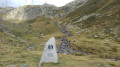
This fourth stage of the Vier Quellen Weg will take you from Cappana Piansecco to Obergesteln. During the day, you’ll discover the source of the Ticino (Tessin). An engraved marker indicates this source. You’ll cross the Nufenen Pass, which will take you to Obergesteln, a charming little village on the banks of the Rhône.
Oberalppass – Vermigel Hütte
 8.47 mi
+2,612 ft
-2,621 ft
6h 10
Difficult
Departure from Tujetsch (Grisons)
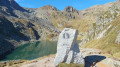
This first stage of the Vier Quellen Weg will take you from the Oberalppass to the Capanna Vermigel. During the day, you’ll discover Lake Tuma, one of the sources of the Rhine. An engraved marker indicates this source. As you climb towards the Col de Maighels, you’ll walk alongside another branch of the Rhine (Rein da Maighels), which has its source at the Maighels Glacier.
For more walks, use our search engine .
The GPS track and description are the property of this route's author. Please do not copy them without permission.

