Ospizio del San Gottardo – Capanna Piansecco

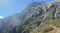
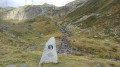
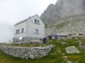
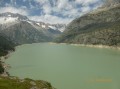
This third stage of the Vier Quellen Weg will take you from the Hospice da Saint Gothard to Capanna Piansecco. During the day, you’ll walk alongside the stunning Lake Lucendro. As you approach the Col de Lucendro, you’ll discover one of the sources of the Reuss (Gothardreuss). The final stretch of the route leading to Capanna Piansecco overlooks the Ticino.

This walk is part of a multi-day hike: Vier Quellen Weg

Details

n°107736131
Creation:
Last update:
Last review:
–
  • Walking
    Activity: Walking
  • ↔
    Distance: 12.17 mi
  • ◔
    Average duration: 9h 25 
  • ▲
    Difficulty: Difficult

  • ⚐
    Back to start: No
  • ↗
    Ascent: + 4,423 ft
  • ↘
    Descent: - 4,921 ft

  • ▲
    Highest point: 8,448 ft
  • ▼
    Lowest point: 6,306 ft

Photos

Description of the walk

The starting point for this stage is at the Ospizio San Gottardo

Signposting: signposts bearing the No. 49 symbol on a green background (Vier Quellen Weg).

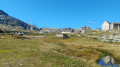
(S) From the Ospizio San Gottardo, take the old Saint Gotthard Pass road, skirting Lago della Piazza. You’ll come across a sign marked No. 49 at Lago di San Carlo. Follow the path that branches off from the road, then rejoin the road until you reach a tunnel beneath the New Saint Gotthard Road.

(1) Just after the tunnel, follow the sign for No. 49. Take a road closed to traffic as far as an old car park.

(2) Turn left and follow the direction indicated by a ‘Sentiero’ sign. Begin the climb towards the Lago Lucendro dam via a few fairly steep hairpin bends.

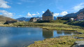
(3) Keep to the left and walk alongside Lake Lucendro, which lies below on the left. This will take you to the western end of the lake.

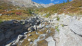
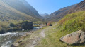
(4) Continue south and begin the ascent towards the Col de Lucendro after crossing the Alpe of the same name. After a few sections over rocks and scree, you’ll reach a pretty little unnamed lake where an engraved marker indicating the source of the Reuss stands.

(5) Continue southwards along the path and you will soon reach the pass.

(6) Turn left (east) and head downhill.

(7) At the junction, turn right, continuing downhill.

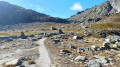
(8) You’ll come out onto a track; follow it to the right (south-west). Walk for a long while until you reach a stream, then signpost No. 49.

(9) Take the track on the left and follow it to another fork (sign No. 49).

(10) Keep to the right and follow an almost flat path. Pass a building on your right and arrive at a crossroads.

(11) Carry on straight ahead.

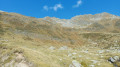
(12) Continue westwards until you reach a stream. Begin a new, fairly steep ascent through scree up to Gane di Ruino. Descend towards Alpe di Ruino and continue along the path leading to Capanna Piansecco (E).

Waypoints

  1. S : mi 0 - alt. 7,159 ft - Ospizio del San Gottardo
  2. 1 : mi 0.84 - alt. 6,804 ft - Sign No. 49 – Tunnel
  3. 2 : mi 0.99 - alt. 6,726 ft - Signpost ‘Sentiero’ – Car park
  4. 3 : mi 1.77 - alt. 7,067 ft - Dam at - Lago di Lucendro
  5. 4 : mi 2.88 - alt. 7,100 ft - Western end of the - Lago di Lucendro
  6. 5 : mi 4.24 - alt. 8,304 ft - Unnamed lake – Reuss source marker
  7. 6 : mi 4.61 - alt. 8,448 ft - Sign No. 49 - Passo di Lucendro
  8. 7 : mi 5.14 - alt. 7,884 ft - Crossroads
  9. 8 : mi 5.92 - alt. 6,850 ft - T-junction – Trail
  10. 9 : mi 7.67 - alt. 6,765 ft - Signpost No. 49 – Fork in the road
  11. 10 : mi 8.05 - alt. 6,414 ft - Signpost No. 49 – Fork in the road
  12. 11 : mi 9.25 - alt. 6,555 ft - Crossroads
  13. 12 : mi 9.96 - alt. 6,526 ft - Sign No. 49 – Junction
  14. E : mi 12.17 - alt. 6,660 ft - Capanna Piansecco

Notes

Hike completed by the author on 15 September 2026

This hike follows the Vier-Quellen-Weg route, which is marked on Swiss maps.

Signposting: at every major junction, you will find signposts:
- Sign No. 49 or P49 with a No. 49 sticker indicating this trail.
- R sign: Yellow sign with a hiker pictogram

Before setting off, it is advisable to check the Suisse Topo website for any trail closures and diversions that may be in place. This information is updated in real time.

As well as the Visorando app, you can also download the swisstopo app ( free of charge), where you’ll find this information too.

Transport: Timetables

Weather: before setting off, check the Swiss Weather Service or Météo Blue

Hiking kit, including good walking boots.

Accommodation at Capanna Piansecco: Capanna Piansecco

Worth a visit

  • The St Gotthard Pass
  • Lake Lucendro
  • The source of the Reuss.
  • The Lucendro Pass

Other walks in the area

For more walks, use our search engine .

The GPS track and description are the property of this route's author. Please do not copy them without permission.