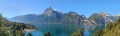
Seelisberg – Flüelen

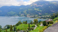
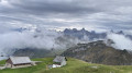
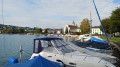
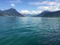
This seventh stage will take you from Seelisberg (UR) to Flüelen (UR). The route passes through the village of Seelisberg to Oberdorf, then climbs up to the Marienhöhe. The highlight of the day is near Beroldingen Castle. The descent towards the lake is quite steep. A final section, partly cobbled and featuring around 900 steps, leads to Bauen. The route then follows the lake’s shore, passing through the Harderband Tunnel , where light installations bring Swiss history to life. Once you reach the southern end of the lake, you’ll cross the Reuss, the main river feeding into Lake Lucerne

This walk is part of a multi-day hike: Tour du Lac des Quatre Cantons

Details

n°109931402
Creation:
Last update:
Last review:
–
  • Walking
    Activity: Walking
  • ↔
    Distance: 10.74 mi
  • ◔
    Average duration: 7h 00 
  • ▲
    Difficulty: Moderate

  • ⚐
    Back to start: No
  • ↗
    Ascent: + 2,395 ft
  • ↘
    Descent: - 3,438 ft

  • ▲
    Highest point: 2,867 ft
  • ▼
    Lowest point: 1,414 ft

Waypoints

  1. S : mi 0 - alt. 2,487 ft - Hotel Bellevue – Seelisberg
  2. 1 : mi 0.29 - alt. 2,625 ft - Chilendorf
  3. 2 : mi 0.74 - alt. 2,782 ft - Sign No. 99
  4. 3 : mi 0.96 - alt. 2,772 ft - Oberdorf
  5. 4 : mi 1.42 - alt. 2,766 ft - Marienhöhe
  6. 5 : mi 1.64 - alt. 2,795 ft - Sign No. 99
  7. 6 : mi 1.89 - alt. 2,733 ft - Schlänggen
  8. 7 : mi 2.2 - alt. 2,867 ft - Sign No. 99
  9. 8 : mi 2.48 - alt. 2,690 ft - Wissigstrasse
  10. 9 : mi 3.6 - alt. 2,044 ft - Sign No. 99
  11. 10 : mi 4.12 - alt. 1,440 ft - Bauen (jetty)
  12. 11 : mi 5.02 - alt. 1,660 ft - tunnel de Harderband
  13. 12 : mi 5.73 - alt. 1,440 ft - Isleten
  14. 13 : mi 7.33 - alt. 1,480 ft - Bolzbach
  15. 14 : mi 8.23 - alt. 1,434 ft - Seehof
  16. 15 : mi 8.83 - alt. 1,427 ft - Sign No. 99
  17. 16 : mi 9.4 - alt. 1,434 ft - The mouth of the Reuss where it flows into the lake – detour
  18. 17 : mi 10.18 - alt. 1,421 ft - End of diversion
  19. 18 : mi 10.48 - alt. 1,427 ft - Sign No. 99
  20. E : mi 10.74 - alt. 1,434 ft - Flüelen, railway station

Notes

Hike completed by the author on 10 October 2026

This hiking route follows the ‘Weg der Schweiz’, which is marked on Swiss maps.

Signposting: at every major junction, you will find signposts:
- Sign No. 99 or P99 with a No. 99 sticker indicating this trail.
- R sign: a yellow sign with a hiker pictogram

Before setting off, it is advisable to check the Suisse Topo website for any trail closures and diversions. This information is updated in real time.

As well as the Visorando app, you can also download the swisstopo app ( free of charge), where you’ll find this information too.

Transport: Timetables

Weather: before setting off, check the Swiss Weather Service or Météo Blue

Hiking kit, including good walking boots.

Accommodation: Take the train from Flülen to Brunnen

Worth a visit

Other walks in the area

For more walks, use our search engine .

The GPS track and description are the property of this route's author. Please do not copy them without permission.