Alpnachstad – Bürgenstock

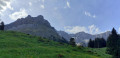
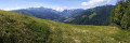
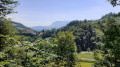
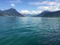
This fourth stage will take you from Alpnachstad (OW) to Bürgenstock (NW). The start of the stage passes through the meadows of the Alpnachstader Ried before descending to Stansstad via the Rotzlochschlucht gorge. After a visit to the town of Stansstad, taking in the Schnitzturm, the path runs alongside the lake to Harissen Bay. From there, the steep climb to the former resort of Fürigen begins. The gradient eases off towards Ober Schilt before the ascent to Bürgenstock begins.

This walk is part of a multi-day hike: Tour du Lac des Quatre Cantons

Details

n°109483916
Creation:
Last update:
Last review:
–
  • Walking
    Activity: Walking
  • ↔
    Distance: 9.79 mi
  • ◔
    Average duration: 7h 15 
  • ▲
    Difficulty: Difficult

  • ⚐
    Back to start: No
  • ↗
    Ascent: + 3,159 ft
  • ↘
    Descent: - 1,729 ft

  • ▲
    Highest point: 3,169 ft
  • ▼
    Lowest point: 1,401 ft

Waypoints

  1. S : mi 0 - alt. 1,407 ft - Alpnachstad SBB-CFF railway station
  2. 1 : mi 0.5 - alt. 1,427 ft - Sign No. 98
  3. 2 : mi 1.34 - alt. 1,424 ft - Sarneraa
  4. 3 : mi 2.96 - alt. 2,021 ft - Sign No. 98
  5. 4 : mi 3.24 - alt. 1,883 ft - White-Red-White marker
  6. 5 : mi 3.85 - alt. 1,663 ft - Hinterbach
  7. 6 : mi 3.97 - alt. 1,647 ft - Crossroads
  8. 7 : mi 4.41 - alt. 1,447 ft - Sign No. 98
  9. 8 : mi 5.56 - alt. 1,430 ft - Stansstad railway station
  10. 9 : mi 5.87 - alt. 1,421 ft - Sign No. 98
  11. 10 : mi 6.02 - alt. 1,427 ft - Schnitzturm
  12. 11 : mi 6.64 - alt. 1,493 ft - Harissen Bay
  13. 12 : mi 7.42 - alt. 2,116 ft - Füringen
  14. 13 : mi 7.84 - alt. 2,267 ft - Ober Schilt
  15. 14 : mi 8.08 - alt. 2,674 ft - Sign No. 98
  16. 15 : mi 9.19 - alt. 2,871 ft - Bürgenstock
  17. E : mi 9.79 - alt. 2,831 ft - Bürgenstock Resort (Bus Zentrum)

Notes

Hike completed by the author on 7 October 2026

The route for this hike follows the Waldstätterweg, which is marked on Swiss maps.

Signposting: at every major junction, you’ll find signposts:
- Sign No. 98 or P98 with a No. 98 sticker indicating this trail.
- R sign: a yellow sign with a hiker pictogram

Before setting off, it is advisable to check the Suisse Topo website for any trail closures and diversions. This information is updated in real time.

As well as the Visorando app, you can also download the free swisstopo app, where you’ll find this information too.

Transport: Timetables

Weather: before setting off, check the Swiss Weather Service or Météo Blue

Hiking equipment, particularly good walking boots.

Accommodation: Take the bus from Bürgenstock to Stansstad – there are three hotels in Bürgenstock (5-star, around 1,000 CHF per night), so it’s best to stay in Stansstad.

Worth a visit

  • Alpnachstad
  • The Rotzlochschlucht gorge
  • Sansstad
  • Fürigen
  • Bürgenstock Resort: a prestigious 5-star luxury hotel complex. Founded in the late19th century (1873), the resort has hosted numerous famous figures (including Audrey Hepburn, Konrad Adenauer and Jimmy Carter) as well as international conferences and diplomatic summits (notably on peace in Ukraine in 2024).

Other walks in the area

For more walks, use our search engine .

The GPS track and description are the property of this route's author. Please do not copy them without permission.