Morgins – Torgon

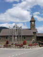
This ninth stage will take you from Morgins to Torgon. The start of the route climbs towards the Col des Portes du Culet, which offers a magnificent view of the Dents du Midi. The route continues towards Portes D’Onne and then on to the Tour de Don, where you can enjoy views of the Mont Blanc massif and Lake Geneva. A fairly steep ridge then leads to the Col de la Reculaz. Alpine pastures and forests alternate during the descent towards Torgon. At Les Fignards, you’ll cross a 150-metre-long footbridge , rising to a height of 28 metres above the Avançon torrent.

Details

n°110961698
Creation:
Last update:
Last review:
–
  • Walking
    Activity: Walking
  • ↔
    Distance: 11.45 mi
  • ◔
    Average duration: 7h 55 
  • ▲
    Difficulty: Difficult

  • ⚐
    Back to start: No
  • ↗
    Ascent: + 3,068 ft
  • ↘
    Descent: - 3,780 ft

  • ▲
    Highest point: 6,516 ft
  • ▼
    Lowest point: 3,553 ft

Waypoints

  1. S : mi 0 - alt. 4,288 ft - Morgins – Hôtel Helvetia
  2. 1 : mi 0.68 - alt. 4,662 ft - Chemin de Sépaz
  3. 2 : mi 1.94 - alt. 5,558 ft - Hiking sign – Turn left
  4. 3 : mi 2.5 - alt. 5,866 ft - Sign No. 6 - Portes du Culet
  5. 4 : mi 2.81 - alt. 5,591 ft - Sign No. 6 – Chalet Neuf
  6. 5 : mi 5.16 - alt. 6,263 ft - Sign No. 6 - Portes d'Onne (1911 m)
  7. 6 : mi 5.76 - alt. 6,499 ft - Sign No. 6 - Tour de Don
  8. 7 : mi 6.22 - alt. 6,214 ft - Sign No. 6 – Tronchey
  9. 8 : mi 6.73 - alt. 5,919 ft - Sign No. 6 - Col de Reculaz (1807 m)
  10. 9 : mi 7.53 - alt. 5,121 ft - Sign No. 6 – Croix
  11. 10 : mi 8.52 - alt. 4,882 ft - Sign No. 6
  12. 11 : mi 9.04 - alt. 4,593 ft - Sign No. 6 – Eusin
  13. 12 : mi 10.43 - alt. 3,747 ft - Route de la Jorette
  14. 13 : mi 10.62 - alt. 3,707 ft - Jorette Footbridge
  15. 14 : mi 11.25 - alt. 3,596 ft - Sign No. 6 – Torgon
  16. E : mi 11.45 - alt. 3,556 ft - Torgon – Hôtel de Torgon

Notes

This hiking route follows the Chemin des cols alpins, which is marked on Swiss maps.

Signposting: at every major junction, you will find signposts:
- Sign No. 6 with a No. 6 sticker indicating this trail.
- R sign: Yellow sign with a hiker pictogram

Before setting off, it is advisable to check the Suisse Topo website for any trail closures and diversions. This information is updated in real time.

As well as the Visorando app, you can also download the swisstopo app ( free of charge), where you’ll find this information too.

Transport: Timetables

Weather: before setting off, check the Swiss Weather Service or Météo Blue

Hiking equipment, particularly good walking boots.

Accommodation:

Other walks in the area

For more walks, use our search engine .

The GPS track and description are the property of this route's author. Please do not copy them without permission.