Vitznau – Küssnacht am Rigi

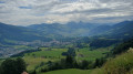
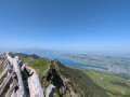
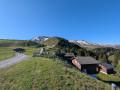
This first stage will take you from Vitznau (LU) to Küssnacht am Rigi (SZ). The start of the route is a long climb up numerous steps and ladders to Oberwilen. The route passes above Weggis and gradually descends towards the Hertenstein peak before turning towards Lake Küssnacht.

This walk is part of a multi-day hike: Tour du Lac des Quatre Cantons

Details

n°109299092
Creation:
Last update:
Last review:
–
  • Walking
    Activity: Walking
  • ↔
    Distance: 11.25 mi
  • ◔
    Average duration: 7h 10 
  • ▲
    Difficulty: Difficult

  • ⚐
    Back to start: No
  • ↗
    Ascent: + 2,270 ft
  • ↘
    Descent: - 2,290 ft

  • ▲
    Highest point: 2,592 ft
  • ▼
    Lowest point: 1,421 ft

Waypoints

  1. S : mi 0 - alt. 1,447 ft - Hotel Terrasse am See
  2. 1 : mi 0.58 - alt. 1,460 ft - Sign No. 98
  3. 2 : mi 0.97 - alt. 1,854 ft - Sign No. 98
  4. 3 : mi 1.59 - alt. 2,044 ft - Langwilen
  5. 4 : mi 2.13 - alt. 2,562 ft - Sign No. 98
  6. 5 : mi 2.97 - alt. 2,274 ft - Bannholz
  7. 6 : mi 3.88 - alt. 1,772 ft - Linde
  8. 7 : mi 4.01 - alt. 1,791 ft - Zingenstrasse
  9. 8 : mi 4.46 - alt. 1,801 ft - Undereggi
  10. 9 : mi 5.47 - alt. 1,572 ft - Zopf
  11. 10 : mi 6.09 - alt. 1,542 ft - Sign No. 98
  12. 11 : mi 6.39 - alt. 1,608 ft - Côte 484
  13. 12 : mi 6.6 - alt. 1,621 ft - Sign No. 98
  14. 13 : mi 7.72 - alt. 1,476 ft - Röhrlistrasse
  15. 14 : mi 8.97 - alt. 1,608 ft - Gütschestrasse
  16. 15 : mi 9.97 - alt. 1,476 ft - Eichholternweg
  17. 16 : mi 10.81 - alt. 1,470 ft - Seemattzopfweg
  18. E : mi 11.25 - alt. 1,430 ft - Hotel Seehof – Küssnacht am Rigi

Notes

Hike completed by the author on 4 October 2026

The route for this hike follows the Waldstätterweg, which is marked on Swiss maps.

Signposting: at every major junction, you will find signposts:
- Sign No. 98 or P98 with a No. 98 sticker indicating this trail.
- R sign: a yellow sign with a hiker pictogram

Before setting off, it is advisable to check the Suisse Topo website for any trail closures and diversions. This information is updated in real time.

As well as the Visorando app, you can also download the free swisstopo app, where you’ll find this information too.

Transport: Timetables

Weather: before setting off, check the Swiss Weather Service or Météo Blue

Hiking equipment, particularly good walking boots.

Accommodation:

Worth a visit

  • Vitznau
  • Weggis
  • Küssnacht am Rigi
  • The Rigi

Other walks in the area

For more walks, use our search engine .

The GPS track and description are the property of this route's author. Please do not copy them without permission.