Obergesteln – Belvedere Furka

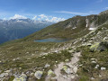
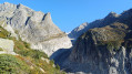
This fifth stage of the Vier Quellen Weg will take you from Obergesteln to the source of the Rhône. This magnificent route will have the Rhône as your constant companion. Right from the start, it will be by your side; you’ll follow it upstream to its source via the Furka Pass, then descend towards the historic Hotel Belvédère at the foot of the glacier. As with the other sources, you’ll find an engraved marker indicating the Rhône.

This walk is part of a multi-day hike: Vier Quellen Weg

Details

n°108446585
Creation:
Last update:
Last review:
–
  • Walking
    Activity: Walking
  • ↔
    Distance: 11.02 mi
  • ◔
    Average duration: 8h 40 
  • ▲
    Difficulty: Very difficult

  • ⚐
    Back to start: No
  • ↗
    Ascent: + 4,150 ft
  • ↘
    Descent: - 1,178 ft

  • ▲
    Highest point: 8,120 ft
  • ▼
    Lowest point: 4,432 ft

Description of the walk

The starting point for this stage is at the Hotel Hubertus in Obergesteln.

Signposting: Signposts bearing the No. 49 symbol on a green background (Vier Quellen Weg).

(S) From the Hotel Hubertus, head back to the left bank of the Rhône. Follow the river on your left until you reach Oberwald.

(1) Cross the Dorfstrasse and head for the next bridge over the Rhône. Take this bridge to cross the river.

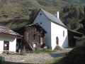
(2) At a place called Älmi, you’ll come out onto another path; follow it to the right. Head north-east. A little further on, take a few bends and you’ll reach St Niklaus Chapel.

(3) Continue north-north-east, walking alongside the Rhône, which lies below on your right. You’ll come to a bridge.

(4) Cross the Rhône again and climb up the other side. Then turn left and walk alongside the river, which lies below on the left. After a few hairpin bends, rejoin the Furkstrasse (Road 19).

(5) Follow the road carefully for about fifty metres.

(6) Leave the road and take a path on the right, just after the bridge over the Rhône. Climb steadily.

(7) At the entrance to Gletsch, rejoin the Furkstrasse and follow it to the left (pavement). Cross another bridge over the Rhône.

(8) Just after the bridge, turn left onto a footpath, following the direction indicated by sign No. 49. Cross a large meadow. Further on, cross a railway line. Walk along a good footpath between the railway line and Furkastrasse.

(9) Cross the road at a bend in Oberalpstafel and look out for sign No. 49 again. Continue between the Rhône and the railway line as far as the Muttbach-Belvédère stop. With a bit of luck, you might spot the steam train running on this line.

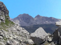
(10) Follow the railway line for a little while longer, then first turn left then right to begin the long climb towards the Furka Pass. After numerous hairpin bends, you’ll reach the pass, the highest point of this stage.

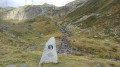
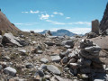
(11) Cross the large car park and then the road. Continue westwards along a path. Then head west-north-west, keeping parallel to the road. Pass an old military fort on your left, then another on your right, and head towards the Rhône Glacier. Descend towards the engraved marker for the “Vier Quellen”, which mentions the Rhône.

(12) Turn left and head downhill. Join Route 19 and follow it to the right as far as the former Hôtel Belvédère (closed since 2015), nestled in a hairpin bend in the road.

(E) Cross the car park and go into the souvenir shop. There is an admission charge of 6 CHF to use the path leading to the lake. Walk down to a viewing tower.

(13) Take the same path in the opposite direction back to the former hotel and the bus stop (E).

Then take a bus towards Oberwad for your accommodation for the night.

Waypoints

  1. S : mi 0 - alt. 4,442 ft - Obergesln – Hotel Hubertus
  2. 1 : mi 1.99 - alt. 4,498 ft - Oberwald
  3. 2 : mi 2.27 - alt. 4,554 ft - Intersection – Älmi
  4. 3 : mi 2.91 - alt. 4,829 ft - St. Niklaus Kapelle (Oberwald)
  5. 4 : mi 3.28 - alt. 4,954 ft - Sign No. 49 – Bridge over the - Rhône (River)
  6. 5 : mi 4.47 - alt. 5,594 ft - Furkastrasse (Road 19)
  7. 6 : mi 4.5 - alt. 5,597 ft - Trail start
  8. 7 : mi 4.95 - alt. 5,764 ft - Furkastrasse – Gletsch
  9. 8 : mi 5.14 - alt. 5,781 ft - Sign No. 49 – Trail start
  10. 9 : mi 6.99 - alt. 6,690 ft - Sign No. 49
  11. 10 : mi 7.4 - alt. 6,939 ft - Arrêt Muttbach-Belevdere
  12. 11 : mi 8.49 - alt. 7,927 ft - Crossing Route 19 - Furkapass
  13. 12 : mi 10 - alt. 7,759 ft - Crossroads
  14. 13 : mi 10.7 - alt. 7,323 ft - Viewpoint - Rhonegletscher / Glacier du Rhône
  15. E : mi 11.02 - alt. 7,418 ft - Belvedere Furka

Notes

Hike completed by the author on 17 September 2026

This hike follows the Vier-Quellen-Weg route, which is marked on Swiss maps.

Signposting: at every major junction, you will find signposts:
- Sign No. 49 or P49 with a No. 49 sticker indicating this trail.
- R sign: Yellow sign with a hiker pictogram

Before setting off, it is advisable to check for any trail closures and diversions on the Suisse Topo website. This information is updated in real time.

As well as the Visorando app, you can also download the swisstopo app ( free of charge), where you’ll find this information too.

Transport: Timetables

Weather: before setting off, check the Swiss Weather Service or Météo Blue

Hiking equipment, particularly good walking boots.

Accommodation: Hotel Furka

Worth a visit

  • Obergesteln
  • Oberwald
  • Furka Pass
  • The Belvédère Hotel
  • The Rhône Glacier: To get an idea of the impact of global warming, less than 25 years ago the Rhône Glacier reached right down to the road, and of course the Glacial Lake did not exist

Other walks in the area

For more walks, use our search engine .

The GPS track and description are the property of this route's author. Please do not copy them without permission.