Capanna Piansecco – Obergesteln

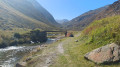
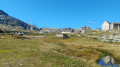
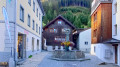
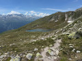
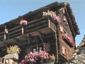
This fourth stage of the Vier Quellen Weg will take you from Cappana Piansecco to Obergesteln. During the day, you’ll discover the source of the Ticino (Tessin). An engraved marker indicates this source. You’ll cross the Nufenen Pass, which will take you to Obergesteln, a charming little village on the banks of the Rhône.

This walk is part of a multi-day hike: Vier Quellen Weg

Details

n°107807024
Creation:
Last update:
Last review:
–
  • Walking
    Activity: Walking
  • ↔
    Distance: 11.78 mi
  • ◔
    Average duration: 7h 10 
  • ▲
    Difficulty: Difficult

  • ⚐
    Back to start: No
  • ↗
    Ascent: + 2,028 ft
  • ↘
    Descent: - 4,055 ft

  • ▲
    Highest point: 8,015 ft
  • ▼
    Lowest point: 4,432 ft

Description of the walk

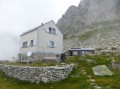
The starting point for this stage is at Capanna Piansecco.

Signposting: Signposts bearing the No. 49 symbol on a green background (Vier Quellen Weg).

(S) From Capanna Piansecco, head west. Follow the path until you reach a junction.

(1) Then turn left (ignore the sign on the right for Lago delle Pigne). Walk for a long stretch south-west, then west-south-west.

(2) At a hairpin bend, you’ll join Road 413 (the Col de Nufenen road), which you’ll cross numerous times during this stage. Follow it to the left for about fifty metres, then leave it to take a path that branches off to the left and runs parallel to the road.

(3) Go through a small tunnel under the road and follow the signs on Sign No. 49.

(4) At the junction, take the first path on the right, heading due west. You’ll come to an engraved boundary stone marked ‘Ticino’.

(5) Continue westwards uphill to the Nufenen Pass.

(6) Turn left and head downhill.

(7) Return to the Nufenen Pass road and follow it to the left for about fifty metres.

(8) At the first hairpin bend, to the right, leave Route 413 for a track that heads south and soon turns west-south-west.

(9) When the track turns left, take a path that branches off to the right. Head downwards and, via numerous hairpin bends, rejoin the Col de Nufenen road.

(10) Cross it carefully and continue the descent.

(11) Return to the road and follow it to the right as far as the hamlet of Ladstafel (bus stop).

(12) Turn left onto a path that runs alongside the River Agene.

(13) Cross the pass road with care and continue along a path that runs parallel to it for some time. You’ll reach a fork in the road just before Kittbrigg.

(14) Turn left (south-west) and continue down the slope.

(15) Cross the pass road with care. On a wider path than before, continue alongside the Agene.

(16) Cross the D413 once more, taking care as before, and continue alongside it. Join the road and follow it straight on to the hamlet of Zum Loch (sign No. 49).

(17) Then turn right (north-east), pass St Anne’s Chapel and reach the banks of the Rhône.

(18) Turn right and walk along the river on your left. You will soon reach the first houses in Obergesteln, including the Hotel Hubertus (E).

Waypoints

  1. S : mi 0 - alt. 6,486 ft - Capanna Piansecco
  2. 1 : mi 0.72 - alt. 6,811 ft - Sign No. 49 – Junction
  3. 2 : mi 2.53 - alt. 6,864 ft - Route 413
  4. 3 : mi 2.97 - alt. 6,683 ft - Sign No. 49 – Tunnel under Road 413
  5. 4 : mi 3.19 - alt. 6,644 ft - Crossroads
  6. 5 : mi 3.81 - alt. 6,926 ft - Source du Ticino signpost
  7. 6 : mi 5.06 - alt. 8,015 ft - Three-way junction - Nufenenpass / Passo della Novena (2439 m)
  8. 7 : mi 5.52 - alt. 7,572 ft - Sign No. 49
  9. 8 : mi 5.56 - alt. 7,566 ft - Junction – Trail
  10. 9 : mi 5.83 - alt. 7,546 ft - Trail start
  11. 10 : mi 6.75 - alt. 6,683 ft - Crossing Road 413
  12. 11 : mi 7.17 - alt. 6,335 ft - Route 413
  13. 12 : mi 7.28 - alt. 6,306 ft - Ladstafel – Path on the left
  14. 13 : mi 8.29 - alt. 5,781 ft - Crossing Road 413
  15. 14 : mi 9.96 - alt. 5,135 ft - Fork in the road
  16. 15 : mi 10.11 - alt. 5,069 ft - Crossing Road 413
  17. 16 : mi 10.8 - alt. 4,587 ft - Crossing Road 413
  18. 17 : mi 10.98 - alt. 4,465 ft - Sign No. 49 - Sankt-Anna-Kapelle (Zum Loch)
  19. 18 : mi 11.34 - alt. 4,436 ft - Rhône (River)
  20. E : mi 11.78 - alt. 4,442 ft - Obergesteln – Hotel Hubertus

Notes

Hike completed by the author on 16 September 2026

This hike follows the Vier-Quellen-Weg route, shown on Swiss maps.

Signposting: at every major junction, you will find signposts:
- Sign No. 49 or P49 with a No. 49 sticker indicating this trail.
- R sign: Yellow sign with a hiker pictogram

Before setting off, it is advisable to check the Suisse Topo website for any trail closures and diversions. This information is updated in real time.

As well as the Visorando app, you can also download the swisstopo app ( free of charge), where you’ll find this information too.

Transport: Timetables

Weather: before setting off, check the Swiss Weather Service or Météo Blue

Hiking equipment, particularly good walking boots.

Accommodation: Hotel Hubertus

Worth a visit

  • Nufenen Pass
  • Source du Ticino
  • Obergesteln

Other walks in the area

For more walks, use our search engine .

The GPS track and description are the property of this route's author. Please do not copy them without permission.