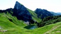
Torgon – Taney

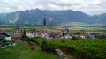
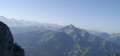
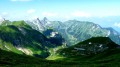
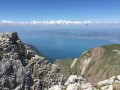
This tenth stage will take you from Torgon to Lake Taney. The route begins with a fairly steep climb to La Caux, then becomes more pleasant as it reaches Le Planellet. Les Dents once again offer magnificent views. The route continues with a descent towards the Col de Blancsex, down to the Plan de l’Ortie. The path climbs back up towards La Charmille with a few tricky sections, but these are secured by chains. A final climb leads to the Col de Taney before reaching the lovely Lac de Taney.

Details

n°110961731
Creation:
Last update:
Last review:
–
  • Walking
    Activity: Walking
  • ↔
    Distance: 6.05 mi
  • ◔
    Average duration: 5h 25 
  • ▲
    Difficulty: Difficult

  • ⚐
    Back to start: No
  • ↗
    Ascent: + 3,068 ft
  • ↘
    Descent: - 1,982 ft

  • ▲
    Highest point: 5,512 ft
  • ▼
    Lowest point: 3,553 ft

Waypoints

  1. S : mi 0 - alt. 3,556 ft - Torgon – Hôtel de Torgon
  2. 1 : mi 0.2 - alt. 3,599 ft - Multi-directional sign
  3. 2 : mi 2.54 - alt. 5,509 ft - Le Planellet
  4. 3 : mi 2.89 - alt. 5,121 ft - Blancsex Pass
  5. 4 : mi 4.36 - alt. 4,213 ft - Multi-directional sign
  6. 5 : mi 5.47 - alt. 4,639 ft - Multi-directional sign
  7. 6 : mi 5.68 - alt. 4,754 ft - Col de Taney (1440 m)
  8. 7 : mi 5.84 - alt. 4,705 ft - Sign No. 6
  9. E : mi 6.05 - alt. 4,669 ft - La Vouivre Inn and Mountain Refuge - Lac de Tanay

Notes

This hiking route follows the Chemin des cols alpins, which is marked on Swiss maps.

Signposting: at every major junction, you will find signposts:
- Sign No. 6 with a No. 6 sticker indicating this trail.
- R sign: Yellow sign with a hiker pictogram

Before setting off, it is advisable to check the Suisse Topo website for any trail closures and diversions. This information is updated in real time.

As well as the Visorando app, you can also download the swisstopo app ( free of charge), where you’ll find this information too.

Transport: Timetables

Weather: before setting off, check the Swiss Weather Service or Météo Blue

Hiking equipment, particularly good walking boots.

Accommodation:

Other walks in the area

For more walks, use our search engine .

The GPS track and description are the property of this route's author. Please do not copy them without permission.