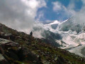
Arolla – Cabane des Dix

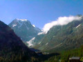
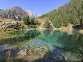
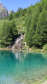
This fourth stage will take you from the village of Arolla to the Cabane des Dix. The route begins with an ascent through a forest up to the Tsijiores de Nouves mountain pasture. The climb to the Remointse mountain pasture follows a winding path. The Tsijiore Nouve glacier and the Pigne d’Arolla seem very close by. The climb continues to the Col de Riedmatten (the famous pass used by the Patrouille des Glaciers). At the pass, the start of the descent is very steep but secured by chains. The route continues, skirting a lake formed by the meltwater from the Cheilon Glacier. At the Cabane des Dix/Pas du Chat junction, a final climb leads to the Cabane des Dix. To choose between thePas de Chèvres and the Col de Riedmaten, see the ‘Practical Information’ section.

Details

n°110762798
Creation:
Last update:
Last review:
–
  • Walking
    Activity: Walking
  • ↔
    Distance: 6.72 mi
  • ◔
    Average duration: 6h 40 
  • ▲
    Difficulty: Very difficult

  • ⚐
    Back to start: No
  • ↗
    Ascent: + 4,108 ft
  • ↘
    Descent: - 1,119 ft

  • ▲
    Highest point: 9,688 ft
  • ▼
    Lowest point: 6,575 ft

Waypoints

  1. S : mi 0 - alt. 6,575 ft - Arolla – Hôtel du Glacier
  2. 1 : mi 0.07 - alt. 6,611 ft - Sign No. 6
  3. 2 : mi 0.39 - alt. 6,785 ft - Fork in the road
  4. 3 : mi 0.71 - alt. 7,008 ft - Sign No. 6
  5. 4 : mi 0.84 - alt. 7,119 ft - Tsijiores Nouves
  6. 5 : mi 1.67 - alt. 7,887 ft - La Remointse
  7. 6 : mi 3.29 - alt. 9,042 ft - Riedmatten/Pas de Chèvres junction
  8. 7 : mi 3.67 - alt. 9,531 ft - Riedmatten Pass
  9. 8 : mi 5.35 - alt. 8,648 ft - Cabane des Dix/Pas du Chat junction
  10. E : mi 6.72 - alt. 9,544 ft - Cabane des Dix

Notes

This walking route follows the Alpine Passes Trail, which is marked on Swiss maps.

Signposting: at every major junction, you’ll find signposts:
- Sign No. 6 with a No. 6 sticker indicating this trail.
- R sign: Yellow sign with a hiker pictogram

Before setting off, it is advisable to check the Suisse Topo website for any trail closures and diversions. This information is updated in real time.

As well as the Visorando app, you can also download the swisstopo app ( free of charge), where you’ll find this information too.

Transport: Timetables

Weather: before setting off, check the Swiss Weather Service or Météo Blue

Hiking kit, including good walking boots.

Accommodation:

Pas de Chèvres or Col de Riedmaten: The Alpine Passes Trail passes through the Col de Riedmaten.

To head over to the Cabane des Dix, there are two options once you reach the pass.

A webpage with a video shows both routes – the choice is yours!

Other walks in the area

For more walks, use our search engine .

The GPS track and description are the property of this route's author. Please do not copy them without permission.