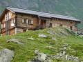
Prafleuri Hut – Louvie Hut

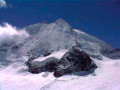
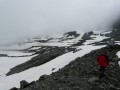
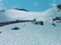
This sixth stage will take you from the Prafleuri Hut to the Louvie Hut. The route begins with the ascent to the Col de Prafleuri. The descent takes you down scree before you begin another climb up to the Col de Louvie (some sections require you to use your hands). The Col de Louvie is the perfect spot to take a break and enjoy the panoramic views of the Combins. A long descent will take you to the Louvie Hut, situated at the far end of the lake.

Details

n°110762924
Creation:
Last update:
Last review:
–
  • Walking
    Activity: Walking
  • ↔
    Distance: 6.89 mi
  • ◔
    Average duration: 5h 10 
  • ▲
    Difficulty: Difficult

  • ⚐
    Back to start: No
  • ↗
    Ascent: + 2,343 ft
  • ↘
    Descent: - 3,714 ft

  • ▲
    Highest point: 9,790 ft
  • ▼
    Lowest point: 7,231 ft

Waypoints

  1. S : mi 0 - alt. 8,698 ft - Prafleuri Hut
  2. 1 : mi 0.07 - alt. 8,632 ft - Sign No. 6
  3. 2 : mi 1.28 - alt. 9,790 ft - Prafleuri Pass
  4. 3 : mi 3.43 - alt. 9,603 ft - Louvie Pass
  5. 4 : mi 5.21 - alt. 8,615 ft - Elevation 2627
  6. 5 : mi 5.68 - alt. 7,959 ft - Map of La Gole
  7. 6 : mi 6.55 - alt. 7,329 ft - Sign No. 6 - Lac de Louvie
  8. E : mi 6.89 - alt. 7,313 ft - Lac de Louvie

Notes

This hiking route follows the Alpine Passes Trail, which is marked on Swiss maps.

Signposting: at every major junction, you will find signposts:
- Sign No. 6 with a No. 6 sticker indicating this trail.
- R sign: Yellow sign with a hiker pictogram

Before setting off, it is advisable to check the Suisse Topo website for any trail closures and diversions. This information is updated in real time.

As well as the Visorando app, you can also download the swisstopo app ( free of charge), where you’ll find this information too.

Transport: Timetables

Weather: before setting off, check the Swiss Weather Service or Météo Blue

Hiking kit, including good walking boots.

Accommodation:

Other walks in the area

For more walks, use our search engine .

The GPS track and description are the property of this route's author. Please do not copy them without permission.