


From Grimentz to the Great St Bernard Pass via the Alpine Passes Trail


This second section of the Alpine Passes Trail offers magnificent panoramic views of the peaks of the Valais Alps. You’ll enjoy numerous vantage points overlooking glaciers and peaks such as Mont Colomb, La Dent Blanche, the Combin Massif and the Mont Blanc massif.
Details
Creation:
Last update:
Last review:
–
–
-
 Activity: Walking
-
 Distance: 77.62 mi
-
 Average duration: 10 days
-
 Difficulty: Very difficult
-
-
 Back to start: No
-
 Ascent: + 30,338 ft
-
 Descent: - 27,520 ft
-
-
 Highest point: 9,790 ft
-
 Lowest point: 4,403 ft
-
 Country:
Switzerland
-
 Area: Alps
-
 City:
Grimentz
-
 Start: N 46.176367° / E 7.574202°
-
 End: N 45.86813° / E 7.16486°
-


 Hour-by-hour weather


Stages of the route
This route needs several days, find the details below:
Other walks in the area
Grimentz – Becs de Bossons Hut
 Visorando Member5.98 mi
+4,806 ft
-282 ft
6h 55
Very difficult
Departure from Grimentz (Valais)
This first stage will take you from Grimentz to the Becs de Bossons mountain hut. The route begins with the climb to Bendolla via a winding path. The ascent continues towards the Pointe de la Lona, which you go round to reach the area above Lake Lona. The climb continues as you make your way to the Pas de la Lona. The final, fairly steep climb will take you to the foot of the Becs de Bosson for a night’s stay at almost 3,000 metres.
Grimentz - Vercorin
 13.69 mi
+4,744 ft
-5,636 ft
10h 25
 Difficult
Departure from Grimentz (Valais)
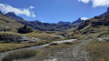
This seventh stage will take you to Vercorin. This small, traditional village is located on the border between the Vallon de Réchy and the Val d'Anniviers. From Grimentz, take the Bendolla cable car and follow the trails through the ski area to reach the Col du Louché. You will then descend into the magnificent Vallon de Réchy. After Lac du Louché, follow the Rèche to the towpath where the peaceful Bisse de Vercorin begins. You will soon reach the pretty little village of Vercorin.
Grimentz - Hotel Weisshorn
 7.13 mi
+3,786 ft
-1,325 ft
6h 35
Difficult
Departure from Grimentz (Valais)
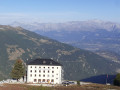
This eleventh stage takes place in the mid-mountains. The Hotel Weisshorn, perched at an altitude of nearly 2,400 metres, is visible from Grimentz. The path descends towards Navisence and then passes through the village of Ayer. Follow the Chemin des Cols Alpins to reach the Hotel Weisshorn. From its terrace, it offers a superb view of the summit that bears its name.
Becs de Bosson Hut and Pas de Lona from La Bendolla
8.36 mi
+3,084 ft
-3,074 ft
6h 30
Difficult
Departure from Grimentz (Valais)
This beautiful walk offers one of the finest panoramic views in the region from the Becs de Bosson hut. It’s well worth doing in fine weather to see as far as Mont Blanc. The walk is challenging due to the 900 m elevation gain and because the path is a bit tricky near the hut. The path is also somewhat exposed after the Lona mountain pasture.
Barage de Moiry - Cabane des Becs de Bosson
6.73 mi
+3,363 ft
-994 ft
6h 00
 Moderate
Departure from Grimentz (Valais)
Beautiful hike along a long alpine path, then a steeper trail at the end. At the hut, there is a route equipped with chains, and the one I took, which is less steep. Spectacular view from the hut, very warm welcome, and very comfortable for spending the night. Multiple options for returning to different valleys.
Moiry Dam – Arolla
8.58 mi
+4,970 ft
-5,679 ft
8h 15
Very difficult
Departure from Grimentz (Valais)
From Zinal to Arolla, you need to take a bus to the Moiry dam, which drops you off at the same spot in 50 mins–1 hour (it goes all the way up to Vissoie, which makes the journey longer). It’s also possible to try and find accommodation in St-Luc or Vissoie.
Becs de Bosson Mountain Hut – Evolène
6.93 mi
+171 ft
-5,423 ft
3h 20
Difficult
Departure from Saint-Martin (Canton du Valais) (Valais)
This second stage will take you from the Cabane des Becs de Bosson to Evolène. This route is almost entirely downhill. At the start, you’ll need to head down to the Pas de la Lona, then turn due west towards the hamlet of l’A Vieille. The route then crosses mountain pastures and forests to reach the Mayen de Volovron. The final part of the walk is mainly along stony tracks as far as Evolène.
Cabane des Becs de Bosson - Grimentz
 5.27 mi
+469 ft
-5,033 ft
2h 50
Difficult
Departure from Saint-Martin (Canton du Valais) (Valais)
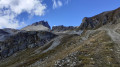
This sixth stage will take you to Grimentz, a beautiful village typical of the Val d'Anniviers. From the Col des Becs de Bosson, the route is all downhill. For the more experienced, it is possible to climb the Petit Bec de Bosson.
For this climb: at the pass, the route is marked by a white-blue-white sign. The final section is rated T4 to T5. Not for inexperienced climbers.
For more walks, use our search engine .
The GPS track and description are the property of this route's author. Please do not copy them without permission.

