Barme – Morgins

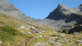
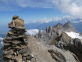
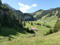
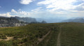
This eighth stage will take you from La Barmaz to the village of Morgins. The start of the route follows a ridge to the Col de Cou, which marks the border with France. After a descent into the Val d’Illiez, the route alternates between footpaths and tracks until it reaches the Col des Portes du Soleil. The route continues along the Vièze de Morgins to the village of Morgins

Details

n°110961635
Creation:
Last update:
Last review:
–
  • Walking
    Activity: Walking
  • ↔
    Distance: 13.09 mi
  • ◔
    Average duration: 8h 30 
  • ▲
    Difficulty: Difficult

  • ⚐
    Back to start: No
  • ↗
    Ascent: + 2,825 ft
  • ↘
    Descent: - 3,451 ft

  • ▲
    Highest point: 6,732 ft
  • ▼
    Lowest point: 4,278 ft

Waypoints

  1. S : mi 0 - alt. 4,918 ft - Barme - Cantine de la Barmaz
  2. 1 : mi 0.54 - alt. 5,312 ft - Sign No. 6
  3. 2 : mi 1.66 - alt. 5,991 ft - Croix d'Increne (1838 m)
  4. 3 : mi 1.91 - alt. 5,971 ft - Berroi
  5. 4 : mi 2.72 - alt. 6,263 ft - Sign No. 6
  6. 5 : mi 2.79 - alt. 6,302 ft - Orientation map - Col de Cou (Coux)
  7. 6 : mi 4.35 - alt. 5,499 ft - La Pierre
  8. 7 : mi 4.84 - alt. 5,876 ft - Alpe de Lapisa
  9. 8 : mi 8.14 - alt. 6,407 ft - Col des Portes du Soleil (1950 m)
  10. 9 : mi 10.15 - alt. 4,997 ft - Signpost No. 6 – Sassey
  11. 10 : mi 11.21 - alt. 4,698 ft - Sign No. 6 – Cantine de They
  12. 11 : mi 12.58 - alt. 4,393 ft - Route de Chésery
  13. E : mi 13.09 - alt. 4,285 ft - Morgins – Hôtel Helvetia

Notes

This walking route follows the Chemin des cols alpins, which is marked on Swiss maps.

Signposting: at every major junction, you will find signposts:
- Sign No. 6 with a No. 6 sticker indicating this trail.
- R sign: Yellow sign with a hiker pictogram

Before setting off, it is advisable to check the Suisse Topo website for any trail closures and diversions. This information is updated in real time.

As well as the Visorando app, you can also download the swisstopo app ( free of charge), where you’ll find this information too.

Transport: Timetables

Weather: before setting off, check the Swiss Weather Service or Météo Blue

Hiking equipment, particularly good walking boots.

Accommodation:

Other walks in the area

For more walks, use our search engine .

The GPS track and description are the property of this route's author. Please do not copy them without permission.