


Refine your search for walks in Usseaux
Usseaux walks


 The route from Usseaux to Balboutet
 Visorando Member
 4.44 mi
 +1,398 ft
 -1,394 ft
 3h 15
3h 15
 Moderate
 Departure from Usseaux (Torino)
In the Val Cluson between Pragelato and Fénestrelle, this idyllic walk takes you through two splendid villages and a particularly pleasant mountain pasture below the Col de Fénestrelle.
Lake Lauson and Fort Gran Costa from Grand Puy
 4.80 mi
+2,585 ft
-2,579 ft
4h 30
Moderate
Departure from Pragelato (Torino)
4.80 mi
+2,585 ft
-2,579 ft
4h 30
Moderate
Departure from Pragelato (Torino)
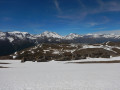
Enjoy both the pleasure of a lake and a beautiful ridge offering a 360° panorama (Écrins, Vanoise, Orsiera Park, Val Troncea, Queyras), all starting from a charming little hamlet that has been beautifully restored.
Monte Albergian
 6.18 mi
+4,934 ft
-4,934 ft
7h 10
6.18 mi
+4,934 ft
-4,934 ft
7h 10
 Difficult
Departure from Pragelato (Torino)
Difficult
Departure from Pragelato (Torino)
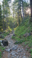
A 3,000-metre peak very popular with Italian visitors, offering sweeping panoramic views of the Alpine massifs on a clear day: Queyras, Ubaye, Écrins, Cerces, Savoie, Vanoise and the Swiss Valais.
Walk near the Germanasca
1.46 mi
+299 ft
-269 ft
0h 55
 Easy
Departure from Massello (Torino)
Easy
Departure from Massello (Torino)
An easy walk along a path running alongside the Germanesca. The starting point is not far from the Hotel de la Forestiera. The path is fairly flat and shaded. It is an easy walk for families and very pleasant in summer.
Punta Rognosa de Sestrières
 7.70 mi
+4,022 ft
-4,019 ft
7h 05
Difficult
Departure from Sestriere (Torino)
7.70 mi
+4,022 ft
-4,019 ft
7h 05
Difficult
Departure from Sestriere (Torino)
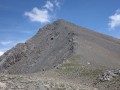
A hike to a stunning 3,000-metre peak in the Italian Piedmont, adorned with a statue of the Madonna, offering sweeping views of the French and Italian Alps and the Swiss Valais on a clear day.
 Strada del Valle Argentera
22.07 mi
+2,533 ft
-4,052 ft
3 hrs
Moderate
Departure from Sestriere (Torino)
A wonderful mountain bike ride from Sestrières to the Valle d’Argent. A stunning spot at the bottom of a beautiful, unspoilt valley. Waterfalls, rivers… well worth a visit. The climb back up to Sestrières is a bit technical.
La Madone de Cotolivier
 5.71 mi
+2,152 ft
-2,169 ft
4h 30
Moderate
Departure from Oulx (Torino)
5.71 mi
+2,152 ft
-2,169 ft
4h 30
Moderate
Departure from Oulx (Torino)
Close to the French-Italian border, this is a very pleasant route offering splendid views over the valley linking Bardonecchia to Turin.
Four villages on the left bank of the Doria Ripaira
 4.57 mi
+1,670 ft
-1,673 ft
3h 35
Moderate
Departure from Oulx (Torino)
4.57 mi
+1,670 ft
-1,673 ft
3h 35
Moderate
Departure from Oulx (Torino)
For a tour of four typical villages, this is a very shaded route that will delight young and old alike.
The edelweiss at Fort Foens
 2.13 mi
+1,027 ft
-1,040 ft
1h 50
Moderate
Departure from Oulx (Torino)
2.13 mi
+1,027 ft
-1,040 ft
1h 50
Moderate
Departure from Oulx (Torino)
A short walk amongst the edelweiss for anyone planning to camp at Fort Foens and wishing to take a short stroll before or after spending the night there, to view the fort from above. You’ll discover the surrounding mountains and the little stream at the bottom of the narrow gorges.
Refuge de la Chardouse - Pamplinet
10.60 mi
+3,166 ft
-3,681 ft
7h 40
 Very difficult
Departure from Oulx (Torino)
Very difficult
Departure from Oulx (Torino)
This is the first stage of a journey that will take you across France, following the 45th parallel as closely as possible (within 10 km). To truly cross France and avoid going back and forth, the starting point is in Italy. However, it is possible to start from Pamplinet and climb up to the Col de Désertes to start from the French-Italian border.
 The hilltop villages above Cesana Torinese
7.27 mi
+2,651 ft
-2,677 ft
8 hrs
Difficult
Departure from Cesana Torinese (Torino)
This circular route along the south-western bank of the River Dora Riparia allows you to visit the beautiful hilltop villages overlooking the valley. Excellently situated, these villages enjoy maximum sunshine as well as superb views of the valley and the Saulx d’Oulx resort.
The hidden side of the Maurienne
 Association / Club / Walk leader
 22.39 mi
+9,124 ft
-9,035 ft
3 days
Difficult
Departure from Bramans (Savoie)
22.39 mi
+9,124 ft
-9,035 ft
3 days
Difficult
Departure from Bramans (Savoie)
The lower part of the Maurienne Valley is better known for its motorway – which people drive along without stopping – than for its wild high-mountain landscapes.
This route, starting from St Pierre d’Extravache and winding through rocky landscapes, deep blue lakes and ever-present glaciers, disproves the reputation that the valley may have been given. You’ll be walking for three days amongst mountain pastures and high peaks, whilst remaining in mid-mountain terrain.
From the Ambin Refuge to Le Planey
 11.65 mi
+3,363 ft
-5,233 ft
8h 15
Difficult
Departure from Bramans (Savoie)
11.65 mi
+3,363 ft
-5,233 ft
8h 15
Difficult
Departure from Bramans (Savoie)
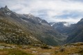
A very beautiful route amongst glaciers and lakes, which crosses the Italian border (beautiful view of the Val di Suza) and returns to France via the Col Clapier, which Hannibal and his elephants probably passed through.
This route follows on from the hike “From the Bramanette Refuge to the Ambin Refuge”, but can easily be done starting from the Ambin Refuge alone.
Cima del Pelvo
 6.00 mi
+4,577 ft
-4,577 ft
8 hrs
Very difficult
Departure from Sauze di Cesana (Torino)
6.00 mi
+4,577 ft
-4,577 ft
8 hrs
Very difficult
Departure from Sauze di Cesana (Torino)
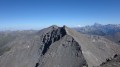
Cima del Pelvo is one of the 3,000-metre peaks in the Italian Piedmont. It offers a breathtaking panorama of the French-Italian Alps, the Po Valley and the Swiss Valais.A hike that is half on-trail and half off-trail, for which I recommend using the Visorando app.
Soleil Bœuf, starting from Champlas Seguin
5.55 mi
+1,191 ft
-1,211 ft
3h 35
Moderate
Departure from Cesana Torinese (Torino)
A very pleasant circular walk through the woods leading to Soleil Bœuf, a key hub of the San Sicarrio Ski Resort.
Circular Fenils starting from Césane
7.26 mi
+1,644 ft
-1,631 ft
4h 45
Moderate
Departure from Cesana Torinese (Torino)
A particularly pleasant circular route above the Doria Riparia valley, which links Césane to Oulx and joins the main route leading to Turin and the Fréjus Tunnel. From Fenils, there’s a lovely view of the ski slopes at Sestrières.
Cima del Bosco
 4.89 mi
+2,326 ft
-2,326 ft
4h 15
Moderate
Departure from Cesana Torinese (Torino)
4.89 mi
+2,326 ft
-2,326 ft
4h 15
Moderate
Departure from Cesana Torinese (Torino)
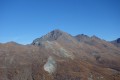
A lovely hike to an easily accessible summit, offering superb views of some of the peaks of Queyras, Écrins and the Italian Piedmont.
Pointe du Lamet
 Tourism professional
 10.47 mi
+4,846 ft
-4,849 ft
8 hrs
Very difficult
Departure from Lanslebourg-Mont-Cenis (Savoie)
10.47 mi
+4,846 ft
-4,849 ft
8 hrs
Very difficult
Departure from Lanslebourg-Mont-Cenis (Savoie)
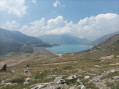
A hike for experienced walkers that takes you to an altitude of 3,500 metres – one of the highest in France – without the need for specialist kit. No major difficulties apart from the elevation gain and the narrow corridor leading out of the steep slopes, but at the summit, if you’re lucky enough to avoid the nebbia, you’ll be rewarded with a magnificent view (Rochemelon, Charbonnel, Pointe de Ronce, Giusalet...).
Mont Giassez
 8.31 mi
+2,986 ft
-3,002 ft
6h 25
Difficult
Departure from Cesana Torinese (Torino)
8.31 mi
+2,986 ft
-3,002 ft
6h 25
Difficult
Departure from Cesana Torinese (Torino)
A hike to a very accessible summit in the Piedmont, offering sweeping views of the surrounding French and Italian peaks and the Écrins.
Lac Noir via the Ambin Refuge
10.89 mi
+3,153 ft
-3,153 ft
7h 45
Difficult
Departure from Bramans (Savoie)
Less well-known than its neighbour, Lac d’Ambin or Lac Bleu, Lac Noir, nestled at the foot of the summit of Petit Vallon, is well worth a visit to this peaceful and very pleasant spot.
Lac de Savine - Col du Clapier
 9.12 mi
+1,453 ft
-1,450 ft
5h 30
Moderate
Departure from Bramans (Savoie)
9.12 mi
+1,453 ft
-1,450 ft
5h 30
Moderate
Departure from Bramans (Savoie)
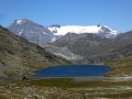
Route following the hypothetical passage of Hannibal and his elephants across the Alps. At the end of the wild and long valley lies the superb and large Lake Savine, at the foot of the Dents D'Ambin. A little further on, the Clapier border pass offers a magnificent view. On the way back, take a short detour to the Perrin Lakes.
Lake Savine and the Col Clapier or Col de Savine as seen from Le Suffret
 10.72 mi
+2,887 ft
-2,867 ft
7h 25
Moderate
Departure from Bramans (Savoie)
10.72 mi
+2,887 ft
-2,867 ft
7h 25
Moderate
Departure from Bramans (Savoie)
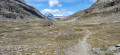
A long hike offering the chance to follow in the (potential, as they are unproven) footsteps of Hannibal and his elephants during his war against the Roman Empire.
Aside from this historical fact, this walk winds through the beautiful and wild Savine valley, leading to the lake of the same name and to the Col du Clapier or Col de Savine on the France–Italy border.
Former Fort de la Ronce and Balcon du Lac du Mont-Cenis
 4.30 mi
+1,204 ft
-1,201 ft
3h 00
Moderate
Departure from Lanslebourg-Mont-Cenis (Savoie)
4.30 mi
+1,204 ft
-1,201 ft
3h 00
Moderate
Departure from Lanslebourg-Mont-Cenis (Savoie)
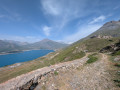
This walk avoids too much elevation gain and takes you back along the lake via a short, technical path that at times resembles the customs officers’ path. There are deckchairs halfway along the route, offering a lovely view and a well-deserved rest.This walk is best done in summer as the pass is closed in winter.
From Lac du Mont-Cenis to Lac Clair
 4.34 mi
+2,247 ft
-2,247 ft
3h 55
Moderate
Departure from Lanslebourg-Mont-Cenis (Savoie)
4.34 mi
+2,247 ft
-2,247 ft
3h 55
Moderate
Departure from Lanslebourg-Mont-Cenis (Savoie)
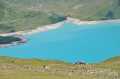
An easy hike above 2,000 metres. It starts near the Col du Mont-Cenis, a pass known since ancient times for crossing the Alps.
Starting from the superb Lac du Mont-Cenis, it leads to the modest Lac Clair at the foot of what remains of the Lamet Glacier.
From Lake Mont-Cenis to Lake Clair via the Ronce stream
 4.61 mi
+2,306 ft
-2,287 ft
4h 10
Moderate
Departure from Lanslebourg-Mont-Cenis (Savoie)
4.61 mi
+2,306 ft
-2,287 ft
4h 10
Moderate
Departure from Lanslebourg-Mont-Cenis (Savoie)
A lovely hike from Lake Mont Cenis to the small clear lake.
The route offers beautiful views of Lac de Mont-Cenis (although it was cloudy the day we did it). A fairly family-friendly hike.
From the Bramanette Refuge to the Ambin Refuge
 8.50 mi
+4,186 ft
-3,665 ft
7h 35
Difficult
Departure from Bramans (Savoie)
8.50 mi
+4,186 ft
-3,665 ft
7h 35
Difficult
Departure from Bramans (Savoie)
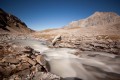
A beautiful route, sometimes off the beaten track or on poorly marked paths. From the top of the passes, you can see both the peaks of the Vanoise (the Dent Parachée) and the Barre des Ecrins.This hike follows on from the "Le refuge de Bramanette" route.
Lake Liael and the Col de Bramanette
 9.72 mi
+4,265 ft
-4,275 ft
8h 10
Difficult
Departure from Bramans (Savoie)
9.72 mi
+4,265 ft
-4,275 ft
8h 10
Difficult
Departure from Bramans (Savoie)
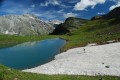
A beautiful circular route in the Haute-Maurienne via the Etache Valley and the Bramanette Valley.
Steep gradients.
The Refuge de Bramanette
2.24 mi
+1,575 ft
-138 ft
2h 25
Moderate
Departure from Bramans (Savoie)
This short hike is the starting point for a magnificent three-day trek between Haute Maurienne and Val de Suze (Italy), with beautiful lakes and numerous small glaciers.But the setting and the welcome at the Refuge de Bramanette are such that they alone justify spending the night there and descending back down to the valley the next day!
The Cime de la Charvie
 6.45 mi
+3,379 ft
-3,386 ft
5h 55
Difficult
Departure from Cervières (Hautes-Alpes)
6.45 mi
+3,379 ft
-3,386 ft
5h 55
Difficult
Departure from Cervières (Hautes-Alpes)
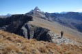
This is one of the mountain guides' favourite hikes to a summit with a ridge trail offering exceptional views of the Alps and returning to a valley that is very popular with chamois.
I recommend using the Visorando app.
The Col Chabaud and Bousson Circular
 4.98 mi
+1,112 ft
-1,112 ft
3h 15
Moderate
Departure from Cervières (Hautes-Alpes)
4.98 mi
+1,112 ft
-1,112 ft
3h 15
Moderate
Departure from Cervières (Hautes-Alpes)
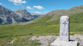
A very easy circular route via two mountain passes on the border between France and Italy.
The Sioux trail in Cervières
3.59 mi
+381 ft
-361 ft
2h 00
Easy
Departure from Cervières (Hautes-Alpes)
For a multi-faceted walk in the Vallée des Fonts de Cervières:- a wide path along the edge of the Cerveyrette,- an arrival point featuring not teepees, but remarkable chalets,- an impressive view of the Pic du Lombard summit,- and above all, a delicious meal at the Refuge des Fonts,this is an interesting idea for a pleasant day out.
Dormillouse Ridge
 6.74 mi
+3,356 ft
-3,337 ft
6h 00
Difficult
Departure from Cervières (Hautes-Alpes)
6.74 mi
+3,356 ft
-3,337 ft
6h 00
Difficult
Departure from Cervières (Hautes-Alpes)
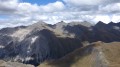
A hike off the beaten track towards a border ridge offering exceptional panoramic views of Italy, the Queyras, the Cerces and the Vanoise.Use of the Visorando app is recommended.
Cima Dorlier
 7.63 mi
+2,802 ft
-2,802 ft
5h 55
Difficult
Departure from Cervières (Hautes-Alpes)
7.63 mi
+2,802 ft
-2,802 ft
5h 55
Difficult
Departure from Cervières (Hautes-Alpes)
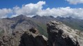
A hike away from the crowds towards a pass where lovely meadows stretch out and towards a pretty Italian summit offering panoramic views of the Écrins, the Cerces, Piedmont and some of the Queyras peaks.
The route includes a few off-trail sections where I recommend using the Visorando app.
L’Escalinade
9.80 mi
+4,551 ft
-4,551 ft
8h 30
Difficult
Departure from Cervières (Hautes-Alpes)
From this summit, you can (almost) touch the Pic de Rochebrune, the second-highest peak in the Queyras.
Lac des Cordes circuit
 5.46 mi
+2,100 ft
-2,096 ft
4h 20
Moderate
Departure from Cervières (Hautes-Alpes)
5.46 mi
+2,100 ft
-2,096 ft
4h 20
Moderate
Departure from Cervières (Hautes-Alpes)
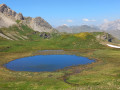
A remarkable circuit in the famous Fonts de Cervières valley, with a magnificent lake at the foot of the Pic de Rochebrune cirque.
Summit of the Grand Vallon
 6.06 mi
+2,684 ft
-2,684 ft
5h 10
Moderate
Departure from Cervières (Hautes-Alpes)
6.06 mi
+2,684 ft
-2,684 ft
5h 10
Moderate
Departure from Cervières (Hautes-Alpes)
A hike to a summit situated on the border between Queyras and Briançonnais, offering a stunning panoramic view of the Italian Piedmont, the Queyras, the Ubaye, as well as the Cerces and the Vanoise.
Pic de Fond Queyras
7.30 mi
+3,097 ft
-3,071 ft
6h 05
Difficult
Departure from Cervières (Hautes-Alpes)
From Les Fonts de Cervières, dozens of hikes set off. This one, similar to the Petit Rochebrune route, allows you to traverse part of the ridge linking the Col des Péas to the summit of the Petit Rochebrune.
Pic Lombard
 4.98 mi
+3,015 ft
-3,015 ft
4h 55
Difficult
Departure from Cervières (Hautes-Alpes)
4.98 mi
+3,015 ft
-3,015 ft
4h 55
Difficult
Departure from Cervières (Hautes-Alpes)
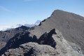
A hike partly off the beaten track, in a very wild and unspoilt setting, towards a summit above the hamlet of Les Fonts de Cervières, offering sweeping views over the Queyras, the Ubaye, the Cerces, the Vanoise, the Écrins and Italy. A little surprise box at the foot of the cross.
For this route, I recommend using the Visorando app.