Country:

 City:
City:


Park in the car park before the junction with the Route de Désertes.
(S/E) Head down the wide path opposite and you’ll soon rejoin the Route de Désertes. Cross the large bridge over the Dora Riparia. Continue along the road until you reach a second bridge.
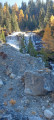
(1) Leave the road and take the path on the left. Follow the small stream, alternating between the right and left banks through the woods. Emerge from the woods to reach the Route de Désertes.
(2) Cross this road and continue straight ahead along the path. Cross the road again and, after a fairly steep climb, emerge at the first hamlet, Désertes.
(3) Let the road branch off to the left and continue along the path, climbing gently, heading north-east then north-west, until you reach the second hamlet, Millaures.
(4) Keep heading generally north along path no. 601A; this is indicated on the signposts. You will reach the third hamlet, Lozet. Here, you’ll come to the junction with the wide path no. 716A, or the Sentiero Balcone.
(5) Take this path north-eastwards, passing the junction with the Madone de Cotolivier path. Turn right at this junction and head downhill to reach the fourth hamlet, Vazon.
(6) Here, change direction completely and head south-west. Cross the mountain pastures and, further on, reach the fifth hamlet, Soubras.
(7) Continue down a short descent. At the junction below this hamlet, keep well to the right to begin a final climb, first along the path, then through the mountain pastures and finally into the forest. At the highest point, head downhill to reach the sixth and final hamlet on this circular route, Balbière.
(8) Take the road and, at the crossroads, leave the road leading to Désertes on your right and head left. Continue this descent via numerous hairpin bends. You’ll come back to the crossroads by the second bridge you passed on the way out.
(1) Follow the route taken on the way out to return to the starting car park (S/E).
 Visorando Member
 Moderate
 Easy
Easy