Country:

 City:
City:


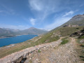
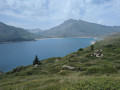
Park in the car park at the Franco-Italian House.
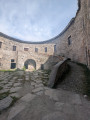
(S/E) Set off with your back to the lake, keeping the fort ahead of you in your sights. Cross the D1006 with great care as this road is very busy. Head uphill, taking the left-hand path at the next junction – it’s less steep than the one on the right – and this will take you to the Old Fort of Ronce.
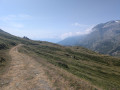
(1) Turn right and walk along this long, gentle path, keeping the lake on your right as it descends gently. You’ll emerge at the edge of the D1006 at the crossroads in the hamlet of La Cassa.
(2) Turn right at almost a 180° angle until you reach the D1006.
(3) Continue on the right-hand side of the road along a lovely little path, before reaching the junction with a wide track.
(4) Cross the road with great care, then head down this track. After a hairpin bend, turn left onto a footpath. Continue down the slope to the sun loungers by the lake, near the dam.
(5) Take the track on the right, then continue to a further hairpin bend.
(6) Leave the track and turn left onto the path running alongside the lake. Gradually move away from the lakeshore to follow the path overlooking it. Walk with the lake on your left until you reach the junction at the Pyramide du Mont-Cenis.
(7) Here you have two options:
- turn right to reach the museum, then continue left to the car park at the Franco-Italian House (S/E),
- continue straight ahead – this is the route shown on the map – and pass the sewage treatment plant.
(8) Head up the path on the right through the vegetation to reach the car park at the Franco-Italian House (S/E).
 Visorando Member

 Tourism professional
 Very difficult
 Difficult
 Easy
Easy