From the Ambin Refuge to Le Planey

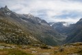
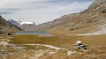
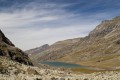
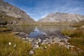
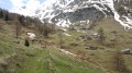
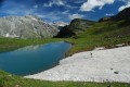
A very beautiful route amongst glaciers and lakes, which crosses the Italian border (beautiful view of the Val di Suza) and returns to France via the Col Clapier, which Hannibal and his elephants probably passed through.
This route follows on from the hike “From the Bramanette Refuge to the Ambin Refuge”, but can easily be done starting from the Ambin Refuge alone.

This walk is part of a multi-day hike: The hidden side of the Maurienne

Details

66
Creation:
Last update:
Last review:
  • Walking
    Activity: Walking
  • ↔
    Distance: 11.65 mi
  • ◔
    Average duration: 8h 15 
  • ▲
    Difficulty: Difficult

  • ⚐
    Back to start: No
  • ↗
    Ascent: + 3,363 ft
  • ↘
    Descent: - 5,233 ft

  • ▲
    Highest point: 10,154 ft
  • ▼
    Lowest point: 5,545 ft

Photos

Description of the walk

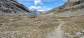
(S/E) From the Ambin refuge, head up the valley towards Lac d’Ambin.

(1) Follow the Ambin stream.

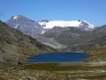
(2) You can avoid going via the lake, but the time saved is minimal and this short detour is well worth it. From the lake, you reach the Col de l’Agnel via easy scree, but the path is very poorly marked and even non-existent in places.

(3) From there, there’s a lovely view over the Italian Val di Suza, and the well-marked path leads straight to the Refuge Vaccarone

(4) You can take a short detour via Lago dell’Agnello.
A narrow, very steep path descends straight down through the rocky outcrops, below the refuge. You look out over the Clapier lakes, near which you can stop for a bite to eat. From there, you reach the Col Clapier.

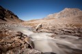
(5) Descend to Lac de Savine, quite easily, along the beautiful Savine torrent.

(6) At the ruins of the Chalets de Savine, always take the paths leading down to the left, as far as the Fesse du Haut, and you’ll then reach Le Planey (E).
If you haven’t been able to park a second car here, there’s a good path leading to Saint-Pierre d’Extravache.

Waypoints

  1. S : mi 0 - alt. 7,434 ft - Refuge d'Ambin
  2. 1 : mi 0.14 - alt. 7,441 ft - Ruisseau d'Ambin (ruisseau) - Affluent de l'Arc
  3. 2 : mi 2.07 - alt. 8,825 ft - Lac d'Ambin
  4. 3 : mi 3.16 - alt. 10,154 ft - Col de l'Agnel (3091m)
  5. 4 : mi 4.63 - alt. 9,003 ft - Refuge Vaccarone (2741m)
  6. 5 : mi 6.28 - alt. 8,153 ft - Col Clapier
  7. 6 : mi 8.99 - alt. 7,316 ft - Savine Chalets
  8. E : mi 11.65 - alt. 5,545 ft - Le Planey

Notes

Ambin Mountain Hut: hut: 04 79 20 35 00, warden: 06 72 64 36 94

Reviews and comments

4.2 / 5
Based on 2 reviews

Reliability of the description
2.5 / 5
Ease of following the route
5 / 5
Route interest
5 / 5
fredmauny
fredmauny

Overall rating : 1 / 5

Date of your route : Jul 24, 2019
Reliability of the description : ★☆☆☆☆ Very disappointing
Ease of following the route : Not used / Not applicable
Route interest : Not used / Not applicable

The description refers to following paint markings, although the climb up to the Col Agnel is currently completely covered in snow on 24 July 2019. This is a very long stage if you want to cover the route from the Ambin refuge to Le Planey in a single day. An overnight stop at the Vaccarone refuge might be a good idea!

Machine-translated

Xari
Xari

Overall rating : 4.7 / 5

Date of your route : Aug 18, 2016
Reliability of the description : ★★★★☆ Good
Ease of following the route : ★★★★★ Very good
Route interest : ★★★★★ Very good

The route over the Col de l’Agnel is straightforward and well signposted from rock to rock. The start of the descent on the Italian side is much less clearly marked. Follow the cairns until, shortly before the Vaccarone refuge, you come across plenty of yellow paint markings.
From Vaccarone, there are two possible routes to the Col Clapier, one of which is described as steeper. Nothing too daunting, though; a few fixed ropes make the descent easier.
Near the Col Clapier, and in the event of bad weather (which was temporarily the case for us), a brand-new Franco-Italian bivouac allows hikers to warm up, and it features a magnificent and striking bay window.
From the Savine chalets, you can continue on to the Col du Petit Mont Cenis and reach the refuge of the same name, where you’ll spend the night. The refuge is a sort of hotel-style refuge (cars can be parked less than 300 m away), but the location is remarkable, the welcome is really friendly and the prices are very reasonable.
The next day, you can head back down to Le Planay and retrieve your car at St Pierre d’Extravache via the Col de Sollières (easy) and from there, before descending through the wild Combe des Archettes (beware of aggressive patou dogs, but the geology is impressive), you can either climb Mont Froid or head for the Signal du Petit Mont Cenis (you can stop on the ridge at the cross at 2,857 m – the view is already magnificent).

Machine-translated

Other walks in the area

For more walks, use our search engine .

The GPS track and description are the property of this route's author. Please do not copy them without permission.