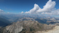
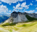
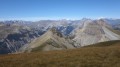
Soleil Bœuf, starting from Champlas Seguin

A very pleasant circular walk through the woods leading to Soleil Bœuf, a key hub of the San Sicarrio Ski Resort.

Details

59736809
Creation:
Last update:
Last review:
  • Walking
    Activity: Walking
  • ↔
    Distance: 5.55 mi
  • ◔
    Average duration: 3h 35 
  • ▲
    Difficulty: Moderate

  • ⚐
    Back to start: Yes
  • ↗
    Ascent: + 1,191 ft
  • ↘
    Descent: - 1,211 ft

  • ▲
    Highest point: 6,755 ft
  • ▼
    Lowest point: 5,571 ft

Description of the walk

Park in the village of Champlas Seguin, situated on the left-hand side of the road linking Césanne to Sestrières. Please note that in summer, parking can be tricky as many spaces are private.

(S/E) Head to the top of the village, then take the path on the right, which leads, shortly afterwards, onto a wider track. Turn right onto this track and walk level until you reach a three-way junction.

(1) Turn left and continue slightly uphill to reach the ruined barracks of Fort Seguin. Head right to reach Fort Seguin.

(2) Return to the track, continue to the right and arrive at a four-way junction. Take the track on the left and, after a steady climb, you’ll come out onto a ski run.

(3) Cross this and two others.

(4) Carry on, passing under the Ski Lodge de la Sellette cable car. You will then reach the Soleil Bœuf resort, the highest point of the walk.

(5) Begin the descent along the path on the left. Please note that this path is also used as a mountain bike trail. Wind your way through this larch forest via numerous hairpin bends, then rejoin a wider track.

(6) Turn left onto this track to reach the open area at the 1800 intermediate station.

(7) After the top station of the Césana Ski Lodge, join the wide piste. Now walk gently uphill through this larch forest to return to the car park in the village of Champras Seguin (S/E).

Waypoints

  1. S/E : mi 0 - alt. 5,863 ft - Champlas Seguin car park
  2. 1 : mi 0.24 - alt. 5,935 ft - Three-way junction
  3. 2 : mi 0.95 - alt. 6,312 ft - Fort Seguin
  4. 3 : mi 1.31 - alt. 6,437 ft - Ski run
  5. 4 : mi 2 - alt. 6,736 ft - Ski run
  6. 5 : mi 2.38 - alt. 6,745 ft - Soleil Bœuf
  7. 6 : mi 3.16 - alt. 6,063 ft - Wider track
  8. 7 : mi 4.01 - alt. 5,600 ft - Station 1800
  9. S/E : mi 5.54 - alt. 5,863 ft - Champlas Seguin car park

Notes

(5) Dining available.

Worth a visit

(2) The ruins of Fort Seguin, offering a remarkable view of the valley and, above all, the French border.
(5) Soleil Bœuf: a large, particularly well-appointed area where, for €5 (2024 price), you can enjoy the blue or red deckchairs provided here.

Reviews and comments

4.7 / 5
Based on 2 reviews

Reliability of the description
5 / 5
Ease of following the route
4 / 5
Route interest
5 / 5
User 13367796

Overall rating : 4.7 / 5

Date of your route : Jul 06, 2026
Reliability of the description : ★★★★★ Very good
Ease of following the route : ★★★★☆ Good
Route interest : ★★★★★ Very good
Very busy route : No

A lovely walk through a larch forest with a stunning view from the summit.

Machine-translated

jp11
jp11

Overall rating : 4.7 / 5

Date of your route : May 27, 2026
Reliability of the description : ★★★★★ Very good
Ease of following the route : ★★★★☆ Good
Route interest : ★★★★★ Very good
Very busy route : No

A great walk in warm weather, as you’re mostly under lovely larch trees. Outside the summer months, it’s easy to park in the village if you’re friendly with the locals. At (5), the start of the descent—supposedly a mountain bike track—is just a faint trail through the grass. Go round the back of the restaurant and head straight west. After that, it’s really easy. At (7), head due south.

Machine-translated

Other walks in the area

For more walks, use our search engine .

The GPS track and description are the property of this route's author. Please do not copy them without permission.