Variselle Fort

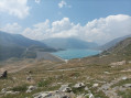
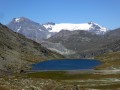
A short walk to Lake Mont Cenis, which will take you to one of the many forts in the area. You’ll have the chance to cross the dam to reach the fort, which is very well preserved. Unfortunately, a regulation prohibits access to the interior.

Details

n°60972269
Creation:
Last update:
Last review:
  • Walking
    Activity: Walking
  • ↔
    Distance: 4.71 mi
  • ◔
    Average duration: 2h 40 
  • ▲
    Difficulty: Easy

  • ⚐
    Back to start: Yes
  • ↗
    Ascent: + 538 ft
  • ↘
    Descent: - 558 ft

  • ▲
    Highest point: 6,913 ft
  • ▼
    Lowest point: 6,490 ft

Photos

Description of the walk

After leaving Lanslebourg, cross the Mont Cenis Pass, heading towards the lake of the same name. Pass the Mont Cenis Pyramid, which houses a museum. Park your car above the dam, in a car park to the left of the main road.

(S/E) Walk down from the car park, past some ancient ruins, to the dam.

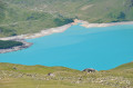
(1) Turn right and walk along the dam. You’ll enjoy superb views of the lake.
At the end of the dam, continue a few metres to the left, past the information boards.

(2) Ignore the track that leads down to the bottom of the dam, near the large cross. Carry on to the right.

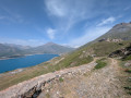
(3) Also ignore the second path leading up towards Fort de Malamort; walk past the dam management centre and follow the track as it climbs gradually in hairpin bends, without straying from it. Do not take the paths cutting through the vegetation.

(4) At an altitude of 2,106 metres, you’ll arrive in front of this imposing and very well-preserved fort, although it is abandoned. Walk carefully around it.
Unfortunately, an order prohibits access to it. The view over the lake is splendid.

The return journey follows the same path, in the opposite direction to the outward journey (S/E).

Waypoints

  1. S/E : mi 0 - alt. 6,657 ft - Car park on the left above the - Barrage du lac de Mont Cenis
  2. 1 : mi 0.36 - alt. 6,493 ft - Head right along the - Lac du Mont Cenis
  3. 2 : mi 1.24 - alt. 6,506 ft - Continue to the right
  4. 3 : mi 1.27 - alt. 6,519 ft - Walk past the dam management centre
  5. 4 : mi 2.36 - alt. 6,906 ft - Fort de Varisselle
  6. S/E : mi 4.71 - alt. 6,657 ft - Car park on the left above the dam

Notes

Fort de Variselle: https://fr.wikipedia.org/wiki/Fort_de_Va...
Variselle Fort is a high-altitude fortification situated in the commune of Val-Cenis, in the Savoie department. Built by the Italians from 1877 onwards under the name Forte Varisello, its purpose was to defend the Susa Valley against a French attack coming down from the Mont-Cenis Pass. The site became French in 1947.

In 1860, Savoy was annexed by France. In 1874, the Kingdom of Italy decided to strengthen the defences of its new borders with modern fortifications based on Montalembert’s designs¹. A series of forts was therefore built to the south-east of the Mont-Cenis Pass: Varisello, Cassa (it) and Roncia on either side of the carriage road leading down from the pass, Pattacroce (it) and Malamot (it) on the higher ground further south (to block the Petit Mont-Cenis Pass), reinforced by a number of infantry casemates, ditches and artillery batteries, between 1877 and 1908: together, these formed the Campo trincerato del Moncenisio.

Opposite, between 1895 and 1910, the French built Fort de la Turra, perched to the west of the Mont-Cenis Pass, to defend the Maurienne Valley. The Italian fort was disarmed in 1915, as the French threat had temporarily subsided: the artillery pieces, removed from their carriages, were sent to the front to fire on the Austro-Hungarians. The resurgence of tensions in the late 1920s led to the return of Italian and French soldiers along the border, facing each other in a standoff that involved the reoccupation of the forts and the installation of several batteries of 149 mm/35 Model 1901 guns.

In 1947, the Treaty of Paris ceded the entire Mont-Cenis plateau, including its fortifications, to the French Republic. The Fort de La Cassa was demolished in 1968 to make way for the dam of the artificial lake. Variselle was left to fall into disrepair.

Description
The fort stands at an altitude of 2,118 metres, on a hill south of Lake Mont-Cenis.

It has a pentagonal layout, with two firing levels (artillery above and small arms below) in vaulted casemates, open at the rear. Its original artillery consisted of 27 120 mm/21 Model 1882 guns (known as ‘12 ARC Ret’), with a range of 6,000 metres. At the centre of the fort lies the underground, casemated barracks, comprising the powder magazines, the shell store, the food store, the infirmary and the bread oven

A short walk with beautiful panoramic views, particularly of the lake.
However, as you are in the mountains, the weather can change quickly, so it is advisable to bring warm clothing even in summer.
Hiking boots recommended
There are no water points along the route

Worth a visit

Several other forts add to the appeal of this site:

  • Fort de Ronce
  • Fort de Malamot
  • Fort de Pattacreuse
  • Fort de la Turra

Reviews and comments

5 / 5
Based on 1 review

Reliability of the description
Not used
Ease of following the route
5 / 5
Route interest
5 / 5
NRBJ
NRBJ

Overall rating : 5 / 5

Date of your route : Jul 25, 2024
Reliability of the description : Not used / Not applicable
Ease of following the route : ★★★★★ Very good
Route interest : ★★★★★ Very good
Very busy route : Yes

Route taken on 25 July 2024.
The surroundings are stunning, with such lovely views of the lake.
I set off from the foot of the dam at Grande Croix, ‘almost in Italy’, and people were waiting for me at La Pyramide, but I think it’s perfectly possible to take the path on the right after the dam (heading back along the route described) to return to my starting point.
Here’s a video to remember the dayby.
If you fancy heading back and visiting a fort, head up to Fort de Ronce from La Pyramide – it’s well worth it.

Machine-translated

Other walks in the area

For more walks, use our search engine .

The GPS track and description are the property of this route's author. Please do not copy them without permission.