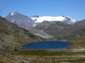
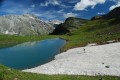
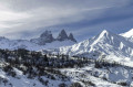
Lake Savine and the Col Clapier or Col de Savine as seen from Le Suffret

A long hike offering the chance to follow in the (potential, as they are unproven) footsteps of Hannibal and his elephants during his war against the Roman Empire.
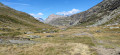
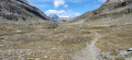
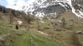
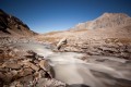
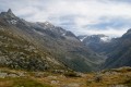
Aside from this historical fact, this walk winds through the beautiful and wild Savine valley, leading to the lake of the same name and to the Col du Clapier or Col de Savine on the France–Italy border.

Details

39426126
Creation:
Last update:
Last review:
  • Walking
    Activity: Walking
  • ↔
    Distance: 10.72 mi
  • ◔
    Average duration: 7h 25 
  • ▲
    Difficulty: Moderate

  • ⚐
    Back to start: Yes
  • ↗
    Ascent: + 2,887 ft
  • ↘
    Descent: - 2,867 ft

  • ▲
    Highest point: 8,150 ft
  • ▼
    Lowest point: 5,551 ft

Photos

Description of the walk

Park in the large Suffet car park before the bridge leading to the Suffet refuge.

Yellow markings and signposts.

(S/E) Take the path to reach the hamlet known as La Fesse du Haut.

(1) Continue to the right on theGRP® Tour de la Haute Tarentaise until you reach a fork.

(2) Leave theGRP®. Turn right, then keep left to climb up through the rocky outcrops until you reach a fork.

(3) Carry on to the right towards a small hut and a picnic table offering a beautiful panoramic view. You’ll reach a Y-junction.

(4) Turn right to follow the Ruisseau de Savine to the ruins of Savine.

(5) Immediately afterwards, turn right to cross the stream, then continue straight on at the bottom of the valley along a long flat stretch, followed by a slight incline up to Lac de Savine.

(6) Carry on straight ahead to reach the Col du Clapier or Col de Savine.

(7) From the pass, turn round and head back to the car park via the same route you took on the way out (S/E).

Waypoints

  1. S/E : mi 0 - alt. 5,551 ft - Refuge du Suffet (1690m)
  2. 1 : mi 0.16 - alt. 5,692 ft - La Fesse du Haut
  3. 2 : mi 1.34 - alt. 6,972 ft - La Crosta
  4. 3 : mi 1.73 - alt. 7,362 ft - Below the Coulours Lakes
  5. 4 : mi 2.22 - alt. 7,238 ft - Water catchment
  6. 5 : mi 2.54 - alt. 7,310 ft - Ruins of Savine
  7. 6 : mi 4.47 - alt. 8,035 ft - Lac de Savine (2450m)
  8. 7 : mi 5.35 - alt. 8,127 ft - Col Clapier
  9. S/E : mi 10.72 - alt. 5,551 ft - Refuge du Suffet (1,690 m) - Ruisseau d'Ambin (ruisseau) - Affluent de l'Arc

Notes

Several information boards line the path, recounting the story of Hannibal and his elephants’ crossing of the Alps.

Worth a visit

It is possible to significantly extend the hike and increase the elevation gain by passing via Lakes Giaset, Perrin and des Coulours.

Reviews and comments

5 / 5
Based on 2 reviews

Reliability of the description
5 / 5
Ease of following the route
5 / 5
Route interest
5 / 5
lion90
lion90

Overall rating : 5 / 5

Date of your route : Jun 23, 2025
Reliability of the description : ★★★★★ Very good
Ease of following the route : ★★★★★ Very good
Route interest : ★★★★★ Very good
Very busy route : Yes

A well-signposted and pleasant walk!

Machine-translated

champet67
champet67

Overall rating : 5 / 5

Date of your route : Jul 30, 2024
Reliability of the description : ★★★★★ Very good
Ease of following the route : ★★★★★ Very good
Route interest : ★★★★★ Very good
Very busy route : No

VISITOR NUMBERS / Very few visitors from the Suiffet, but very busy with walkers arriving from Petit Montcenis.
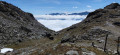
Beautiful views over the Suze Valley from the heights of the Col du Clapier.

Machine-translated

Other walks in the area

For more walks, use our search engine .

The GPS track and description are the property of this route's author. Please do not copy them without permission.