The route from Usseaux to Balboutet

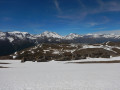
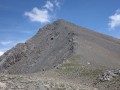
In the Val Cluson between Pragelato and Fénestrelle, this idyllic walk takes you through two splendid villages and a particularly pleasant mountain pasture below the Col de Fénestrelle.

Details

n°1342216
Creation:
Last update:
Last review:
  • Walking
    Activity: Walking
  • ↔
    Distance: 4.44 mi
  • ◔
    Average duration: 3h 15 
  • ▲
    Difficulty: Moderate

  • ⚐
    Back to start: Yes
  • ↗
    Ascent: + 1,398 ft
  • ↘
    Descent: - 1,394 ft

  • ▲
    Highest point: 6,165 ft
  • ▼
    Lowest point: 4,760 ft

Photos

Description of the walk

Park in the upper car park in the village of Usseaux.

(S/E) Set off straight ahead along the cobbled street closed to traffic and, after the fountain, take the wide track on the left. This track, marked in blue and also in red and white, leads to a large, well-sheltered farm. Continue for a few metres until you find a pathhead on the right

(1) Turn right onto this path and you’ll soon reach a tarmac road leading to the Don Bosco holiday camp. Leave the road on your right and turn left onto the grass, keeping a few metres away from the fence around the holiday camp grounds. You’ll soon reach the forest track at Plan dell’Alpe.

(2) Turn left onto this track, pass the campsite, then join the tarmac road to the Col de Fénestrelle.
Begin the descent along this road until you reach the first hairpin bend.

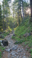
(3) Leave the road and turn right onto a poorly marked track, walk past the ruins of the chalet and continue along this old path, which is, unfortunately, overgrown. The path is still distinguishable, however, but caution is advised to ensure a safe descent. Join the road and stay on it for a few metres until you reach the junction with the direct path leading to Balboutet.

(4) Turn left and, following a path that is in better condition than the previous one, reach the village of Balboutet.

(5) Walk through the village and take the last cobbled street; at a wayside shrine, join the path towards Usseaux. Further down, you’ll come to the road linking these two villages; turn left onto it to make your way gently back to the car park where you started (S/E).

Waypoints

  1. S/E : mi 0 - alt. 4,767 ft - Upper car park at Usseaux
  2. 1 : mi 1.26 - alt. 5,705 ft - Crossroads at the farm
  3. 2 : mi 2.18 - alt. 6,119 ft - Plan dell’Alpe
  4. 3 : mi 2.51 - alt. 5,988 ft - Crossroads with a hairpin bend
  5. 4 : mi 3.07 - alt. 5,459 ft - Balboutet crossroads
  6. 5 : mi 3.61 - alt. 5,154 ft - Balboutet
  7. S/E : mi 4.44 - alt. 4,770 ft - Upper car park at Usseaux

Notes

There are plenty of water sources on this route, including fountains at Plan dell’Alpe and in the two villages of Balboutet and Usseaux.

Worth a visit

Reviews and comments

4.3 / 5
Based on 2 reviews

Reliability of the description
4.5 / 5
Ease of following the route
4 / 5
Route interest
4.5 / 5
jp11
jp11

Overall rating : 4.7 / 5

Date of your route : Aug 30, 2025
Reliability of the description : ★★★★☆ Good
Ease of following the route : ★★★★★ Very good
Route interest : ★★★★★ Very good
Very busy route : Yes

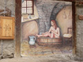
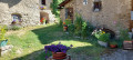
This route takes you through two very special villages in Occitanie, which are well worth exploring (allow an hour), with surprises around every corner. These villages are typical of the region, as this type of decorated and well-maintained village is often found here, and the Piedmontese are very friendly people who enjoy speaking French

For the tour:
- Contrary to what has been said, the path after Don Bosco is clearly visible and passes under a farm located on a hill.
- At (3), the path to the ruins is excellent, mowed, newly marked and with a new footbridge: a job well done. There is no chance of getting lost
-At (4): The Balboutet trail is not found after a few metres on the road, but after a good kilometre, after seeing the village bell tower on the left.
In summary, no problems encountered in a very pleasant landscape

Machine-translated

selinarobine
selinarobine

Overall rating : 4 / 5

Date of your route : Jul 15, 2024
Reliability of the description : ★★★★★ Very good
Ease of following the route : ★★★☆☆ Average
Route interest : ★★★★☆ Good
Very busy route : No

A really lovely route, but not really suitable for beginners as it’s all uphill for the first half of the route. The route after the holiday camp isn’t great – in fact, the path no longer exists, so you have to follow the road until, a little further on, you come to a path on the left that takes you to the mountain hut – a brilliant spot for a picnic with tables, benches and even some play equipment for the children.Be careful on certain sections of the descent where the markings aren’t very visible and don’t quite match the Visorando route; there are also lots of herds, so if you have a dog, make sure you keep it close to you (leashes are compulsory anyway).
A very lovely walk, and the villages of Usseaux and Balboutet are truly superb

Lots of people park in Usseaux – the car parks are full – yet you hardly come across anyone on the walk.

Machine-translated

Other walks in the area

For more walks, use our search engine .

The GPS track and description are the property of this route's author. Please do not copy them without permission.