The hidden side of the Maurienne

The lower part of the Maurienne Valley is better known for its motorway – which people drive along without stopping – than for its wild high-mountain landscapes.

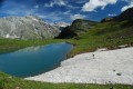
This route, starting from St Pierre d’Extravache and winding through rocky landscapes, deep blue lakes and ever-present glaciers, disproves the reputation that the valley may have been given. You’ll be walking for three days amongst mountain pastures and high peaks, whilst remaining in mid-mountain terrain.

Details

5340
Creation:
Last update:
Last review:
  • Walking
    Activity: Walking
  • ↔
    Distance: 22.39 mi
  • ◔
    Average duration: 3 days 
  • ▲
    Difficulty: Difficult

  • ⚐
    Back to start: Yes
  • ↗
    Ascent: + 9,124 ft
  • ↘
    Descent: - 9,035 ft

  • ▲
    Highest point: 10,154 ft
  • ▼
    Lowest point: 5,348 ft

Photos

Stages of the route

This route needs several days, find the details below:

  1. S
  2. 2
  3. E

Notes

Bramanette Refuge: 0033 (0)4 79 05 10 93 – 06 74 28 48 01 (at the refuge)

Ambin Refuge: Refuge: 04 79 20 35 00, Warden: 06 72 64 36 94

Please note that it is possible to complete a circular route between Le Planey and St Pierre d’Extravache, but this involves taking a small tarmac road. In this case, it is best to set off from Le Planey, as the first stage is short.

Worth a visit

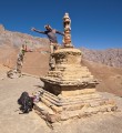
Before leaving the car park at St Pierre d’Extravache, don’t forget to visit this magnificent chapel, the ruins of which have been beautifully preserved.

Always be cautious and plan ahead when you're outdoors. Visorando and the author of this route cannot be held responsible for any accidents occurring on this route.

Reviews and comments

4.7 / 5
Based on 3 reviews

Reliability of the description
4.3 / 5
Ease of following the route
4.7 / 5
Route interest
5 / 5
Richard D288
Richard D288

Overall rating : 4.7 / 5

Date of your route : Jul 17, 2017
Reliability of the description : ★★★★☆ Good
Ease of following the route : ★★★★★ Very good
Route interest : ★★★★★ Very good

Hello,
A three-day hike over the long weekend of 14 July, starting from Le Planey.
We went self-catering and camped (the lodges were fully booked – we’d left it too late...).
There weren’t many people on the trails, though there were a few more towards the end in the stunning Savine valley.
We saw a few marmots but no ibex or chamois...

No trouble following the markings; paint marks and/or cairns are clearly visible where the trail is less obvious.

Day 1: Planey – between the refuge and the Col de Bramanette
Day 2: to the Lacs Blancs, just before descending to the bottom of the Ambin valley (elevation 2,628 m on the IGN map: the sun sets later and rises earlier there than at the bottom of the valley!!)
Day 3: Return to Pleney
The description refers to mid-mountain terrain: be warned, you’re still at over 2,500m for most of the time, with stony paths that are quite technical in places.
There are a few sections on snowfields below the passes, but nothing dangerous if tackled with the minimum caution required in the mountains.

Between Le Planay and Bramanette, there are no difficulties; the trail(s) is (are) very well signposted – the plural is necessary as you have several options depending on whether you choose the most direct route or head down more or less towards St Pierre d’Extravache. The Bramanette valley is superb and the welcome from the refuge warden was delightful (he was sorry to have had to turn us away for the night due to lack of space, but prioritises the quality of his hospitality over the number of tourists he accommodates).

The climb up to the Col de Bramanette is easy, with a clearly visible path. PLEASE NOTE: at the bottom of the pass, a sign indicates ‘Refuge d’Ambin 3h40’: this is clearly a typo, as it will take you about an hour longer (a second sign further on towards Plan d’Etache indicates 3h20, which is closer to reality).
The Col de la Coche is marked on several signs as ‘not recommended’, in favour of the Pas de la Coche, which is reached via a path that is also clear and well signposted.

From the start of the Ambin valley, the path is shared with those heading for the Col de l’Agnel and Lac d’Ambin (yellow and red markings). On the ascent, the yellow markings (for the Col de l’Agnel) veer off to the left to go round a rocky outcrop, whilst the red markings (for Lac d’Ambin and the Col d’Ambin) continue straight on. And we didn’t see a sign at the fork indicating the two directions… If – like us – you follow the red markings (which feel more ‘natural’ as they follow the natural course of the path), don’t panic: once you reach a plateau below the passes, get out your compass (or ‘read’ the terrain) heading NNE: you’ll easily find the yellow path again – the paint marks and cairns are frequent.
The start of the descent on the Italian side is also marked in yellow; the markings are visible, though a bit sparse at first, but absolutely unmissable thereafter, with a ‘cleared’ path all the way to the Vaccarone refuge (where the welcome is, once again, perfect!).
The path is a little technical on the descent below the refuge, but the climb up to the Col Clapier poses no problems and leads into the superb (and rather busy.. Savine valley.
At the bottom of the valley, take a small path to the left towards the Suffet refuge (1 hr 40 mins). A lovely, technical descent (where it’s easy to miss the turn-off to the refuge and end up at Plan de la Vie… where you’ll discover a section of the Mont-Cenis waterworks, but above all, you’ll end up extending an already very long day!

A superb hike, but best suited to walkers who aren’t put off by long stages.

Machine-translated

romvic
romvic

Overall rating : 5 / 5

Date of your route : Jul 17, 2017
Reliability of the description : ★★★★★ Very good
Ease of following the route : ★★★★★ Very good
Route interest : ★★★★★ Very good

A walk undertaken exactly as described, with no prior knowledge of the Haute-Maurienne.
Stage 1 is very short and of little interest, except, of course, for the warm welcome at the Bramanette refuge.
That said, it’s handy if you’re coming from a bit further afield. Setting off in the middle of the afternoon is more than enough.
It’s best to park at Le Planay (you’ll be glad you did on the way back)
Stage 2 is pleasant and fairly relaxed. Do make sure to set aside some time to wander around the foothills of the Pas de la Coche (on both sides), to enjoy the scenery, the wildlife and the climbers tackling multi-pitch routes.
Stage 3 is a mixed bag, with a marvellous first section – Lac d’Ambin, partly frozen (15 July) – a very beautiful climb up to the Colle del Agnello (we veered slightly left before the summit, following the ridges up to around 3,200 metres); the view over the Val de Suze is impressive. The descent is very beautiful and wild. A quick break for a cold beer at the Vaccarone refuge (4 hours including the detour along the ridges), waterfalls, lakes, wildlife – everything is beautiful.
It’s a whole different world at the Col Clapier, where you find yourself on a very busy walking path (apparently even used by elephants, though we didn’t see any!!) leading to the junction for the descent into the Vallon d’Ambin, which you reach via a steep and rather unpleasant path.
If, like us, you’ve left your car in St Pierre, I hope – as we did – that you’ll find a friendly motorist who’ll kindly give you a lift back to your car.
We did this hike whilst camping near the mountain huts (which were fully booked).
Thank you for introducing me to this beautiful mountain; I’ll certainly be back for the section from Plan-les-Eaux to Le Clapier, with variations to explore in France or Italy.
Happy hiking to you all...

Machine-translated

aster88
aster88

Overall rating : 4.3 / 5

Date of your route : Jul 15, 2016
Reliability of the description : ★★★★☆ Good
Ease of following the route : ★★★★☆ Good
Route interest : ★★★★★ Very good

We did this walk by splitting it up as follows:
Day 1: St Pierre d’Extravache – Lac Noir
Day 2: Lac Noir – Lac de Savine (without going via the Ambin refuge)
Day 3: Lac de Savine – St Pierre d’Extravache

The path is fairly well signposted.
We encountered several difficulties:
- We cut across the rocky outcrops to reach the Pas de la Coche, but on reflection it might be quicker to stay on the marked path. The Col de la Coche is not recommended.
- The path from Lac d’Ambin to the Col de l’Agnel is virtually non-existent (until you come across a marked path for the final stretch).
- The path leading down from the Col de l’Agnel is also virtually non-existent in places, or hidden beneath snowfields.
- There were still plenty of snowfields when we did the hike (the weekend of 14 July), especially around the passes. This meant we had to take a few detours or waste a bit of time finding our way.
- To get back down to Le Planey, we followed the signs for ‘Refuge du Suffet’ (as there were no signs for Le Planey) and descended to ‘Plan de la Vie’, which must have added a bit to the distance. At the second junction after the ruins of Savine, we took the path furthest to the left (a hairpin bend); it might have been better to take another path that also went to the left and looked as though it was going downhill, but there were no signposts.

It takes a good hour to walk from Le Planey to St Pierre d’Extravache.

In total, we walked for 10 hours over the first two days and 6 hours on the last day, including plenty of breaks (snacks, meals, a nap, and stops to watch marmots, ibex and chamois) and a few moments spent finding our way or looking for cairns in the scree!

This hike is definitely worth doing: the scenery is magnificent, and you’re sure to spot marmots and ibex…

Machine-translated

Willis43
Willis43

Oh well... Thanks anyway, and have a great summer!
But if anyone has any ideas for this project,
thanks in advance!
Willis

Machine-translated

Pierrot
Pierrot ★

Well… I don’t really have much to say about it. I did the raid three years ago, I haven’t set foot in that area since, and at the moment I’m a bit swamped with work, so I can’t be bothered to think about it when I log in in the evening… To top it all off, half the names mentioned don’t mean much to me anymore! Sorry…

Machine-translated

Willis43
Willis43
• Edited:

Hello,
I’m quite interested in this hike in principle. However, given the (fairly recent) opening of the Vaccarone refuge, I’m considering (as I only have 3 days):
Day 1: arrival from Lyon; set off from Le Planay, stop at Vaccarone via the Col de l’Agnel,
Day 2: Col Clapier to the Petit-Mt-Cenis refuge, with a few lakes (Giaset? Blanc? Noir?...) depending on how I’m feeling
Day 3: Signal du Petit-Mont-Cenis, then back to Le Planay and on to Lyon.

What do you think, Pierrot? I should point out that I’m a fairly experienced senior solo walker – though I’ve no experience with gas stoves or bivouacking.
Thanks!
Willis

Machine-translated

Pierrot
Pierrot ★

Come to think of it, I’ve just realised I’ve posted very few photos from this rally. I’ll sort that out today!

Machine-translated

Other walks in the area

For more walks, use our search engine .

The GPS track and description are the property of this route's author. Please do not copy them without permission.