


The edelweiss at Fort Foens


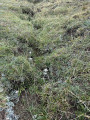
A short walk amongst the edelweiss for anyone planning to camp at Fort Foens and wishing to take a short stroll before or after spending the night there, to view the fort from above. You’ll discover the surrounding mountains and the little stream at the bottom of the narrow gorges.
Details
Creation:
Last update:
Last review:
–
–
-
 Activity: Walking
 -
 Distance: 2.13 mi
 -
 Average duration: 1h 50
 -
 Difficulty: Moderate
 -
-
 Back to start: Yes
 -
 Ascent: + 1,027 ft
 -
 Descent: - 1,040 ft
 -
-
 Highest point: 8,281 ft
 -
 Lowest point: 7,257 ft
 Country:

 City:
City:


Photos
Waypoints
- S/E : mi 0 - alt. 7,277 ft
- S/E : mi 2.13 - alt. 7,264 ft
Other walks in the area
La Madone de Cotolivier
 Visorando Member
 5.71 mi
+2,152 ft
-2,169 ft
4h 30
Moderate
5.71 mi
+2,152 ft
-2,169 ft
4h 30
Moderate
 Departure from Oulx (Torino)
Close to the French-Italian border, this is a very pleasant route offering splendid views over the valley linking Bardonecchia to Turin.
Refuge de la Chardouse - Pamplinet
10.60 mi
+3,166 ft
-3,681 ft
7h 40
 Very difficult
Departure from Oulx (Torino)
Very difficult
Departure from Oulx (Torino)
This is the first stage of a journey that will take you across France, following the 45th parallel as closely as possible (within 10 km). To truly cross France and avoid going back and forth, the starting point is in Italy. However, it is possible to start from Pamplinet and climb up to the Col de Désertes to start from the French-Italian border.
Four villages on the left bank of the Doria Ripaira
 4.57 mi
+1,670 ft
-1,673 ft
3h 35
Moderate
Departure from Oulx (Torino)
4.57 mi
+1,670 ft
-1,673 ft
3h 35
Moderate
Departure from Oulx (Torino)
For a tour of four typical villages, this is a very shaded route that will delight young and old alike.
Croce Chabriere
 5.04 mi
+3,117 ft
-3,114 ft
5h 00
5.04 mi
+3,117 ft
-3,114 ft
5h 00
 Difficult
Departure from Bardonecchia (Torino)
Difficult
Departure from Bardonecchia (Torino)
Above Bardonecchia, this cross has a particularly striking view of the winding road connecting the exit from the Fréjus tunnel to the Italian cities, beginning with Turin.
From the Ambin Refuge to Le Planey
 Association / Club / Walk leader
 11.65 mi
+3,363 ft
-5,233 ft
8h 15
Difficult
Departure from Bramans (Savoie)
11.65 mi
+3,363 ft
-5,233 ft
8h 15
Difficult
Departure from Bramans (Savoie)
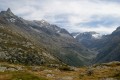
A very beautiful route amongst glaciers and lakes, which crosses the Italian border (beautiful view of the Val di Suza) and returns to France via the Col Clapier, which Hannibal and his elephants probably passed through.
This route follows on from the hike “From the Bramanette Refuge to the Ambin Refuge”, but can easily be done starting from the Ambin Refuge alone.
The hidden side of the Maurienne
 22.39 mi
+9,124 ft
-9,035 ft
3 days
Difficult
Departure from Bramans (Savoie)
22.39 mi
+9,124 ft
-9,035 ft
3 days
Difficult
Departure from Bramans (Savoie)
The lower part of the Maurienne Valley is better known for its motorway – which people drive along without stopping – than for its wild high-mountain landscapes.
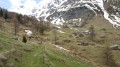
This route, starting from St Pierre d’Extravache and winding through rocky landscapes, deep blue lakes and ever-present glaciers, disproves the reputation that the valley may have been given. You’ll be walking for three days amongst mountain pastures and high peaks, whilst remaining in mid-mountain terrain.
Lake Lauson and Fort Gran Costa from Grand Puy
 4.80 mi
+2,585 ft
-2,579 ft
4h 30
Moderate
Departure from Pragelato (Torino)
4.80 mi
+2,585 ft
-2,579 ft
4h 30
Moderate
Departure from Pragelato (Torino)
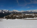
Enjoy both the pleasure of a lake and a beautiful ridge offering a 360° panorama (Écrins, Vanoise, Orsiera Park, Val Troncea, Queyras), all starting from a charming little hamlet that has been beautifully restored.
For more walks, use our search engine .
The GPS track and description are the property of this route's author. Please do not copy them without permission.

