The Hamlets of Champlas

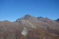
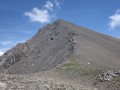
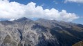
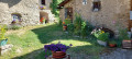
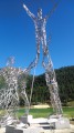
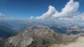
Just before the Sestrières ski resort lie three hamlets, situated to the west, which overlook the valley and offer remarkable views of the French-Italian border. This very easy circular walk links the hamlets of Champlas du Col, Champlas Janvier and Champlas Seguin.

Details

n°25031457
Creation:
Last update:
Last review:
  • Walking
    Activity: Walking
  • ↔
    Distance: 4.84 mi
  • ◔
    Average duration: 3h 25 
  • ▲
    Difficulty: Moderate

  • ⚐
    Back to start: Yes
  • ↗
    Ascent: + 1,339 ft
  • ↘
    Descent: - 1,339 ft

  • ▲
    Highest point: 6,644 ft
  • ▼
    Lowest point: 5,820 ft

Description of the walk

In Cesana-Torinese, take the road to Setrières, pass the Champlas Seguin junction and then turn left at the next junction. Park in the car park at the entrance to Champlas Janvier.

(S/E) Continue left along the road to pass through Champlas Janvier. At the end of the road, follow a wide track and continue slightly uphill to reach Champlas Seguin.

(1) Turn right onto the road, which is tarmac at first but soon becomes a dirt track, and, after a steep climb, you’ll reach a junction where there is a bunker. Keep to the right to reach Fort Seguin.

(2) Walk round it, then continue along the track until you reach a crossroads with a footpath.

(3) Continue along the track; the climb becomes easier. At the Y-junction, turn right to reach Rifugio Chalmette.

(4) Follow the same route in the opposite direction to return to the path junction.

(3) Turn left onto the path running alongside a canal that no longer exists. Continue along this almost level path until you reach the Sentiero Natura Louis XIV.

(5) Continue straight ahead downhill to reach the hamlet of Champlas du Col.

(6) Return in the opposite direction to the previous junction.

(5) Turn left and continue along the Louis XIV path. You will reach a four-way junction above Champlas Janvier.

(7) Turn sharply left (90°) onto the path leading downhill to return to the Champlas Janvier car park (S/E).

Waypoints

  1. S/E : mi 0 - alt. 5,820 ft - Champlas Janvier car park
  2. 1 : mi 0.83 - alt. 5,856 ft - Champlas Seguin
  3. 2 : mi 1.66 - alt. 6,316 ft - Fort Seguin
  4. 3 : mi 1.85 - alt. 6,398 ft - Chalmette Refuge
  5. 4 : mi 2.16 - alt. 6,621 ft - Crossroads at the end of the circular loop
  6. 5 : mi 3.39 - alt. 6,188 ft - Louis XIV Trail
  7. 6 : mi 3.67 - alt. 5,837 ft - Champlas du Col
  8. 7 : mi 4.59 - alt. 6,093 ft - Four-way junction
  9. S/E : mi 4.84 - alt. 5,820 ft - Champlas Janvier car park

Notes

(S/E), (1), (6); water is available at the fountains in the hamlets and at the refuge (3).

Worth a visit

(2) Walk round Fort Seguin, which was demolished following the 1947 agreements.

Reviews and comments

4.7 / 5
Based on 1 review

Reliability of the description
5 / 5
Ease of following the route
5 / 5
Route interest
4 / 5
fribourg-blanc
fribourg-blanc

Overall rating : 4.7 / 5

Date of your route : Oct 13, 2022
Reliability of the description : ★★★★★ Very good
Ease of following the route : ★★★★★ Very good
Route interest : ★★★★☆ Good
Very busy route : No

An easy, enjoyable walk.
Excellent route description. You just need to follow the directions!

Machine-translated

Other walks in the area

For more walks, use our search engine .

The GPS track and description are the property of this route's author. Please do not copy them without permission.