


Strada del Valle Argentera


A wonderful mountain bike ride from Sestrières to the Valle d’Argent. A stunning spot at the bottom of a beautiful, unspoilt valley. Waterfalls, rivers… well worth a visit. The climb back up to Sestrières is a bit technical.
Details
Creation:
Last update:
Last review:
–
–
-
 Activity: Mountain biking
 -
 Distance: 22.07 mi
 -
 Duration according to the author: 3 hrs
 -
 Difficulty: Moderate
 -
-
 Back to start: No
 -
 Ascent: + 2,533 ft
 -
 Descent: - 4,052 ft
 -
-
 Highest point: 7,024 ft
 -
 Lowest point: 5,226 ft
 Country:

 City:
City:


Waypoints
- S : mi 0 - alt. 6,749 ft - Sestriere
- 1 : mi 2.11 - alt. 6,004 ft - Grangesises
- 2 : mi 3.15 - alt. 5,738 ft - Bessen Basse
- 3 : mi 4.05 - alt. 6,243 ft - Fork in the road
- 4 : mi 4.39 - alt. 6,178 ft - Brusa de la Merle
- 5 : mi 4.84 - alt. 6,027 ft - Brusa del Plan
- 6 : mi 8.46 - alt. 6,319 ft - Torrente Ripa
- 7 : mi 8.86 - alt. 6,237 ft - Grange Graces
- 8 : mi 13.37 - alt. 6,660 ft - Rio della Brusa
- 9 : mi 14.83 - alt. 6,742 ft - Rio Ciagrassa
- 10 : mi 15.31 - alt. 6,476 ft - Bessén Haut
- 11 : mi 16.53 - alt. 6,575 ft - Rio Sises
- 12 : mi 19.8 - alt. 6,004 ft - Borgata
- E : mi 22.07 - alt. 5,246 ft - Club Med
Other walks in the area
Lake Néal
 Visorando Member
 9.00 mi
+2,556 ft
-2,536 ft
2 hrs
Moderate
9.00 mi
+2,556 ft
-2,536 ft
2 hrs
Moderate
 Departure from Arvieux (Hautes-Alpes)
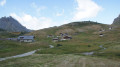
A lovely ride, taking in the Clapeyto chalets, mountain lakes and superb views of the surrounding peaks.
Ascent via the trails to the Col de Furfande from Arvieux
3.90 mi
+3,117 ft
-33 ft
1.5 hrs
 Very difficult
Departure from Arvieux (Hautes-Alpes)
Very difficult
Departure from Arvieux (Hautes-Alpes)
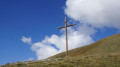
Instead of taking the ‘classic’ ascent via the forest road, opt for a route that climbs more steeply and features much more technical single-track sections – this will give you a good warm-up for the descent towards Les Granges de Furfande, then on to Le Queyron and finally back to Arvieux. I’ve only described the ascent route here. For the descent, use the Col de Furfande route guide , described by morgiou13, available at (2). Given the difficulty of the climb (steep sections and tight, steep hairpin bends), this route is best suited to e-MTBs.
Col de Furfande
 13.50 mi
+3,753 ft
-3,737 ft
2.5 hrs
13.50 mi
+3,753 ft
-3,737 ft
2.5 hrs
 Difficult
Departure from Arvieux (Hautes-Alpes)
Difficult
Departure from Arvieux (Hautes-Alpes)
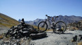
A lovely ride. It starts with a good climb along the track, followed by a lovely view of the Granges de Furfande. A stop at the Refuge de Furfande for a break, followed by a lovely technical descent, finishing with a traverse through the forest from Queyron.
Pic de Château Renard – Col du Longet
 15.46 mi
+3,573 ft
-3,570 ft
2.5 hrs
Difficult
Departure from Molines-en-Queyras (Hautes-Alpes)
15.46 mi
+3,573 ft
-3,570 ft
2.5 hrs
Difficult
Departure from Molines-en-Queyras (Hautes-Alpes)
A high-mountain ride taking in Saint-Véran, the highest inhabited village in Europe. A beautiful climb up to the Pic de Château Renard observatory, with magnificent views. To finish, a lovely technical descent from the Col du Longet.
Antique Circuit
9.66 mi
+2,641 ft
-2,618 ft
4 hrs
Difficult
Departure from Freissinières (Hautes-Alpes)
A lovely mountain bike loop, climbing on a forest track and descending on a remarkable trail through a cool larch forest. Fans of fast, flowing single tracks will be delighted. Straddling the municipalities of Freissinières and Champcella, the latter have always fought over the mountain pastures, and this is still the case today. There is a very short section where you will need to carry your bike.
For more walks, use our search engine .
The GPS track and description are the property of this route's author. Please do not copy them without permission.

