Dormillouse Ridge

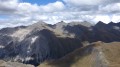
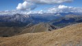
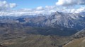
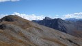
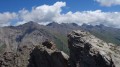
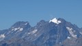
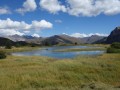
A hike off the beaten track towards a border ridge offering exceptional panoramic views of Italy, the Queyras, the Cerces and the Vanoise.
Use of the Visorando app is recommended.

Details

285183
Creation:
Last update:
Last review:
  • Walking
    Activity: Walking
  • ↔
    Distance: 6.74 mi
  • ◔
    Average duration: 6h 00 
  • ▲
    Difficulty: Difficult

  • ⚐
    Back to start: Yes
  • ↗
    Ascent: + 3,356 ft
  • ↘
    Descent: - 3,337 ft

  • ▲
    Highest point: 9,491 ft
  • ▼
    Lowest point: 6,155 ft

Photos

Description of the walk

Access: Head towards the Col d’Izoard and Cervières via the D902.
In Cervières, just after the entrance chicane, head up towards the higher part of the village by taking the first junction on your left, to join the D89T at the Church of Saint-Michel.
Cross the Bourget plain, then take the lane on the left leading to the Chapel of the Transfiguration, which can be seen from the road. Park near the chapel.

(S/E) Take the lane to the north-east towards the hamlet of Le Bourget.
Walk through the hamlet, then head towards the Cabot farms.

(1) Cross the stream of the same name, then head off-trail north-east as the terrain dictates towards the ‘La Gondrée’ farm.

(2) Continue in the same direction, following the valley of the Ruisseau de Jouan on the left to reach the ridge and boundary marker 39.

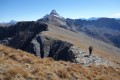
(3) Follow the ridge as best you can south-eastwards to the cross at the Cime de Dormillouse.
During this ascent, it is not possible to follow the entire ridge line, and you will sometimes need to go below it on the right to bypass certain small secondary outcrops.
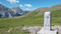
At the foot of the cross, there is a visitors’ book where you can record your visit.

(4) Return in the opposite direction along the same route as the outward journey to the car park (S/E).

Waypoints

  1. S/E : mi 0 - alt. 6,155 ft - Car park near the chapel
  2. 1 : mi 0.23 - alt. 6,191 ft - Cabot hamlet
  3. 2 : mi 0.43 - alt. 6,339 ft - Bergerie la Gondrée
  4. 3 : mi 2.08 - alt. 8,635 ft - Border ridge
  5. 4 : mi 3.37 - alt. 9,491 ft - Cime de Dormillouse
  6. S/E : mi 6.74 - alt. 6,155 ft - Car park near the chapel

Notes

I’ve made a video, which includes the names of the peaks, captures the atmosphere and shows the route of this walk.

Although it is possible to complete the route using a map and compass, I recommend using GPS or a smartphone(connected to a power bank for extended battery life) to save time. The Visorando app is ideal for this purpose.

Reviews and comments

4.3 / 5
Based on 1 review

Reliability of the description
4 / 5
Ease of following the route
4 / 5
Route interest
5 / 5
Marie-Claude PRICAZ
Marie-Claude PRICAZ

Visorando – wherever you want to go, it’s absolutely BRILLIANT

Machine-translated

Britanicus100
Britanicus100
• Edited:

Thank you for posting your review, which confirms how useful a GPS is for this hike, as mentioned in the practical information.
For your information, the Italian peaks visible from this ridge can also be reached on foot via the Col de Montgenèvre. I’ve created the route guides for these 3,000-metre peaks on the website, as well as the videos.
Roc del Boucher, Cima del Pelvo and the Bric Froid or Pointe Ramière (which is easier to climb from Italy than from the Queyras).

Machine-translated

PHILIPPONNEAU
PHILIPPONNEAU

Overall rating : 4.3 / 5

Date of your route : Aug 14, 2023
Reliability of the description : ★★★★☆ Good
Ease of following the route : ★★★★☆ Good
Route interest : ★★★★★ Very good
Very busy route : No

An unmarked walk requiring the use of a GPS for the first part of the ascent towards the ridges. You will need to adjust the route slightly to take account of sheep pens, which must be bypassed. Herds of sheep and sheepdogs are present near the summit of Dormillouse.
Breathtaking panoramic views over the ridges.

Machine-translated

Other walks in the area

For more walks, use our search engine .

The GPS track and description are the property of this route's author. Please do not copy them without permission.