


Refine your search for walks in Noirétable
Noirétable walks


 The Altar of the Barony and the Gilbernie Oak Tree
 Visorando Member
 5.79 mi
 +597 ft
 -571 ft
 3h 10
3h 10
 Easy
Easy
 Departure from Noirétable (Loire)
An easy walk through fields and woods to discover a beautiful rock formation, the Autel de la Baronnie, with its wobbly stone, armchairs and potholes, followed by a large majestic oak tree at the Ferme de la Gilbernie.
The chestnut tree of La Bitortie
6.50 mi
+801 ft
-778 ft
3h 40
 Moderate
Departure from Noirétable (Loire)
Moderate
Departure from Noirétable (Loire)
A walk in the Netrablaise countryside, across fields, from hamlet to hamlet, to discover an old and majestic chestnut tree.
Noirétable Lake and Puy de Rot
 4.64 mi
+472 ft
-476 ft
2h 35
Easy
Departure from Noirétable (Loire)
4.64 mi
+472 ft
-476 ft
2h 35
Easy
Departure from Noirétable (Loire)
A gentle hike to start your holiday in the Forez mountains.
Lit de la Vierge - Pas de la Vierge
 2.31 mi
+489 ft
-489 ft
1h 30
Moderate
Departure from Noirétable (Loire)
2.31 mi
+489 ft
-489 ft
1h 30
Moderate
Departure from Noirétable (Loire)
A pleasant, mostly shaded walk leading to a magnificent panorama from the summit (granite chaos at an altitude of 1,260 metres).
Bois de Dôle
 Local authority
 2.34 mi
+276 ft
-276 ft
1h 20
Easy
Departure from Chausseterre (Loire)
2.34 mi
+276 ft
-276 ft
1h 20
Easy
Departure from Chausseterre (Loire)
A family-friendly route for a breath of fresh air in the Dole forest at Chausseterre. A shaded route, very pleasant on hot days. It has its charms in other seasons, too. This is a route marked by Urfé Random and the Pays d’Urfé Community of Communes with the number 28.
The Vernières oak tree via the Chemin de la Pierre aux deux Yeux
7.80 mi
+1,220 ft
-1,234 ft
4h 40
Moderate
Departure from Chabreloche (Puy-de-Dôme)
Hidden in the heart of the Bois Noirs, the Pierre aux Deux Yeux (Two-Eyed Stone) watches over the unwary hiker. If you escape it, the majestic old oak tree will grant you some of its serenity. Then take a break at the foot of the Roc du Guet rock formation, a place conducive to meditation.
La Renaudie – Sainte-Agathe
 Association / Club / Walk leader12.96 mi
+1,673 ft
-2,661 ft
7h 25
Association / Club / Walk leader12.96 mi
+1,673 ft
-2,661 ft
7h 25
 Difficult
Departure from La Renaudie (Puy-de-Dôme)
Difficult
Departure from La Renaudie (Puy-de-Dôme)
This fourth stage of the route is the longest and most challenging. We will often be walking at high altitudes (highest point: 1,153 m). We will follow the River Couzon before descending along good paths through the woodland towards Vollore-Montagne. The walk through the Ayguebonne Forest, near the Grun de Chignore, will take us to Sainte-Agathe.
Circular Cornes d'Urfé starting from Saint-Marcel d'Urfé
 9.92 mi
+1,883 ft
-1,893 ft
6h 10
Moderate
Departure from Saint-Marcel-d'Urfé (Loire)
9.92 mi
+1,883 ft
-1,893 ft
6h 10
Moderate
Departure from Saint-Marcel-d'Urfé (Loire)
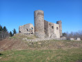
Circular through the countryside and forest to discover Les Cornes d'Urfé.
Between agriculture and heritage in Saint-Marcel-d'Urfé
 11.77 mi
+1,969 ft
-1,978 ft
7h 10
Moderate
Departure from Saint-Marcel-d'Urfé (Loire)
11.77 mi
+1,969 ft
-1,978 ft
7h 10
Moderate
Departure from Saint-Marcel-d'Urfé (Loire)
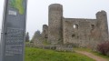
A hike to an altitude of nearly 1,000 metres, through a farming landscape where you will encounter ancient heritage.
Around the Ruisseau de la Faye
 5.54 mi
+663 ft
-656 ft
3h 05
Easy
Departure from Le Brugeron (Puy-de-Dôme)
5.54 mi
+663 ft
-656 ft
3h 05
Easy
Departure from Le Brugeron (Puy-de-Dôme)
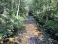
A pleasant walk in summer thanks to the cool, refreshing air. The stream is well-known to anglers, and the lucky few may even find some chanterelle mushrooms to pick. This is the realm of wild boar and roe deer…You’ll pass through old villages such as La Terrasse (with a very old house on the right), which was very important in the early 20th century. A victim of rural depopulation, Montolas is now nothing but ruins!
Around the Roc de l’Olme
4.80 mi
+886 ft
-896 ft
3h 00
Easy
Departure from Chalmazel (Loire)
A short route mainly through the forest, where the autumn sun plays through the foliage.
From the summit of the climbing rock, a unique panorama unfolds before you.
Route des Loges on the Hautes Chaumes
9.32 mi
+1,368 ft
-1,398 ft
5h 30
Moderate
Departure from Chalmazel (Loire)
The lodges or shepherd's huts, located on the Hautes Chaumes, were summer pasture buildings from May to October.
To get to the start of the hike, after passing the hamlet of Nermond, 200 m away, in a straight line, at the crossroads of this road with the Route de la Combe on the right, turn more to the right and take a stony path, heading for the calvary. Park at the bottom or in the cornfields on the left-hand side of the uphill path.
Le Puy de Montoncel
 7.50 mi
+1,516 ft
-1,493 ft
4h 45
Moderate
Departure from Palladuc (Puy-de-Dôme)
7.50 mi
+1,516 ft
-1,493 ft
4h 45
Moderate
Departure from Palladuc (Puy-de-Dôme)
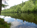
For much of this route, it is clear why we are walking through the Bois Noirs, as the light sometimes struggles to penetrate the foliage. In other places, however, tree felling has opened up the view, and the number of logs stacked along the paths is impressive.
The Puy de Montoncel from La Lizolle
 4.45 mi
+1,385 ft
-1,401 ft
3h 15
Moderate
Departure from Palladuc (Puy-de-Dôme)
4.45 mi
+1,385 ft
-1,401 ft
3h 15
Moderate
Departure from Palladuc (Puy-de-Dôme)
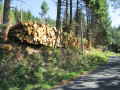
The Giant of the Bois Noirs, whose summit is often shrouded in clouds or mist, can be approached from Lavoine or Saint-Priest-la-Prugne. For this walk, we chose to approach it via Palladuc. It is a fairly strenuous walk, but one that guarantees peace and quiet, wide open spaces and sweeping views over this part of the beautiful Auvergne region.
Circular Col de la Loge starting from Chalmazel
12.74 mi
+2,034 ft
-2,028 ft
7h 40
Difficult
Departure from Chalmazel (Loire)
A walk in the Monts du Forez, towards the Hautes Chaumes, passing through heathland dotted with heather and blueberry bushes, then through forests.
4-pass circular starting from Chalmazel-Jeansagnières
10.85 mi
+1,565 ft
-1,545 ft
6h 20
Moderate
Departure from Chalmazel (Loire)
An ideal hike to do in the morning to enjoy the coolness of the undergrowth, sheltered from the rising sun.
You will overlook the Chalmazelloise valley, the Haut Lignon valley and, in the distance, the summit of Pierre sur Haute.
Your attention will be drawn to the numerous blueberry fields.
Tour of Chalmazel via Roc de l'Olme
9.93 mi
+1,407 ft
-1,440 ft
5h 45
Moderate
Departure from Chalmazel (Loire)
From the top of Roc de l'Olme, a rock climbing spot, you can admire the view overlooking Chalmazel and the Lignon valley.
The sound of streams will accompany your steps.
The mountain-pass route starting from Palogneux
 5.72 mi
+961 ft
-942 ft
3h 30
Moderate
Departure from Palogneux (Loire)
5.72 mi
+961 ft
-942 ft
3h 30
Moderate
Departure from Palogneux (Loire)
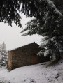
Starting from the village of Palogneux, this forest route passes by the Saint-Roch Chapel on its way to the hamlet of Boissel. It then returns to the village via the Col du Las and the Col de la Grande Roue.
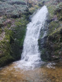
The basalt columns of Puy de Chavanne and the Ligeay waterfalls
 10.68 mi
+1,827 ft
-1,844 ft
6h 30
Moderate
Departure from Palogneux (Loire)
10.68 mi
+1,827 ft
-1,844 ft
6h 30
Moderate
Departure from Palogneux (Loire)
Starting from the village of Palogneux, this route takes you past the basalt columns of the Puy de Chavanne, before continuing on to the Ligeay waterfalls. The route then follows a circular route along theGR®89to the village of Les Places, before returning to the village via the Goutte Crémière and the Épeurios.
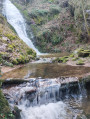
From Puy de Chavanne to the Ligeay Waterfalls via the Bois de Grand Val
 7.97 mi
+1,476 ft
-1,473 ft
4h 55
Moderate
Departure from Palogneux (Loire)
7.97 mi
+1,476 ft
-1,473 ft
4h 55
Moderate
Departure from Palogneux (Loire)
Starting from the village of Palogneux, this route takes you past the basalt columns of the Puy de Chavanne, then on to the fabulous Ligeay waterfalls. The return journey takes you through the Bois de Grand Val.
Circular route across the Hautes Chaumes from the Col du Béal
8.71 mi
+1,506 ft
-1,516 ft
5h 20
Moderate
Departure from Chalmazel (Loire)
A circular walk starting from the Col du Béal. The route takes you via Peyre Mayou, the Refuge de la Roche, the Rochers de la Chapelle, Pierre sur Haute and then the burons de la Richarde. The return route is via the Rocher de la Chaize.
 From the Col du Béal to the Col des Supeyres
 17.18 mi
+1,936 ft
-2,024 ft
6 hrs
Moderate
Departure from Saint-Pierre-la-Bourlhonne (Puy-de-Dôme)
17.18 mi
+1,936 ft
-2,024 ft
6 hrs
Moderate
Departure from Saint-Pierre-la-Bourlhonne (Puy-de-Dôme)
Over two days, discover one of the most beautiful destinations in “France à Cheval”.
 From the Col du Béal to Pierre sur Haute
10.32 mi
+1,696 ft
-1,696 ft
6 hrs
Difficult
Departure from Saint-Pierre-la-Bourlhonne (Puy-de-Dôme)
On snowshoes or on foot, from the Col du Béal to the summit of Pierre-sur-Haute through the forest. Return via the ridges, still on theGR®3or a variant thereof.
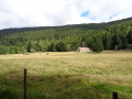
The Fossat valley and Pierre-sur-Haute from the Col du Béal
 10.13 mi
+1,785 ft
-1,781 ft
6h 15
Moderate
Departure from Saint-Pierre-la-Bourlhonne (Puy-de-Dôme)
10.13 mi
+1,785 ft
-1,781 ft
6h 15
Moderate
Departure from Saint-Pierre-la-Bourlhonne (Puy-de-Dôme)
A beautiful circular walk starting from the Fossat valley.
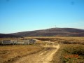
Col du Béal – Col des Supeyres
 10.70 mi
+1,503 ft
-1,591 ft
6h 15
Moderate
Departure from Saint-Pierre-la-Bourlhonne (Puy-de-Dôme)
10.70 mi
+1,503 ft
-1,591 ft
6h 15
Moderate
Departure from Saint-Pierre-la-Bourlhonne (Puy-de-Dôme)
Stage 2: the most beautiful stage of the route. Spectacular, with heathland stretching as far as the eye can see, a boundless 360° view where stunted pines bend under the “burle”. Photos, scents – set aside the whole day.
GR®3route, partly well signposted.
Tour du Teilhet
4.14 mi
+853 ft
-827 ft
1.5 hrs
Easy
Departure from Marat (Puy-de-Dôme)
If you’re on holiday in Marat, here’s a short route for a walk or a horse ride starting from La Ramie.
Pierre sur Haute via the Molinvé shepherd's huts
 11.37 mi
+1,736 ft
-1,736 ft
6h 45
Difficult
Departure from Chalmazel (Loire)
11.37 mi
+1,736 ft
-1,736 ft
6h 45
Difficult
Departure from Chalmazel (Loire)
“Here, more than anywhere else, one perceives the notion of infinity, and the concept of solitude takes on a new dimension.” This is how the famous geneticist Axel Kahn expressed his feelings during his journey through the Monts du Forez.
Pierre sur Haute via the Molinvé shepherd's huts
11.37 mi
+1,736 ft
-1,736 ft
6h 45
Difficult
Departure from Chalmazel (Loire)
Here, more than anywhere else, one gets a real sense of infinity, and the concept of solitude takes on a whole new dimension. This is how the renowned geneticist Axel Kahn described his experience during his journey through the Monts du Forez.
Olliergues – La Renaudie
11.84 mi
+2,933 ft
-1,230 ft
8h 00
Difficult
Departure from Olliergues (Puy-de-Dôme)
Starting from Olliergues town hall, we head uphill along the cobbled path. Most of this third stage follows the white and green-marked ‘Tour de Pays’ trail as far as Le Brugeron. From Le Brugeron, head towards Le Grun de Batailler, passing the Begue mill (waterfall). Cross Le Clef. At La Croix de Sainte-Agathe, take a small road, pass through the hamlet of Rochefolle to reach the village of La Renaudie, where you’ll find the communal lodge.
Dore Valley: Saint-Just Chapel and Meymont Bridge
 7.38 mi
+1,063 ft
-1,083 ft
4h 20
Moderate
Departure from Tours-sur-Meymont (Puy-de-Dôme)
7.38 mi
+1,063 ft
-1,083 ft
4h 20
Moderate
Departure from Tours-sur-Meymont (Puy-de-Dôme)
A hike in the heart of nature to discover a place steeped in history in the Dore river valley, on the borders of the Pays de Courpière, Cunlhat and Olliergues, in the heart of the Livradois-Forez Regional Nature Park.
Part of the route follows "the old path", the ancient medieval road that linked Meymont to Cunlhat via Tours Sur Meymont through Alligier, Les Gouttes, etc.
The Michonnette route starting from Les Moulins Cherier
 6.53 mi
+1,312 ft
-1,329 ft
4h 10
Moderate
Departure from Cherier (Loire)
6.53 mi
+1,312 ft
-1,329 ft
4h 10
Moderate
Departure from Cherier (Loire)
Explore three hamlets to the south and east of the village of Cherier: Le Bouchet, Tour and Mézire. The route follows the valleys of the Isable and the very pretty Michonnette valley, a small stream renowned for its trout and crayfish. There are beautiful viewpoints at the Croix du Bouchet and above Mézire. The elevation changes are quite steep: a 100-metre climb to reach the Croix du Bouchet and, in particular, the ascent of the ‘Trapillon’, which has been fitted with 35 steps.
Circular loop starting from Les Moulins Chérier
 11.13 mi
+1,696 ft
-1,680 ft
6h 35
Moderate
Departure from Cherier (Loire)
11.13 mi
+1,696 ft
-1,680 ft
6h 35
Moderate
Departure from Cherier (Loire)
A beautiful walk alternating between open views and paths along the Isable river.
 The Monts de la Madeleine near Cherier
 16.13 mi
+2,484 ft
-2,470 ft
4 hrs
Difficult
Departure from Cherier (Loire)
16.13 mi
+2,484 ft
-2,470 ft
4 hrs
Difficult
Departure from Cherier (Loire)
A very varied route linking two villages, climbing to the highest point (1,155 m), alternating between long, steady climbs and flat, rolling sections at altitude, with stunning views. Red mountain bike markings on a white background.
More walks in Noirétable
Select a point of interest below: