Country:

 City:
City:


The route starts at the car park situated between the town hall and the church in Moulins Cherier, where you can leave your car whilst on the walk.
(S/E) Walk round the church and take the Sentier des Roches, which leads down to the D53.
(1) Follow the D53 on the left until you reach the edge of the village heading towards Roanne, passing the D41 on your right which leads to Crémeaux, then the picnic area.
(2) Then leave the road by taking the path that climbs to the left, running alongside the Bois du Prieur. After a 100-metre climb, you’ll reach the Croix du Bouchet on a small plateau overlooking the Vallée des Moulins. There’s a picnic area with a table and benches.
(3) Continue straight ahead along the track which crosses the D53 as you reach Le Bouchet. Head downhill straight ahead along the path leading to a cross near a chalet.
(4) Turn left and follow the path to the hamlet of Écoche.
(5) Take the path on the right before the first house in the hamlet, which leads to the bottom of a flight of 35 steps.
(6) Climb these steps, which were built to make the ascent to the Croix Policon on the D53 easier.
(7) Follow the road for 200 metres to the left until you reach the “Grandes Côtes” track, which descends to the left towards the Isable valley and the D41.
(8) Follow this small road to the left for 650 metres until you reach the “Pont du Tuin” (meaning ‘wren’ in the local dialect).
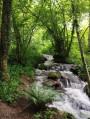
(9) Cross the bridge over the Isable to reach the pretty Michonnette valley, which winds its way between the stream and the deciduous woodland to the hamlet of Tour (with its old houses and a cross listed as a historic monument).
(10) When you reach the road, turn left, then take the first path leading uphill to the right before the last house. The view stretches further and further both before and after the hamlet of Mézire, which you’ll reach after a short stretch of road.
(11) After the first house, turn left onto the small path leading to the Croix Gonin, the highest point of the walk, at an altitude of 826 metres. Then begin the descent towards Moulins-Cherier, with lovely views of the Haut de la Faye, La Salette and then Les Moulins.
(12) At the road, turn left and then immediately right onto the Chemin de Gabet. At the D53 county road, turn left and then head back to the car park via the Sentier des Roches, below the church (S/E).
 Visorando Member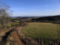

 Association / Club / Walk leader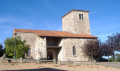
 Difficult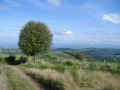
 Easy
Easy