The mountain-pass route starting from Palogneux

Starting from the village of Palogneux, this forest route passes by the Saint-Roch Chapel on its way to the hamlet of Boissel. It then returns to the village via the Col du Las and the Col de la Grande Roue.

Details

46248283
Creation:
Last update:
Last review:
  • Walking
    Activity: Walking
  • ↔
    Distance: 5.72 mi
  • ◔
    Average duration: 3h 30 
  • ▲
    Difficulty: Moderate

  • ⚐
    Back to start: Yes
  • ↗
    Ascent: + 961 ft
  • ↘
    Descent: - 942 ft

  • ▲
    Highest point: 3,307 ft
  • ▼
    Lowest point: 2,618 ft

Photos

Description of the walk

The starting point is in the small village of Palogneux. Park after the town hall, at Montée Saint-Pierre.

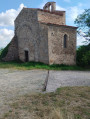
(S/E) Turn left towards the cemetery and continue along the dirt track to the Saint-Roch Chapel.

(1) Carry on straight ahead until you reach the junction with the Chemin de Prajus.

(2) Cross over to the opposite side. Then make sure you keep heading in the same direction without being distracted by the paths branching off on either side, and reach the hamlet of Boissel via the Chemin des Chassagnes.

(3) Take the second street on the left, then, at the next junction, cross the road and take the path almost directly opposite. When you reach the three-way junction at elevation 987, keep left to quickly reach the Col du Las.

(4) Take the path furthest to the left. Continue round the north side of L’Essart to reach the Col de la Grande Roue.

(5) Cross the road to take the path opposite. At the next junction, turn left to reach, 200 metres further on, the junction where you started.

(2) Then turn right to return to the chapel

(1) Continue straight ahead to reach the town hall (S/E).

Waypoints

  1. S/E : mi 0 - alt. 2,628 ft - Saint-Pierre climb
  2. 1 : mi 0.2 - alt. 2,769 ft - Saint-Roch Chapel
  3. 2 : mi 0.45 - alt. 2,851 ft - Junction of the circular loop
  4. 3 : mi 1.85 - alt. 2,661 ft - Boissel
  5. 4 : mi 3.23 - alt. 3,245 ft - Col du Las (987m)
  6. 5 : mi 4.36 - alt. 3,097 ft - Col de la Grande Roue (944m)
  7. S/E : mi 5.72 - alt. 2,618 ft - Saint-Pierre climb

Worth a visit

Reviews and comments

4.3 / 5
Based on 3 reviews

Reliability of the description
4.7 / 5
Ease of following the route
4.7 / 5
Route interest
3.7 / 5
richardd
richardd

Overall rating : 3.7 / 5

Date of your route : Jun 15, 2025
Reliability of the description : ★★★★☆ Good
Ease of following the route : ★★★★☆ Good
Route interest : ★★★☆☆ Average
Very busy route : Yes

Short, fairly easy hike on beautiful trails

Machine-translated

g1l
g1l

Overall rating : 4.7 / 5

Date of your route : Nov 14, 2024
Reliability of the description : ★★★★★ Very good
Ease of following the route : ★★★★★ Very good
Route interest : ★★★★☆ Good
Very busy route : No

A pleasant walk with no difficulties.

Machine-translated

Jean-Paul35
Jean-Paul35

Overall rating : 4.7 / 5

Date of your route : Sep 02, 2024
Reliability of the description : ★★★★★ Very good
Ease of following the route : ★★★★★ Very good
Route interest : ★★★★☆ Good
Very busy route : Yes

A fairly easy route offering lovely views of the surrounding mountains.

Machine-translated

Other walks in the area

For more walks, use our search engine .

The GPS track and description are the property of this route's author. Please do not copy them without permission.