Country:

 City:


Start at the foot of Chalmazel, at a place called Le Pont, following theGR®3(Nermond variant) andPR®8signposts.
The route is very well signposted:GR®3(red and white) andPR®8(yellow and white).
(S) Pass the sawmill, ignore a path branching off to the left and follow the path northwards. Walk uphill for about 1 kilometre.
(1) At the wayside cross, there’s a superb panoramic view of Chalmazel. Continue towards the hamlet of Nermond.
(2) At the first house on the left, turn left onto thePR®8(which you will follow for several kilometres). Pass through Nermond.
(3) Leave Nermond and take the path heading north-west uphill. Continue left along the tarmac road towards Pré Martin.
(4) At a place called Pré Martin, turn left onto the path leading uphill, pass the last house, following thePR®8signpost. At the first junction, carry on straight ahead and pass at the foot of Rocher Faradia. At the next junction (elevation 1128), turn slightly left.
(5) At the water tower, leave thePR®8and turn right. At the next junction, turn left and follow the path along the edge of the forest. Beautiful views over the Lignon valley and Jeansagnière.
(6) At Les Rochettes, turn left into the deciduous forest. At the T-junction, turn left, and at the next Fork in the road, turn right. Leave the forest and stay on the edge of the woodland.
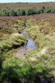
(7) At a place called Le Fossat, the first heather moors come into view. Join thePR®8on the right, then immediately turn left onto an uphill, rutted path. At the 1336-metre mark, ignore the path branching off to the right.
(8) At the 1328-metre mark, take care: before the stream, turn sharply right onto a grassy path. Head towards Les Loges de la Lite and follow a dirt track. Cross the River Lignon. At the junction with a wide forest track, continue to the left.
(9) At the 1336-metre mark, you’ll meet theGR®3at the edge of a clearing. Turn left as you enter the fir forest (very well signposted). Ignore all the paths branching off to the right.
(10) At the ‘Croisement des Deux Boules’, continue south along theGR®3through the heather moors (you are less than an hour from the end of the stage).
(11) At the junction at the 1,410-metre mark, take the raised footbridge to cross the park’s barbed-wire fence, then turn 90° to the left to find theGR®3signpost and walk alongside a summer pasture. Head due south, cross the D102 road and climb up to Roche Courbe (a viewpoint overlooking the Col du Béal).
(12) Descend on the other side, to the south-east, and reach the Col du Béal (E).


 Visorando Member
 Difficult
 Easy