Country:

 City:
City:


Start in front of the campsite, where you can leave your cars.
(S) Opposite the campsite, turn left and head towards the Route de l’Allier at Les Aubards.
(1) Take the path opposite, between the houses. At Chemin de la Bernichon, turn left onto Rue de la Bertonnière. Cross the D495 again and head down the path opposite, which joins the D45.
(2) Follow this road to the right.
(3) Cross the bridge over the Boën and leave the road to the right, heading towards La Tremble. Pass the entrance to the hamlet on your right and follow the path on the left which crosses the Bois des Clous and joins the path coming from Pont Canard.
(4) Take this path by turning left, then at the next junction, turn right to cross the hamlet of Les Clous. Continue to the lake.
(5) Turn right onto Chemin de la Croix Bolot, which leads back up to the D495. Follow it to the left as it passes through the village of La Tuilière. Then continue to the right, then left, and right again. On the left at La Pépinière, you can visit the nursery and buy locally grown fruit and fruit juices. At the bakery/grocery shop, you can find everything you need for a lovely picnic. Pass by a lovelypicnic area near the wash house on the way out of the village.
(6) After the bridge, turn left then left again to reach the hamlet of Barbet. In the hamlet, take the path on the right and follow it as it passes through the hamlets of La Gare, Bigotière and then Empuré.
(7) Head down the Chemin de la Poudrière opposite.
(8) Continuing straight ahead, pass close to the hamlet of Vallas – which you should leave on your left – and carry on along the path which, running alongside the pallet factory, leads to Saint-Priest-la-Prugne.
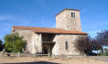
(9) At the Gare crossroads, admire the magnificent 400-year-old Sully lime tree. Turn left onto the main street, which leads past the school – where you can top up your water at the fountain – to the old village centre (with its beautiful Romanesque church and historic houses).
(10) Take the narrow lane heading due north, behind the church, and, at the cross, turn left onto the path that descends to the D495, cuts across the hairpin bend and leads to the Moulin St-Priest. Then turn left onto the road.
(11) Take the D44 to the right and leave it at the next junction.
(12) Take the Route des Tureaux, which climbs to the left, crossing into the Allier department and the Auvergne region.
(13) Just before the hamlet of Les Tureaux, turn right onto the Chemin des Balles, which, after a steep climb of 100 metres in altitude, leads to the Croix des Demandiers, where a sign provides details about this remarkable Gallic site.
(14) Take the road on the right, then the second track leading down to the right. At the road, admire the sweeping view over Laprugne and the ‘H.L.M. de la mine’ social housing blocks, which have stood empty since the uranium mine closed in 1980. Follow the road to the right as it descends to the village of Laprugne.
(15) At the church, turn right onto the main street, which passes in front of the last shop, “La Coopé”, run by the locals on a rota basis, and continue along the Route de la Loge des Gardes. After the left-hand bend, take the path on the right which leads to the Dédalys lodge (E).
 Visorando Member
 Local authority
 Easy
Easy  Association / Club / Walk leader
 Difficult