Country:

 City:
City:


(S) From the Renaudie community lodge, take the first small road on the right which goes uphill; you’ll pass the café and then the fountain, on the right (PR® la croix de fer). Follow a grassy path which leads you to La Chaunias. Take the small road on the left (ignore the sign for La Tuile). At the cross, turn right, pass Chomette (1) then the site of the Croix de Hollade. Ignore the path on the right, then the next one (also on the right), and continue until you reach a sharp bend to the left; there, take the path on the right which leads into the forest.
(2) At the ford, turn left and follow the Couzon stream, heading west-north-west. Cross the stream several times to reach the D317.
(3) Carry on straight ahead along this road to Rossias.
(4) At the sawmill, take the path on the right. Turn left at the three-way junction and head towards Sugier. In the hamlet, turn left, then take the path on the right after the last house. At the three-way junction, keep left, then continue straight on to Montchoisy (tarmac road).
(5) Turn right and cross through Derbize. At the cross, turn left onto a track to reach the entrance to Bellevue.
(6) Head left onto the D53. Pass the D42 on your left, then turn left onto the Chemin de Monplaisir. Next, turn left onto the Chemin des Courmettes. Join the D311 and turn right onto it. Before the cemetery, turn left and follow the arboretum, established in 2011, to reach the Croix de Sainte-Agathe.
(7) Turn right onto the D312 to reach Vollore-Montagne. Walk through the village. 200 metres after the sawmill, turn left onto a path to reach the Croix des Tuiles.
(8) Take the path opposite. Pass a track on the right, then the turn-off for Goutte Marloux on the left. Go straight on at the next junction and continue to a T-junction.
(9) Turn right, passing close to the Ayguebonne forest house. You will then reach a crossroads.
(10) Head straight ahead, passing the footpath on the left and a track on the right. Turn left at the crossroads and head for Rochemulet.
(11) At the entrance to the hamlet, take the path on the left (an old cobbled track) then turn right. Pass two paths on the right. At the T-junction, turn right, then left at the next Fork in the road to reach Raffy.
(12) On leaving the hamlet, turn left and continue along this path, ignoring the turnings to the left and right, until you reach the D7.
(13) Cut across it to take the path opposite. Walk along the edge of the field. When you reach the cemetery, turn left to enter Sainte-Agathe (E).
 Visorando Member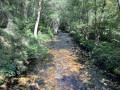
 Easy
Easy 
 Moderate