Country:

 City:


Start from the village of Les Moulins (also known as Moulins-Cherier), in the car park between the town hall and the church.
(S/E) Walk past the town hall on your right, then past the sports ground. Leave a service track on your right and continue uphill.
(1) At the cross, continue to the right along the cemetery road, follow it and leave it at the next dirt track which branches off to the right.
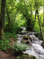
(2) Take the Chemin de l’Ardille on the right, wade across a small stream and carry on straight ahead. At the junction with the Chemin du Mort (a path once used to carry the dead from Les Pras to their final resting place at Vieux Cherier – an 8km journey carried on people’s backs, which may explain its name, especially as there used to be a ‘stone of the dead’ here, which has recently disappeared), which joins from the left, carry on straight ahead and head down towards the hamlet of Blanchardon.
(3) When you reach the houses at Blanchardon, turn right and cross the bridge over the Isable.
(4) Join the D41 road, cross it and take the path leading uphill to the left. Pass the Chemin de Vert Pré on your left and continue uphill towards Vieux Cherier.
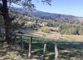
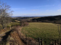
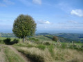
(5) When you reach a clearing where the view opens up, the path turns left. Pass the Chemin des Barges on your right and continue the climb to the hamlet known as “Les Duits”: the view is magnificent: the old bell tower comes into view, overlooking the entire Roanne plain to the east; on a clear day, Mont Blanc can be seen on the horizon; further south, the Chapel of La Salette sits on its hill; to the south, Le Châtelard; and to the west, the peaks of the commune, which rise to 1,155 metres.
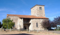
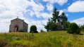
(6) At the craft centre, originally built by “Les Confituriers du Vieux Cherier”, turn right and spend a few minutes visiting the11th-century church, which was fully restored in the 1980s and features remarkable frescoes and statues dating from the Romanesque period.
(7) At the road, turn left to pass beneath the church and head towards the “La Barrière” wayside cross.
(8) Follow the road as it bends to the left, leaving the Roffat track on your left to continue along the Route des Ardillats.
(9) Leave the road and take the next path which climbs to the right and passes above the hamlet of Roffat.To the south, you can see the village of Les Moulins in the valley.
(10) When you reach the junction with the Maucet track, take the track opposite heading towards the Ardillats woods. A short climb leads to the “Pierre des 3 Seigneurs” pass (named after the fine coat-of-arms-adorned boundary stone found here, which is now in the Ambierle Museum) at an altitude of 910 metres. Continue along the path as it descends towards the Croix Trévingt.
(11) Take the D31 road opposite towards St-Just-en-Chevalet and follow it for 300 metres.
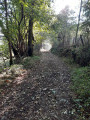
(12) At the three-way junction, take the dirt track between the D31 and the Route du Bessey. At the junction with a path leading down from the road, continue straight on. You’ll come to a footbridge to cross the Isable near its source (on the left are the ruins of the Moulin du Bessey,the first mill on the Isable, which has now lost much of its flow). Carry on straight ahead: the path, lined with ancient beech trees, winds its way through hedges of ferns and holly, leading to the Point du Jour farm.
(13) Continue along the path, passing beneath the farm, and climb up to La Murette (922 metres, the highest point of the walk).
(14) Turn left and take the small tarmac road that descends between the two houses.
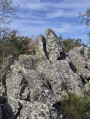
(15) You’ll reach the Croix des Égaux, where you should turn left, then right at the cross, and then right again to pass in front of the rock formation overlooking the house.
(16) At the rock, take the Chemin du Merle, which branches off to the left and offers beautiful, almost panoramic views. After a right-hand bend, the path descends steeply towards Bonnabaud.
(17) At the bottom of the descent, turn left and head due east, skirting the water reservoir.
(18) Before the last house in the hamlet, leave the service road on your right and carry on straight ahead along the dirt track which leads back to Les Moulins. At the first houses, turn left onto the path overlooking the sports ground.
(1) Then turn right to return to the car park where you started (S/E).
 Association / Club / Walk leader

 Visorando Member
 Difficult
 Easy