Country:

 City:


Start from La Croix St-Martin, in the commune of Arconsat (63), at the group lodge “L’île ô Sources”, on the D.324 (formerly the N.89).
(S) Continue along the road straight ahead to climb the Col Saint-Thomas, thus covering a short section of the famous “Roanne–Thiers” walk (56 km), which has been held every year in early December for the past 100 years.
(1) After 2.25 km along the road and a 150-metre climb, cross the Col Saint-Thomas and… the Auvergne/Forez “border”. The inn that has welcomed travellers passing through this pass for years – even back when the electricity line hadn’t yet reached this high up – is due to reopen following ongoing renovation work (2026). Let’s hope it will carry on the tradition of the delicious blueberry tart that made it so popular! Carry on a little further along the road, until you reach the first hairpin bend.
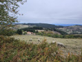
(2) Turn left off the D1, heading towards the hamlet of Châteaugaillard, the first hamlet in the commune of Chausseterre. The landscape is now much more open, the terrain gentler, and the forest recedes up the slopes to make way for livestock farming.
(3) As you leave the hamlet of Cornet, continue to the left, then turn right three times in succession at the junctions you come to. Continue on to the village.
(4) At the hamlet of Brissay, turn left. Cross the Font d’Aix, walking alongside the local market gardener’s plots.
(5) At the cross on leaving the hamlet, take the road on the left, then the one on the right, and then the one on the left. Go round the back of the houses in Chabaud; at the junction, go straight on until you reach the D45 road, which comes from the village of Chausseterre.
(6) Stay on the left-hand side of the road for a few metres and take the path that climbs to the left behind the house and descends back to the road; follow this road to the left for 700 metres.
(7) After the cross behind the houses at La Cartelas, take the path on the left at the bend, which crosses the D45 again and leads to the Croix de Tour.
(8) Cross the D44, walk past the house and take the Chemin du Pey Manissole opposite. Leave the path on your right that leads to La Manissole and continue gently uphill through the forest until you reach the D1.
(9) At the road, turn left and complete the climb to Plan de la Garde, then head back down to Saint-Just-en-Chevalet by following the road for 1,500 metres. Pass the Route de la Bruyère on your left, then leave the D1 at the next right-angled bend to take the Chemin de Combre on the right.
(10) At the house in Combre, take the path on the left which joins the road; here, turn right to descend to the Pont de Combre, where the Ban and the Boën rivers meet.
(11) Take the path on the left which runs alongside the sewage treatment works and head uphill opposite to the supermarket, where you can buy a packed lunch (or continue to the right to the village centre to buy something from the bakery: the quiches come highly recommended!).
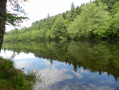
(12) Take the small road on the left which overlooks the campsite and leads to a small lake, the banks of which are equipped with picnic tables.
(13) Return to the road by going round the pond on the left. Follow the road to the left, cross Rue de Vichy, then turn right off it, passing the café. Walk uphill until you reach the Ormet path, which joins from the right. Take it to the left and cross the river.
(14) After the Cardelaine mattress workshop (awarded the ‘Entreprise du Patrimoine Vivant’ label for the manufacture of woollen mattresses spanning six generations), turn right, then right again to walk past the last three houses in the hamlet of Les Rivières and begin the climb.
(15) At the Montgrenier cross, turn right. The path passes above Le Maillet and climbs to Les Bouchauds, where you should take the path on the left above the houses.
(16) You’ll reach the Chez Rivaux path; take this on the right to head downhill. Then keep left until you reach La Croze.
(17) At the road, continue left along the quiet, shaded little road through Montloup for 2 km, until you reach a hairpin bend.
(18) After crossing the river, just out of the bend, take the path that climbs to the right, heading due north towards La Condamine. Pass under a large tree that has fallen across the path (a bit of a challenge with a rucksack!) (2026).
(19) Walk due north past the houses of La Condamine, a hamlet that was once deserted but has seen a revival in recent years as young people have moved in, gradually restoring the ruins and breathing new life into the place. Before the last house, turn left onto the path that climbs up to the Route des Pras.
(20) Cross the road, then turn right in front of the well-restored stone house. Continue along this path, which passes behind the Petit Marais farm. At the junction after the farm, take the path on the right, then the one on the left, and continue left again.
(21) You’ll reach a place called La Croix de la Loge, the highest point of the day at 982 metres, where you can enjoy a fabulous view of Mont Blanc, towering high above the horizon and bathed in the glow of the setting sun, as well as the entire Alpine range stretching far to the south, if the weather is clear. Continue along the path straight ahead to descend to La Murette, cross the departmental road and carry on straight ahead down the slope to Le Point du Jour (E).
 Visorando Member
 Moderate
 Local authority
 Easy

 Association / Club / Walk leader