Country:

 City:


Set off from the Ferme du Lac (3 lodges, each sleeping 15), where you can leave your car.
(S/E) Head down to the main road by turning right at thefirst junction. Continue to the hamlet of La Trappe (inn).
(1) Carry on straight ahead to climb up to the small hilltop village of Saint-Victor-Montvianeix: church, town hall, cemetery and… a theatre!
(2) As the road is a dead end, head back down to La Trappe via the same route.
(1) Take the D43 road, which descends to the left towards La Credogne, and turn right off it at the junction after crossing the river.
(3) Take the small road on the right which climbs up to the hamlet of Monat. The large, unusual stone building and the hamlet’s name suggest a monastic origin.
(4) Continue along the road to the right, cross the D201 and carry on straight ahead. At the junction, turn left to join the Route de la Croix du Château; follow this to the right.
(5) At the cross, take the road opposite, then immediately turn right onto the road that descends to the Ruisseau des Planchettes before climbing slightly to reach the third hilltop village of Duzelier. Pass a path on the right, then one on the left, and take the path that turns right to lead into the heart of the hamlet.
(6) Carry on straight ahead to find the narrow path that descends quite steeply and, after crossing two streams – where you must continue straight on – you’ll reach the Barrage de la Muratte.
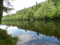
(7) As you approach the dam, ignore the access road to the dam ahead and take the forest track which climbs to the left into the woods and then runs alongside the reservoir to the bridge over the Ruisseau des Etivaux, which feeds the reservoir.
(8) Cross the bridge, follow the opposite bank of the reservoir, then turn left onto the path which climbs quite steeply through the forest. Cross a side track and come out onto a wide, flat forest track; follow this to the right.
(9) After crossing two more streams, you’ll reach the D64 road, between the hamlets of La Lizolle and La Muratte.
(10) Follow it to the right, then head down the path on the left to the Creux du Renard, where you’ll need to cross another stream; the path then turns sharply right and climbs back up to the hamlet of Les Hommades. Head up to the left through the hamlet until you cross the D64 again.
(11) Then take the forest track which climbs to the left up to the La Genosa water reservoir.
(12) Turn right onto the forest track; ignore the path leading off to the right to a house and, further on, also ignore the path climbing left into the woods, keeping a southerly direction until you rejoin the D64, which you should follow to the left as far as the hairpin bend.
(13) Leave the D64 right in the middle of the bend, heading right to join a section of the GR®3 which immediately turns left, heading south, to the hamlet of Bonjean.
(14) At the cross south of Bonjean, leave the GR®3 and head down to the left into the narrow Sabot valley, keeping to the left at the junction. Cross the stream and turn right to go behind the Moulin de Laspiaux.
(15) After the mill, climb up to the left to the hamlet of Laspiaux, where you’ll rejoin the D64; follow this to the right as far as the next hamlet, Les Aygues.
(16) Before the junction with the D84, leave the road to the left onto the small path that climbs between the houses and quickly turns right, heading due east. Cross another river – La Grande Goutte – then the path turns right, leading to Bourg d’Arconsat.
(17) At the cross, carry on straight ahead, then turn left up the Rue de la Route de La Charme, which you should follow until you find the entrance to the cemetery on the right.
(18) Take this road but, just before the cemetery, turn left, following the sign for Notre Dame des Champs up a lovely, steep climb with a 60-metre elevation gain.
(19) At La Madone, turn right onto the forest track, which offers a lovely view to the south and descends to the Moulin de Lunel, where you should turn left onto the D64, which, after 500 metres, ends right opposite the lodge: L’île ô sources, at a place called La Croix Saint-Martin (E).
 Visorando Member
 Easy