From Puy de Chavanne to the Ligeay Waterfalls via the Bois de Grand Val

Starting from the village of Palogneux, this route takes you past the basalt columns of the Puy de Chavanne, then on to the fabulous Ligeay waterfalls. The return journey takes you through the Bois de Grand Val.

Details

46330048
Creation:
Last update:
Last review:
  • Walking
    Activity: Walking
  • ↔
    Distance: 7.97 mi
  • ◔
    Average duration: 4h 55 
  • ▲
    Difficulty: Moderate

  • ⚐
    Back to start: Yes
  • ↗
    Ascent: + 1,476 ft
  • ↘
    Descent: - 1,473 ft

  • ▲
    Highest point: 2,717 ft
  • ▼
    Lowest point: 1,440 ft

Photos

Description of the walk

The start is in the small village of Palogneux. Park after the town hall, on Montée Saint-Pierre.

(S/E) Head straight on along Chemin Lachanal, pass the church and follow the sign for the basalt columns. Turn right at the junction and continue for about fifty metres.

(1) At the cross, turn right onto Chemin de la Croix Trioux, heading towards the basalt columns. On reaching Ladret, turn left to continue along the Chemin du Volcan, then left again onto the path leading to the Puy de Chavanne. Turn left one last time to reach the Puy and the basalt columns.

(2) Turn back to return to the Croix Trioux.

(1) Take the path on the right, then turn right again, heading downhill. Take a left turn, then another right turn to reach a four-way crossroads.

(3) Turn left, then, at the next Fork in the road, turn right onto the lower path, marked with a blue arrow.

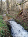
(4) At this point, you can see waterfalls down to the left. Then follow the sign for ‘back to the village’ and head to a junction by a building on the left.

(5) Turn left to reach Ligeay via the Chemin des Waterfalls. Pass the Chemin de Grand Val on your right, then take the sharp left-hand bend at the next junction. Cross the bridge over the Dardannet.

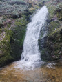
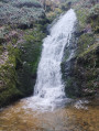
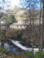
(6) Turn left onto the Chemin de la Pierre Grète and follow the sign for “sentier cascades” to the left. Cross the bridge and follow the Dardannet with its multitude of small waterfalls, passing over the various bridges. Climb the steps, cross one final bridge and look to your right: you’ll arrive at the large waterfall.

(7) Do not go beyond the ‘parcours sportif’ sign; turn back to return to Ligeay.

(6) Turn right and rejoin the Chemin des Cascades, heading in the opposite direction.

(5) Turn left, then ignore the path on the left.

(8) At the T-junction, turn right onto the path leading uphill, then turn right at the next junction.

(3) Carry on straight ahead to reach the Croix Trioux.

(1) Carry on straight ahead, following the outbound route in the opposite direction to reach La Chanal, then the village of Palogneux and the starting point (S/E).

Waypoints

  1. S/E : mi 0 - alt. 2,621 ft - Saint-Pierre Hill after the town hall
  2. 1 : mi 0.41 - alt. 2,644 ft - Trioux Cross
  3. 2 : mi 1.1 - alt. 2,717 ft - Puy de Chavanne (835m)
  4. 3 : mi 2.66 - alt. 2,260 ft - Junction with the Ligeay circular loop
  5. 4 : mi 3.37 - alt. 2,024 ft - Waterfall viewpoint - Dardannet (cours d'eau) - Affluent de l''Anzon
  6. 5 : mi 4.02 - alt. 1,736 ft - Junction for the out-and-back route
  7. 6 : mi 4.53 - alt. 1,444 ft - Ligeay, Chemin de la Pierre Grète
  8. 7 : mi 4.97 - alt. 1,578 ft - Large Waterfall
  9. 8 : mi 6.24 - alt. 1,909 ft - X-shaped junction
  10. S/E : mi 7.97 - alt. 2,621 ft - Saint-Pierre Hill after the town hall

Notes

On the waterfall route, there are two tree trunks on the ground that are easy to step over.

Worth a visit

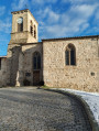
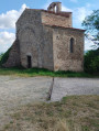
(S/E) The Gothic church of Saint-Pierre.
(2) The Puy de Chavanne and the basalt columns
The waterfalls
(6) The waterfall trail.
(7) The large waterfall.

It is possible to continue past the ‘fitness trail’ sign, but the route is not recommended for children or dogs as it is slippery and vertiginous.

Reviews and comments

4.8 / 5
Based on 2 reviews

Reliability of the description
5 / 5
Ease of following the route
5 / 5
Route interest
4.5 / 5
pierre huraux
pierre huraux

Overall rating : 4.7 / 5

Date of your route : May 18, 2025
Reliability of the description : ★★★★★ Very good
Ease of following the route : ★★★★★ Very good
Route interest : ★★★★☆ Good
Very busy route : No

Hello, fellow walkers!
A very pleasant walk, mostly through the woods. There are basalt columns to see, and a beautiful waterfall at point 7, which has plenty of water this May.
We completed the route in the direction indicated: according to the GPS: 13.7 km, elevation loss: 469 m, elevation gain: 471 m, walking time: 5 hours.
However, going this way, you start with the descent and finish with a 470 m ascent, which is quite steep and in full sun from Ligeay.
In my opinion, it would be better to park at Ligeay, start with the waterfall (point 7) as a warm-up, then do the route by heading up to point 2 (Puy de Chavanne) and then descend back to Ligeay by following the route (points 1, 2, 3, etc.). Personally, I prefer to finish with a descent, but each to their own!!!!
NB: There aren’t really any signposts on this route, so thank you, VisoRando, for the guidance on the app!
Best wishes to you all.
Pierre

Machine-translated

Falsa
Falsa

Overall rating : 5 / 5

Date of your route : Nov 02, 2024
Reliability of the description : ★★★★★ Very good
Ease of following the route : ★★★★★ Very good
Route interest : ★★★★★ Very good
Very busy route : No

As the route is a bit long, we split it into two sections:
- the Ligeay waterfalls: starting from the car park at Ligeay, points 6-7-4-5; the numerous waterfalls are absolutely stunning
- the Puy de Chavanne from Palogneux, joining the road at point 3; superb views of the Alps from the summit
Well worth a go

Machine-translated

Other walks in the area

For more walks, use our search engine .

The GPS track and description are the property of this route's author. Please do not copy them without permission.