


 Country:

 City:
City:


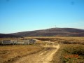
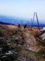
(S) Leave the Col du Béal refuge by crossing the D6 and, opposite, join the very well-markedGR®3, heading for the summit of Pierre-sur-Haute (1,631m), a military base dotted with radio masts.
(1) At Le Procher (1,535 m), begin a challenging descent over rocky terrain towards the Col de la Chamboite.
(2) At Rocher Pavé, there is a stunning view over the Forez plain and the Chalmazelloix basin, with Mont Blanc, the Puy de Sancy and the Puy de Dôme visible in the distance.
Go round the Pierre-sur-Haute military base on the right and continue along theGR®3.
(3) At the signpost, continue along the GR®. At the junction (elevation 1506), turn left heading south-east.
(4) At the Pradoux marker (1,445 m), leave theGR®3and take theGR®3alternative route to the right.
(5) At the Croix du Fossat, leave the marked trail and take the path on the left, passing behind a shepherd's hut. Continue along an old track running alongside a sheep pasture. You are 8 km from your destination, and about a 2-hour walk away. Head straight on, due south.
(6) At the ruined shepherd's hut, open and close the gate on the left-hand side of the enclosure. Continue for 1.5 km through the heather along a barely visible path.
At the second gate, carry on, keeping to the left of the livestock enclosure. At the end, go through the gate on the left. Magnificent view over the Ambert plain.
(7) Continue along the descending path which enters the forest; further on, veer right as you descend towards the Reblats glacial valley.
(8) Go round a ruined shepherd's hut, cross a stream, pass a second shepherd's hut and arrive at the manoeuvring area for timber lorries.
(9) At the end of this, take the path on the left which follows the contour line more or less as it climbs. Head straight on, south-west then south, ignoring the paths on either side.
(10) At the Jasserie des Chaumettes, continue through the beech forest, skirting the shepherd's huts. Carry on straight ahead along the main track, without following the yellow markings.
(11) Cross the D106. Continue opposite on an uphill dirt track, then turn left onto the “Colporteur” path.
Reach the Col des Supeyres (1,365 m) via a lovely dirt track and turn left towards the Chalet des Gentianes (E).
.

 Visorando Member
 Difficult
