Around the Roc de l’Olme

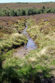
A short route mainly through the forest, where the autumn sun plays through the foliage.
From the summit of the climbing rock, a unique panorama unfolds before you.

Details

24688656
Creation:
Last update:
Last review:
  • Walking
    Activity: Walking
  • ↔
    Distance: 4.80 mi
  • ◔
    Average duration: 3h 00 
  • ▲
    Difficulty: Easy

  • ⚐
    Back to start: Yes
  • ↗
    Ascent: + 886 ft
  • ↘
    Descent: - 896 ft

  • ▲
    Highest point: 3,976 ft
  • ▼
    Lowest point: 3,104 ft

Description of the walk

To park your car, at the junction of Route du Cheix and Route de la Combe, turn right, take a stony track, and head straight on towards the wayside cross to park.
Start from the Combe lodge.

(S/E) From the lodge, take the path leading uphill, pass the hamlet of Le Trêve, cross the road, then continue straight on along a grassy path. Take the tarmac road leading uphill and pass Pré Martin on your right.

(1) At the end of the road, turn left onto path No. 8, which climbs into the deciduous forest. Do not take any side paths to the left or right.

(2) Walk alongside a vast meadow, pass the water tower on your left and continue straight on into the forest. Join the forest track, then turn left, and further on, left again.

(3) Go round the climbing rock on the right, continue along a path running at the foot of the climbing rock and wind your way through the forest.

(4) At the ‘climbing rock’ signpost, turn left and join a road (Route de l’Olme), then follow it to the right until you reach the crossroad (Route des Fougères).

(5) Turn left and follow this road until it bends to the right just after crossing a bridge over the Ruisseau de la Gouérie.

(6) Leave the road and continue along the Chemin de Pré Chétif. On the uphill stretch, just as a bend begins, veer to the right and head towards the hamlet of Le Coin, following the ridge path.

(7) As you leave the hamlet, take the Route du Coin; further on, turn left onto the Route des Fougères and continue until you reach the lodge (S/E).


Waypoints

  1. S/E : mi 0 - alt. 3,245 ft - La Combe
  2. 1 : mi 0.48 - alt. 3,409 ft - Junction on the path
  3. 2 : mi 1.26 - alt. 3,747 ft - Water tower
  4. 3 : mi 2.18 - alt. 3,921 ft - Climbing rock
  5. 4 : mi 2.45 - alt. 3,707 ft - Signpost marking the climbing rock
  6. 5 : mi 2.82 - alt. 3,428 ft - Route des Fougères
  7. 6 : mi 3.25 - alt. 3,353 ft - Gouérie stream
  8. 7 : mi 3.8 - alt. 3,291 ft - Le Coin
  9. S/E : mi 4.8 - alt. 3,251 ft - La Combe

Notes

You’ll find water in the hamlets.
Shelter at the hamlet known as Les Fougères.

Worth a visit

Take a break, climb to the top of the rock near La Madonne and admire the view before you.
Fancy a spot of rock climbing? You can hire all the equipment you need for rock climbing or via ferrata from a chalet near the ski resort.

Reviews and comments

4.2 / 5
Based on 3 reviews

Reliability of the description
4.3 / 5
Ease of following the route
4.3 / 5
Route interest
4 / 5
User 26336084

Overall rating : 3.7 / 5

Date of your route : Sep 15, 2026
Reliability of the description : ★★★★☆ Good
Ease of following the route : ★★★★☆ Good
Route interest : ★★★☆☆ Average
Very busy route : No

I did the PR 3 Yellow route starting from the village; it never takes you round the rock as you did. I don’t see the point in that, and it’s a shame. It should be made clear that when you see the via ferrata sign, you need to follow it to get to the rock
Very disappointed

Machine-translated

mistigris
mistigris

Overall rating : 4 / 5

Date of your route : Aug 07, 2023
Reliability of the description : ★★★★☆ Good
Ease of following the route : ★★★★☆ Good
Route interest : ★★★★☆ Good
Very busy route : Yes

a less shaded descent

Machine-translated

azkaett
azkaett

Overall rating : 5 / 5

Date of your route : Jun 03, 2023
Reliability of the description : ★★★★★ Very good
Ease of following the route : ★★★★★ Very good
Route interest : ★★★★★ Very good
Very busy route : No

It’s lovely in warm spring weather too! It’s 25 degrees today – the shade of the forest was a real treat!
To reach the S/E point by car: at the Chalmazel-Jeansagnière fire station, take the small road that goes up to the right of the station (my sat-nav tried to send me a bit further along on the left, down an unpaved track...).
Waypoint 3: the left-hand turn to head into the forest is just before the trail begins.
And by the way, there are blueberries all along the way, so choose your season carefully so you don’t need to bring a snack in your rucksack

Machine-translated

Other walks in the area

For more walks, use our search engine .

The GPS track and description are the property of this route's author. Please do not copy them without permission.