Refine your search for walks in La Fresnais
La Fresnais walks


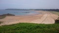
 The Marais Blanc as seen from La Fresnais
 Visorando Member
 4.56 mi
 +10 ft
 -10 ft
 2h 05
 Easy
 Departure from La Fresnais (Ille-et-Vilaine)
A walk through the Marais Blanc in the Bay of Mont-Saint-Michel, starting from the village of La Fresnais.
In fine weather, the view stretches from Cancale to Granville, with Mont-Saint-Michel (a UNESCO World Heritage Site) visible at the far end of the bay.
Running alongside the sea wall built from 1625 onwards by Anne of Brittany to protect the low-lying fields from the sea’s onslaught, the Greenway passes numerous windmills, including the one at La Ville-es-Brune in Hirel; most are now without sails and have been converted into homes.
La Gouesnière circular via Bois Renou
 Association / Club / Walk leader5.04 mi
+164 ft
-174 ft
2h 30
Easy
Departure from La Gouesnière (Ille-et-Vilaine)
This is a short, peaceful walk, partly through built-up areas and partly through what is known locally as the white marsh. In fact, the only remaining evidence of the marsh is the leat Jean. The route follows part of the GRP® Tour du Pays Malouin.
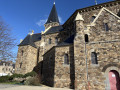
Circular route to Mont-Dol via the river and the two Biez
 9.34 mi
+7 ft
-7 ft
4h 20
 Moderate
Departure from Mont-Dol (Ille-et-Vilaine)
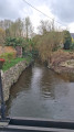
This walk takes you along the paths of the Marais Blanc, and alongside the Guyolut, as well as the Cardequin and Ceinture Nord watercourses. The terrain is flat and easy, but can be exposed to the wind.The section of the route through the Marais Blanc allows you to discover old stone farmhouses that have retained the charm of their original stone construction. Some are listed as heritage sites.
Circular route via La Ville ès Gris to Cancale
 5.53 mi
+328 ft
-328 ft
2h 50
Easy
Departure from Saint-Méloir-des-Ondes (Ille-et-Vilaine)
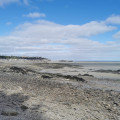
A pleasant little walk that takes you across the fields to the Cancale plateau, then heads back towards the beach to return along the coast via Les Roches Noires and Le Vauleraud. A beautiful view of the bay from the top of the cliff above Cancale.This route is not difficult.
Dol Marshes and Mont-Dol
 12.65 mi
+180 ft
-180 ft
6h 00
Moderate
Departure from Cherrueix (Ille-et-Vilaine)
This is a route with a very distinctive elevation profile: 95% of the route is at sea level, with only the Mont-Dol rising above it.
But the main attractions of this route are, on the one hand, the Bay, a landscape listed as a UNESCO World Heritage Site in 1979, and on the other hand, the 350 km of canals, leats and ditches that help regulate the water level in the marsh.
The Bay of Mont-Saint-Michel from Saint-Méloir-des-Ondes to Cancale
 5.39 mi
+131 ft
-135 ft
2h 35
Easy
Departure from Saint-Méloir-des-Ondes (Ille-et-Vilaine)
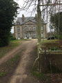
Discover the Bay of Mont-Saint-Michel along the coast from the village of Saint-Méloir-des-Ondes to Cancale. Choose a day when the tide is ebbing or at low tide to walk the outward leg along the foreshore; the return journey follows theGR® 34, which overlooks the bay and offers stunning views of its vast expanse, its oyster beds and Mont-Saint-Michel in the distance.
Circular around the Fort de Saint-Père-Marc-en-Poulet
5.13 mi
+148 ft
-174 ft
2h 30
Easy
Departure from Saint-Père (Ille-et-Vilaine)
The main attraction of this hike is the Fort de Saint-Père, built between 1777 and 1785 to protect Saint-Malo from English attacks by land and to complete the defence system designed by the famous Vauban. Part of its enclosure was destroyed in 1944 by the Germans as they fled during the Liberation. Today, the fort has become a cultural and leisure space. Every year, it hosts various trail events, flower markets, festivals and concerts. The fort is open to the public during the events it hosts, but the outer rampart walk is accessible to walkers all year round.
The Fort of Saint-Père-Marc-en-Poulet
 4.56 mi
+167 ft
-171 ft
2h 15
Easy
Departure from Saint-Père (Ille-et-Vilaine)
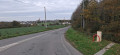
Built in the 18th century, the fort completes the coastal fortifications designed by Vauban to protect the bay of Saint-Malo from English attacks. With a capacity of 3,000 men, 26 casemates and a 46-metre-long powder magazine, it was delivered too late to play a defensive role. During the 1914-1918 war, it housed German prisoners and, during the last war, it was converted into an ammunition depot by the Germans, who blew up part of the casemates during their evacuation. Decommissioned in 1988, it is now owned by the municipality of Saint-Père-Marc-en-Poulet, which has restored it; shows are organised there.
Le Vivier and the Canal des Planches from Mont-Dol
7.70 mi
+187 ft
-190 ft
3h 40
Moderate
Departure from Mont-Dol (Ille-et-Vilaine)
Walk along small country roads, with the exception of the coastal stretch near Vivier-sur-Mer. In Vivier-sur-Mer, a point of interest is where the River Guyoult meets three estuaries flowing from the Marias de Dol: the Canal des Planches, the Banche and the Biez de Cardequin. To see them, head to the bridge at the village exit towards Cherrueix.
Circular route in Dol-de-Bretagne via La Belle Étoile
 5.71 mi
+112 ft
-102 ft
2h 45
Easy
Departure from Dol-de-Bretagne (Ille-et-Vilaine)
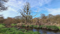
This circular route takes you on a tour of Dol-de-Bretagne, a former episcopal city, notably the 13th-century Saint-Samson Cathedral and beautifully restored half-timbered houses. The route follows the Promenade des Remparts and country lanes along the Guyoult coastal river.
Route Nominoë in Dol-de-Bretagne
 5.03 mi
+66 ft
-69 ft
2h 20
Easy
Departure from Dol-de-Bretagne (Ille-et-Vilaine)
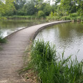
Throughout the walk, visitors can explore the town of Dol-de-Bretagne, the Guyoult and the Dol marshes.
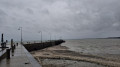
The heights of Cancale, Rocher Gaut and the points
 5.18 mi
+371 ft
-384 ft
2h 40
Moderate
Departure from Cancale (Ille-et-Vilaine)
Circular route around Cancale following the GR®34 and GRP® du Pays Malouin and the PR® de Cancale. The route passes by the points that offer beautiful views of the Bay of Mont Saint-Michel. Along the way, you can sample some oysters in season.
Le Clos Chapelle, south-west of Dol-de-Bretagne
 8.91 mi
+167 ft
-164 ft
4h 15
Moderate
Departure from Dol-de-Bretagne (Ille-et-Vilaine)
This route allows us to alternate between the discovery of a hilly landscape, marked by hedgerows and embankments, and the open landscape of the Dol marshes, criss-crossed by its vast network of canals and ditches and punctuated by the omnipresence of Mont-Dol and Dol-de-Bretagne Cathedral.
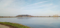
Le Marais Blanc and Le Haut Pont via the Mont Dol hill
 8.40 mi
+194 ft
-217 ft
4h 00
Moderate
Departure from Dol-de-Bretagne (Ille-et-Vilaine)
The route is mainly in the countryside, through the Marais Blanc and Marais Noir marshes, with no particular difficulties except for the ascent of the Mont-Dol hill via the north face (slippery in wet weather) and the descent to the town hall (uneven steps). The route takes the Chemin Vert between Dol de Bretagne and Mont-Dol. Beautiful view of the Marais Blanc and the Bay of Mont Saint-Michel from the top of the Mont Dol hill.
Circular Eastern of Dol-de-Bretagne via Champ Dolent
6.78 mi
+108 ft
-115 ft
3h 10
Moderate
Departure from Dol-de-Bretagne (Ille-et-Vilaine)
Dol-de-Bretagne is a small town full of character offering numerous hiking opportunities, the most popular being the Marais Blanc and Marais Noir trails. The route suggested here follows part of the Nominöe route, but differs in that it passes through the countryside further south, taking in the Menhir du Champ Dolent and the Fontaine Saint-Samson.
The Marais Blanc and La Banche starting from Quercourt.
8.07 mi
+7 ft
-3 ft
3h 45
Moderate
Departure from Dol-de-Bretagne (Ille-et-Vilaine)
This is an easy route through the Marais Blanc and along the Canal de la Banche and the Banche itself. It allows you to discover a few old farms scattered throughout the marsh.
The Forges route in Baguer-Morvan
 6.01 mi
+141 ft
-141 ft
2h 55
Easy
Departure from Baguer-Morvan (Ille-et-Vilaine)
This route runs largely through the countryside and follows sunken lanes. It passes through several hamlets whose names raise questions about their origins: Les Forges, Le Portail des Forges and La Ville Feu.
Circular routes via Pont Allain and Le Perray from Étang de Beaufort
 7.18 mi
+266 ft
-266 ft
3h 30
Moderate
Departure from Plerguer (Ille-et-Vilaine)
The route links two of the water retention ponds in the Plerguer area. It alternates between sections on small country roads and stretches through the undergrowth. The route is mainly on hard ground, small roads or stony paths; it is particularly uninteresting during the wet months from autumn to March but can be enjoyed in the other months of the year.The route presents no particular difficulties.
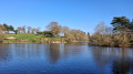
Circular route to the Étang de Beaufort via Mireloup and Le Tronchet
 8.39 mi
+361 ft
-361 ft
4h 10
Moderate
Departure from Plerguer (Ille-et-Vilaine)
The route links two of the reservoirs in the Plerguer region. It alternates between small country roads and sections in the undergrowth, particularly in the Mesnil Forest, along the Mireloup Reservoir.The route does not present any particular difficulties despite the significant cumulative elevation gain (for the region).
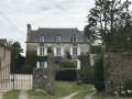
Route des Malouinières de Saint-Coulomb
 4.49 mi
+105 ft
-105 ft
2h 10
Easy
Departure from Saint-Coulomb (Ille-et-Vilaine)
The commune of Saint-Coulomb had twenty malouinières spread across its territory. Malouinières are the country residences of Saint-Malo shipowners. Most were built between 1680 and 1730. Their architecture was strongly influenced by military engineers. Their style is uniform (granite from the Chausey Islands).
This route, in a vegetable-growing countryside, allows you to discover some of them in different sizes. Only the one in Ville Bague is open to visitors.
Circular route starting from Miniac-Morvan via Gué Briand and Saint-Gré.
 7.51 mi
+148 ft
-167 ft
3h 35
Moderate
Departure from Miniac-Morvan (Ille-et-Vilaine)
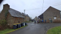
This route, in the hills above Miniac-Morvan, will take you to the "little" Mesnil State Forest via the village of Vieux-Bourg and the old Rennes-Saint-Malo tramway line.From Saint-Gré, on a clear day, you can enjoy a beautiful view of the Cancale coast.This route takes you along numerous paths on land and in the undergrowth. Very pleasant in good weather, but sometimes very wet otherwise.
Circular starting from Dol-de-Bretagne via Epiniac and the Chemin des Évêques.
 8.19 mi
+233 ft
-236 ft
4h 00
Moderate
Departure from Dol-de-Bretagne (Ille-et-Vilaine)
A peaceful hike along grassy paths and a few quiet roads. You will follow part of the Chemin des Évêques, which was used by bishops to reach their summer residence. The nearby Château du Domaine des Ormes was once (in the early 14th century) the summer residence of the bishops of Dol-de-Bretagne. Today, it is a campsite. The paths are shaded. If you walk them in autumn, you can collect lots of chestnuts.
Les Hauts de Miniac-Morvan
 8.35 mi
+246 ft
-269 ft
4h 05
Moderate
Departure from Miniac-Morvan (Ille-et-Vilaine)
This route, in the hills above Miniac-Morvan, will take you to the Mesnil National Forest, passing through the hamlet of Vieux-Bourg and the old Rennes-Saint-Malo tram line.This route takes you along numerous paths on land and in the undergrowth. Very pleasant in fine weather, but sometimes very wet otherwise.
L’Anse des Bas Champs, the bridges over the Rance from La Ville-ès-Nonais
 4.55 mi
+282 ft
-279 ft
2h 20
Easy
Departure from La Ville-ès-Nonais (Ille-et-Vilaine)
The Anse des Bas Champs in La Ville-es-Nonais is a coastal marsh whose reed beds are home to numerous species of birds. Nestled at the far end of the cove is the peaceful hamlet of La Chapelle Saint-Magloire.
This section ofthe GR® Tour du Pays Malouin takes you to the foot of the two iconic bridges of the Rance Valley: the Pont Saint-Hubert and its counterpart, the Pont Chateaubriand. Both span the Rance where it narrows, linking Plouër-sur-Rance (Côtes d’Armor department) to La Ville-ès-Nonais (Ille-et-Vilaine department).
The medieval walls from Ville-es-Nonais
 4.11 mi
+171 ft
-177 ft
2h 00
Easy
Departure from La Ville-ès-Nonais (Ille-et-Vilaine)
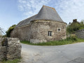
Did the Vikings settle in the Rance valley at the foot of Mont Garot? Nothing is less certain, but in any case, this is a theory put forward by the guides. From La Ville-es-Nonais, along the right bank of the Rance, make your way to the site of the supposed Viking camp. At low tide, you can see the site, covered in short vegetation.
Cancale and its surroundings
 14.18 mi
+1,033 ft
-1,007 ft
7h 25
Moderate
Departure from Cancale (Ille-et-Vilaine)
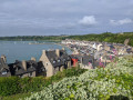
Loop between land and sea around Cancale via St Coulomb, following theGR®34andGR®34Atrails.
Route of the Notre-Dame du Haut Bout Chapel from Port Briac
 4.75 mi
+344 ft
-325 ft
2h 15
Moderate
Departure from Cancale (Ille-et-Vilaine)
This route follows part of the customs officers' path between Port Briac and Port Mer. It then winds its way between the hamlets of Haut Bout, Basse Cancale and Ville ès Péniaux, where you can see old, modest stone houses and other less modest but equally picturesque dwellings. A few passages through the undergrowth add to the charm of the route.
Pointe du Grouin: large circular
5.68 mi
+446 ft
-466 ft
3h 00
Moderate
Departure from Cancale (Ille-et-Vilaine)
This circular follows the GR®34 (Tour de la Bretagne) route from Port Picain to Verger beach, via Pointe du Grouin.
The Pointe du Grouin circular tour from La Gaudichais
 7.67 mi
+568 ft
-564 ft
4h 00
Moderate
Departure from Cancale (Ille-et-Vilaine)
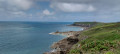
This route follows part of the GR®34 along the coast, an old customs officers' path, and the trails that cross the point between the hamlet of Le Verger and Cancale. The route offers beautiful views of the bay of Mont Saint-Michel and a string of islands to the west. In good weather, you can see Cap Fréhel.
The Grouin Tip (La Pointe du Grouin)
 5.92 mi
+387 ft
-387 ft
3h 05
Moderate
Departure from Cancale (Ille-et-Vilaine)
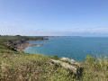
A rocky headland close to Cancale to discover thanks to the customs trails (GR®34). The coastline, interspersed with small sandy coves, is ideal for all kinds of summer activities. Walkers will be surprised if they expect a flat, unattractive trail. If there are occasional sunken paths, it's to allow a rest before rocky areas and steep gradients.
Pointes des Grands Nez et du Meinga, Île Besnard au départ de Saint-Coulomb
 8.22 mi
+459 ft
-469 ft
4h 10
Moderate
Departure from Saint-Coulomb (Ille-et-Vilaine)
Cette randonnée de 12 km vous fera découvrir les pointes des Grands Nez et du Meinga ainsi que l'Île Besnard.
Pointe du Nid and Anse du Verger
 3.48 mi
+200 ft
-177 ft
1h 45
Easy
Departure from Saint-Coulomb (Ille-et-Vilaine)
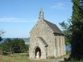
Short walk along the coastal path between beautiful beaches and return via Anse du Verger, owned by the Conservatoire du Littoral.
Along the route, you will find Fort du Guesclin, the Gaudes guardhouse and the Chapelle Notre-Dame du Verger, remarkable for its marine paintings offered as ex-votos.
From Fort du Guesclin to Pointe du Grouin
 7.96 mi
+669 ft
-676 ft
4h 15
 Difficult
Departure from Saint-Coulomb (Ille-et-Vilaine)
A walk along the Sentier des Douaniers between Guesclin Beach, Saint-Coulomb, to the west, and Pointe du Grouin, Cancale, to the east. The route follows the coastline along a well-signposted and accessible but uneven path. There are a succession of superb viewpoints all along the route. Although the route is a return walk, the paths have very different characteristics and equally pleasant scenery.
The Guesclin Cove from Pointe des Grands Nez to Pointe du Nid
 5.90 mi
+312 ft
-295 ft
3h 00
Moderate
Departure from Saint-Coulomb (Ille-et-Vilaine)
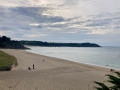
This section ofthe GR® 34trail, which leads to the legendary Pointe du Grouin, has been used by some of the great names in French history: the family of Constable Bertrand du Guesclin, the writer Colette and the singer Léo Ferré.
Follow in their footsteps from Touesse Beach along theGR® 34 from Pointe des Grands Nez to Pointe du Nid.
On the way back, you will pass by the Malouinière La Motte aux Chauff.
Saint-Coulomb and the circular route around La Touesse
 7.69 mi
+584 ft
-584 ft
4h 05
Moderate
Departure from Saint-Coulomb (Ille-et-Vilaine)
A nice little walk, partly on the Sentier des Douaniers on the GR®34. Superb view from the headlands, especially at low tide when the rocks are exposed and covered with sea spray. In good weather, the view stretches as far as Cap Fréhel to the west and Pointe du Grouin and the Herpin lighthouse to the east.
Pointe des Grands Nez - Pointe du Grouin
 12.06 mi
+643 ft
-663 ft
6h 05
Difficult
Departure from Saint-Coulomb (Ille-et-Vilaine)
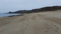
A superb coastal walk towards a major tourist attraction: Pointe du Grouin. During this round-trip route, you’ll discover the beauty of this coastline from different angles, depending on the light and the tide. The view of Fort Du Guesclin, which becomes an island at high tide, perfectly illustrates these varied landscapes.
Pointe du Meinga and Roz Ven Beach
 4.24 mi
+289 ft
-299 ft
2h 10
Moderate
Departure from Saint-Coulomb (Ille-et-Vilaine)
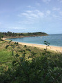
This section ofthe GR® 34 leading to Pointe du Meinga is a must-do walk when staying in the Saint-Malo–Saint-Coulomb area.
From the top of the 46-metre cliff, the view stretches from Cap Fréhel to the Pointe du Grouin, with the Chausey Islands on the horizon.
Pointe du Meinga is bordered to the west by the large beach of La Guimorais (part of which is a naturist beach) and to the east, in the Anse de la Touesse, by Roz Ven beach.
The Pointe du Meinga and the Malouinière de la Vieille Bague
 7.65 mi
+318 ft
-341 ft
3h 50
Moderate
Departure from Saint-Coulomb (Ille-et-Vilaine)
The Pointe du Meinga and Île Besnard areas are ideal for beautiful hikes in any season. This hike starts on the GR®34 and then turns inland to discover some of the malouinières near the Étang Sainte-Suzanne. You can extend the hike by going around Île Besnard.
Pointe du Meinga at Saint-Coulomb
 2.01 mi
+240 ft
-210 ft
1h 10
Easy
Departure from Saint-Coulomb (Ille-et-Vilaine)
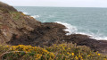
Hike along a coastal path overlooking the sea to Pointe du Meinga, with views of the superb Plage de l'Anse de la Touesse and Pointe du Grouin to the right and Rothéneuf to the left of the tip.
On the Emerald Coast between Pointes de la Varde and Pointes du Grouin
 4.78 mi
+289 ft
-312 ft
2h 25
Moderate
Departure from Saint-Coulomb (Ille-et-Vilaine)
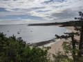
A magnificent GR®34 that, at times, offers passages worthy of a mountain GR®, with magnificent views over the beaches, rocks and sea, not forgetting the multitude of rocky islets visible at low tide but covered at high tide. This short tour of the Côte d'Émeraude gives a magnificent overview.
Pointe du Meinga, Île Besnard and Havre de Rothéneuf
 4.63 mi
+249 ft
-249 ft
2h 20
Easy
Departure from Saint-Coulomb (Ille-et-Vilaine)
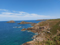
The rocky Pointe du Meinga, the large Plage des Chevrets beach, Île Besnard, which has become a peninsula closing off the Havre de Rothéneuf, offer a magnificent panorama that changes with the tides.The harbour of Rothéneuf or Lupin is a renowned site for birdwatching in lagoon areas.
Between land and sea towards the chapels of Saint-Vincent and Notre-Dame des Flots
 4.02 mi
+171 ft
-177 ft
2h 00
Easy
Departure from Saint-Coulomb (Ille-et-Vilaine)
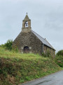
Between the land and the Emerald Coast, this protected natural area invites you to go hiking and enjoy its ever-changing panoramic views. Breathe in the air of Brittany between Saint-Malo and Saint-Coulomb for a breath of fresh air along the customs officers' path, its beaches, windy points and inland areas. Set off to explore its secret chapels and magnificent manor houses.
Saint-Léonard, Les Ormes and the ‘White City’
 7.41 mi
+108 ft
-105 ft
3h 30
Moderate
Departure from Epiniac (Ille-et-Vilaine)
The route takes you through the Domaine des Ormes Park, which has been developed as a luxury campsite. It then leads you through the countryside along wooded paths and small roads. With a bit of luck, if you keep quiet, you might spot some large game, including wild boar, and no doubt some birds such as little egrets, great egrets or grey herons.
No particular difficulty.