Country:
 City:


Park in the car park by the cemetery at the entrance to the village of La Fresnais, or in the car park by the train station, just past the railway line.
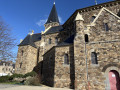
(S/E) On the right, take Rue de la Gare, which runs alongside the town hall on the left and the Church of Sainte-Meén and Sainte-Croix on the right.
(1) At the end of Rue de la Gare, turn right, then left onto Rue de la Chauviette and, continuing on, Rue de la Chenevière (these roads serve the housing estates).
(2) At the end of Rue de la Chenevière, a country road branches off to the right. Take this road and continue straight on. Pass a sewage treatment plant. After 1.6 km, the road leads to the hamlet of Vildé la Marine.
(3) Take the first street on the left, which leads to Place de l’Église Saint-Louis.
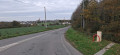
(4) Walk round the church and join the Route du Littoral (D155). Cross it carefully and, on the left, you’ll find the entrance to the narrow path, marked by a stone marker, which leads to the earthen dyke.
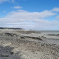
(5) Cross the embankment and head right, towards the east, along the ash-covered path, in the direction of the town of Hirel. You can leave the ash-covered path to get closer to the low-water mark by crossing the salt marshes. There are numerous tracks and paths in the alluvial deposits that have built up over the years. In the event of a spring tide, stay on the Route du Littoral.
(6) At the old Ville ès Brune mill, leave the bay via a well-marked path and cross the sea wall. Carefully cross the coastal road and, on the opposite side, take the track leading to the car park and the campsite.
(7) At the end of this, turn right, then left, and follow the road as it winds through the low-lying fields for 2 km.
(8) Via Rue des Champs, head towards Rue de la Gare.
(1) Turn left and, following the route in reverse to the one you took on the way there, return to the cemetery car park (S/E).
 Association / Club / Walk leader

 Moderate
 Visorando Member