Route Nominoë in Dol-de-Bretagne

Throughout the walk, visitors can explore the town of Dol-de-Bretagne, the Guyoult and the Dol marshes.

Details

960033
Creation:
Last update:
Last review:
  • Walking
    Activity: Walking
  • ↔
    Distance: 5.03 mi
  • ◔
    Average duration: 2h 20 
  • ▲
    Difficulty: Easy

  • ⚐
    Back to start: Yes
  • ↗
    Ascent: + 66 ft
  • ↘
    Descent: - 69 ft

  • ▲
    Highest point: 98 ft
  • ▼
    Lowest point: 16 ft

Photos

Description of the walk

Park near Saint-Samson Cathedral.

(S/E) Set off along Rue du Chanoine Boursier, keeping the monument on your right. In front of the school, turn left and then right to go round the school building.

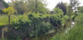
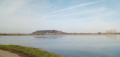
Continue along Promenade Jules Revert to walk alongside the old ramparts. Enjoy the view of the marshes and Mont-Dol. Leave the park and turn left to cross the bridge over the railway lines.

(1) Turn right onto Rue de Verdun. Cross Boulevard de Normandie and continue to the left. After the roundabout, walk along the pedestrian path that runs alongside the boulevard. Cross Rue du Docteur Gringoire and continue along the pedestrian path.

(2) Turn right and cross the railway line. At the right-hand bend, turn left onto Chemin de la Belle Étoile and continue along this small road to the “Belle Étoile” house.

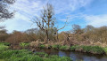
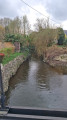
(3) Just before this, head down to the right into the Guyoult valley. Cross the footbridge and follow the stream on your right.

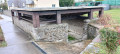
(4) Turning right, cross the Guyoult again and, continuing to the left, pass through the hamlet of Petit Gué. The large building on the left is the old Petit Gué watermill.

After the last house, follow the path on the left which leads back to the banks of the Guyoult and ends at the road at Clos Lupin. Follow this road to the left to reach Rue de Rennes.

(5) Turn right to walk alongside the cemetery and cross to the left at the roundabout. Ignore thefirst street (Rue Pierre Sémard) and turn left onto Boulevard Victor Planson. Cross the railway bridge and turn left twice to continue along Avenue Aristide Briand.

At the roundabout, just before the station, take the street furthest to the right (Rue de Légeard), which leads down towards the Marais de Dol.

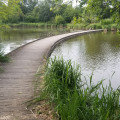
(6) Cross over and take the path slightly to the right leading to the marsh. Take the footbridge and then turn right to cross another footbridge and reach a wide path.

Continue straight ahead with the swimming pool on your left. Carry on straight ahead and walk alongside the new aquatic centre. After a bend to the left, take the first street on the right to reach Rue des Tendières, with a children’s playground opposite on the right.

(7) Turn left and, once you reach Rue des Ponts, continue to the right. Keep right and cross the Moulin bridge. Take a moment to admire the river here.

(8) Cross with great care and go down the few steps to cross the car park. Turn left and, after 50 metres, continue to the right. Walk along the Guyoult towards the north.

(9) Cross the footbridge on the right and join Rue de Saint-Malo. Head down to the right, then turn left in front of the cathedral forecourt to return to the starting point (S/E).


Waypoints

  1. S/E : mi 0 - alt. 56 ft - Car park at Place de la Cathédrale
  2. 1 : mi 0.45 - alt. 62 ft - On the right, Rue de Verdun
  3. 2 : mi 1 - alt. 46 ft - Turn right towards the level crossing
  4. 3 : mi 2 - alt. 89 ft - Belle-Étoile, on the right
  5. 4 : mi 2.61 - alt. 36 ft - Turn right towards Le Petit Gué - Guyoult (fleuve)
  6. 5 : mi 3.27 - alt. 75 ft - Rue de Rennes, on the right
  7. 6 : mi 3.79 - alt. 26 ft - The Dol Marshes
  8. 7 : mi 4.29 - alt. 23 ft - Rue des Tendières, on the left
  9. 8 : mi 4.53 - alt. 26 ft - After the bridge, turn left
  10. 9 : mi 4.83 - alt. 23 ft - Footbridge on the right
  11. S/E : mi 5.03 - alt. 56 ft - Car park at Place de la Cathédrale

Notes

This route is taken from the Rando-guide for the Dol-de-Bretagne region.

This route can only be undertaken during dry weather. Indeed, the River Guyoult can easily burst its banks. The area between (3) and (4) is, in fact, classified as a flood zone.
Also, after (6), if the marshes are impassable, follow Rue de Légeard to the right and take the first street on the left (no cars allowed) towards the swimming pool.

Nominoë: first King of Brittany, crowned in 848. Under the 866 agreement with Pope NicholasI, he placed the city of Dol at the head of the Church of Brittany, replacing the Archbishopric of Tours.

Worth a visit

Saint-Samson Cathedral dates from the 13th century, with its unfinished tower.

The Cathédraloscope: helps visitors understand how these buildings were constructed.

Rue des Stuarts: the town’s main shopping street, with its half-timbered houses featuring porches.

A few kilometres away: Mont-Dol, which, on a clear, unobstructed day, offers a view of the entire Bay of Mont Saint-Michel, from the Abbey to Cancale.

Reviews and comments

3.8 / 5
Based on 6 reviews

Reliability of the description
3.7 / 5
Ease of following the route
3.8 / 5
Route interest
4 / 5
domivasseur2935
domivasseur2935

Overall rating : 4.3 / 5

Date of your route : May 21, 2023
Reliability of the description : ★★★★☆ Good
Ease of following the route : ★★★★☆ Good
Route interest : ★★★★★ Very good
Very busy route : No

A lovely, varied walk: the town, the ramparts, the wetlands, residential areas, a castle… Very varied.
When you reach Boulevard de Normandie, cross over and follow the tree-lined, shaded path, even though the yellow markings have (why!?) been placed on the other side. You’re on the right-hand side to cross the railway line (at the second level crossing) to the right.
No flooding issues today.

Machine-translated

Gisèle 94
Gisèle 94

Overall rating : 2.3 / 5

Date of your route : May 08, 2023
Reliability of the description : ★★★☆☆ Average
Ease of following the route : ★★★☆☆ Average
Route interest : ★☆☆☆☆ Very disappointing
Very busy route : No

We tried to go on this hike on 23 April

  • The section along the boulevard isn’t very pleasant, and the yellow markings are on the opposite side to what the description says....
  • Before reaching La Belle Étoile, you have to go under a motorway (unmarked) and, more importantly, we had to turn back. Two people we met told us that crossing the river was impossible (flooded marshland). Yet it wasn’t a particularly wet time of year. A lady who knew the area well told us it was only passable in summer!

So this really needs to be made clear in the description.

Machine-translated

Gisèle 94
Gisèle 94

Overall rating : 3 / 5

Date of your route : May 08, 2023
Reliability of the description : ★★★☆☆ Average
Ease of following the route : ★★★☆☆ Average
Route interest : ★★★☆☆ Average
Very busy route : No

Walk taken on 23 April 2023

  • The route along the boulevard isn’t very pleasant (and the yellow markings are on the other side of the boulevard)
  • Then on to

Machine-translated

140756Cathy
140756Cathy

Overall rating : 5 / 5

Date of your route : Jun 06, 2022
Reliability of the description : ★★★★★ Very good
Ease of following the route : ★★★★★ Very good
Route interest : ★★★★★ Very good
Very busy route : No

A lovely walk that takes you through the Dol marshes; we did it in March and the marshland was almost impassable as some areas were flooded.
An interesting trip to explore Dol and follow the Petit Guyoult; an added bonus on a Saturday as there’s a lovely market.

Machine-translated

Tesniere Serge
Tesniere Serge

Overall rating : 4 / 5

Date of your route : Oct 09, 2021
Reliability of the description : ★★★☆☆ Average
Ease of following the route : ★★★★☆ Good
Route interest : ★★★★★ Very good
Very busy route : Yes

a lovely route, but the signposting is lacking

Machine-translated

DaDoRando14
DaDoRando14

Overall rating : 4.3 / 5

Date of your route : May 19, 2021
Reliability of the description : ★★★★☆ Good
Ease of following the route : ★★★★☆ Good
Route interest : ★★★★★ Very good
Very busy route : No

It’s a lovely route, but the map is out of date: the route crosses the marshes twice, passing under a new bypass that isn’t marked on the map. Is the GPX track perhaps up to date?

Machine-translated

Other walks in the area

For more walks, use our search engine .

The GPS track and description are the property of this route's author. Please do not copy them without permission.