Country:
 City:
City:


Parking is available at the starting point near Saint-Léonard Church
(S/E) From the square opposite the church, head left onto Rue de la Nouraye, then right onto Rue de l’Église. Take the narrow lane on the left to reach Rue des Écoles. Continue right along the path that extends from it and leads into the woodland. Follow the path opposite until you reach the crossroads.
(1) Take the track on the left, heading due north. Further on, turn right onto a path heading north-east, which leads onto a farm track on the right.
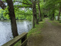
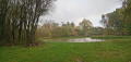
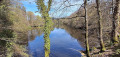
(2) Take this track and you’ll soon be walking alongside a pond. The track leads onto a tree-lined lane.
(3) Pass the gate on your left and head in the opposite direction, i.e. south-west. The avenue slopes gently. After about 300 m, pass between two ponds and turn left. At the end of the path, head towards the castle on the right.
(5) The path splits in two; take the left-hand one and continue. Keep to the right and look out for a path on the left after you’ve passed two ponds.
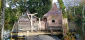
(6) Follow the path, which curves to the left and leads to a hamlet. Keep to the right. The stone houses are soon replaced by more modern-style houses. Admire the beautiful thatched cottage on the left. As you leave the hamlet, keep to the right to enter the woodland. Cross a stream.
(7) The path turns to the right. Follow it and take the track on the left at the first junction. At the hamlet of Les Rieux, take the road on the right to join the D795 and follow it to the left until you reach the car park on the right. Cross the D795 carefullyand reach the car park.
(8) A signpost marks the start of a path under the trees. Take this path, which further on becomes a gravel track. At the junction, take the road on the left for about 450 m.
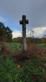
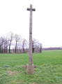
(9) Then turn onto the farm track on the right; after about 170 m, take a path on the left and head towards the hamlet of La Clouyère. Return to the road and follow it to the right towards La Ville Blanche and La Basse Barbotais. Continue along the road until you reach the wayside cross on the left-hand side of the road.
(10) Take the grassy path on the left which runs along the edge of the woods. Follow the path as it veers to the right towards La Basse Barbotaie. This section of the route can be quite strenuous. If so, continue along the road to La Basse Barbotais. 160 m after La Basse Barbotais, take the farm track on the right to join the D795.
(11) Follow it to the right , then cross it carefully and take the road towards the Domaine des Ormes. Before the gates leading into the estate, take the road on the left and continue along the path that runs alongside it until you reach the wayside cross on the right. Take the road on the right as far as the bridge.
(12) Take the path on the left to go round the swimming pool and follow the road to the right; shortly afterwards, take the path on the right overlooking the pond.
(13) At the crossroads, take the road on the left and carry on straight ahead until you reach the car park (S/E).
 Association / Club / Walk leader

 Easy
Easy 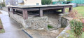
 Visorando Member