Pointe du Meinga and Roz Ven Beach

This section ofthe GR® 34 leading to Pointe du Meinga is a must-do walk when staying in the Saint-Malo–Saint-Coulomb area.
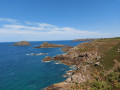
From the top of the 46-metre cliff, the view stretches from Cap Fréhel to the Pointe du Grouin, with the Chausey Islands on the horizon.
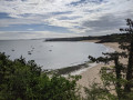
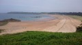
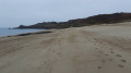
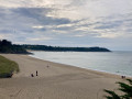
Pointe du Meinga is bordered to the west by the large beach of La Guimorais (part of which is a naturist beach) and to the east, in the Anse de la Touesse, by Roz Ven beach.

Details

36003696
Creation:
Last update:
Last review:
  • Walking
    Activity: Walking
  • ↔
    Distance: 4.24 mi
  • ◔
    Average duration: 2h 10 
  • ▲
    Difficulty: Moderate

  • ⚐
    Back to start: Yes
  • ↗
    Ascent: + 289 ft
  • ↘
    Descent: - 299 ft

  • ▲
    Highest point: 144 ft
  • ▼
    Lowest point: 26 ft

Photos

Description of the walk

Park in the large Les Chevrets car park at La Guimorais (Saint Coulomb).

(S/E) From the far end of the car park (on the left-hand side), join the tarmac path (GR® 34 – Tour du Pays Malouin), and follow it to the right until you reach the top of La Guimorais beach.

(1) Take one of the paths leading down to the beach to rejoin theGR® 34.

(2) The steep path passes successively over and in front of two blockhouses built during the last war.

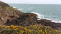
(3) The western slope, battered by the prevailing winds, is covered in low vegetation. After a few rocky sections, you’ll reach the summit of Pointe du Meinga, where the view is breathtaking

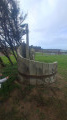
(4) Continue along the eastern side of the massif, where the path is more winding, and leads to a small car park. Follow the path to the left. After overlooking the Anse de la Touesse, the coastal path leads to an imposing flight of steps descending to Roz Ven Beach.

(5) Walk the entire length of the beach, and at the far end, leave it to reach the tarmac road known as the Blé en Herbe.

(6) Turn right onto this road to reach the D201.

(7) Take this on the right – be careful, as it is very busy during the summer months; it is best to use the hard shoulder on the left.

(8) After about 300 m, leave the D201 by turning left onto this country lane (GR® 34). It crosses a small road and leads to a circular loop in the D201. Turn right.

(9) Pass by the hamlet of Le Vieux Châtel and the Anse de La Guimorais, following the departmental road with care.

(10) Leave the D201 and keep to the left-hand side of the road. Enter La Guimorais, where you’ll find the Chevrets car park on your right (S/E).

Waypoints

  1. S/E : mi 0 - alt. 112 ft - Les Chevrets car park
  2. 1 : mi 0.34 - alt. 112 ft - Path to the beach
  3. 2 : mi 0.61 - alt. 105 ft - Blockhouse
  4. 3 : mi 1.06 - alt. 108 ft - Pointe du Meinga
  5. 4 : mi 1.69 - alt. 72 ft - Car park
  6. 5 : mi 2.03 - alt. 49 ft - End of the beach
  7. 6 : mi 2.62 - alt. 39 ft - Beach walk
  8. 7 : mi 2.87 - alt. 125 ft - D201 road
  9. 8 : mi 3.03 - alt. 118 ft - Country lane
  10. 9 : mi 3.73 - alt. 69 ft - Le Vieux Châtel
  11. 10 : mi 3.95 - alt. 98 ft - Entrance to La Guimorais
  12. S/E : mi 4.24 - alt. 112 ft - Les Chevrets car park

Notes

Depending on the weather conditions, the path has sections exposed to strong north-westerly winds.

Worth a visit

Le Vieux Châtel: only the round dovecote with its slate roof (restored) remains of a 15th-century complex comprising a castle, a mill and a chapel.

Villa Roz Ven: this grey sandstone manor house was purchased by the writer Colette in 1910. She lived there until 1924. Now privately owned, the manor house is currently undergoing restoration.

The ‘malouinières’: see the Visorando website for the route entitled: ‘Circuit des Malouinières de Saint Coulomb’.".... : '

Always be cautious and plan ahead when you're outdoors. Visorando and the author of this route cannot be held responsible for any accidents occurring on this route.

The GR® and PR® markings are the intellectual property of the Fédération Française de Randonnée Pédestre.

Reviews and comments

4.8 / 5
Based on 2 reviews

Reliability of the description
5 / 5
Ease of following the route
4.5 / 5
Route interest
5 / 5
mpbn
mpbn
• Edited:

Overall rating : 4.7 / 5

Date of your route : Sep 06, 2026
Reliability of the description : ★★★★★ Very good
Ease of following the route : ★★★★☆ Good
Route interest : ★★★★★ Very good
Very busy route : No

A lovely walk. Beautiful views. A bit steep in places, but that’s what makes it so charming. As for parking, there were very few spaces available, but it was a Sunday and the weather was lovely.

Machine-translated

maryv27MP
maryv27MP

Overall rating : 5 / 5

Date of your route : Apr 22, 2024
Reliability of the description : ★★★★★ Very good
Ease of following the route : ★★★★★ Very good
Route interest : ★★★★★ Very good
Very busy route : No

This section of the customs path is VERY, VERY steep!!!
It takes 2.30 hours for GOOD walkers, but for a group of 20 people who aren’t too used to it,
you’ll need to allow 3.30–4 hours!!
Be careful, especially if it’s very windy!
But the route is very easy to follow!

Machine-translated

Other walks in the area

For more walks, use our search engine .

The GPS track and description are the property of this route's author. Please do not copy them without permission.