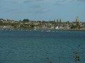
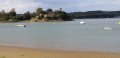
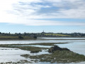
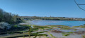
L’Anse des Bas Champs, the bridges over the Rance from La Ville-ès-Nonais

The Anse des Bas Champs in La Ville-es-Nonais is a coastal marsh whose reed beds are home to numerous species of birds. Nestled at the far end of the cove is the peaceful hamlet of La Chapelle Saint-Magloire.
This section ofthe GR® Tour du Pays Malouin takes you to the foot of the two iconic bridges of the Rance Valley: the Pont Saint-Hubert and its counterpart, the Pont Chateaubriand. Both span the Rance where it narrows, linking Plouër-sur-Rance (Côtes d’Armor department) to La Ville-ès-Nonais (Ille-et-Vilaine department).

Details

n°32325515
Creation:
Last update:
Last review:
  • Walking
    Activity: Walking
  • ↔
    Distance: 4.55 mi
  • ◔
    Average duration: 2h 20 
  • ▲
    Difficulty: Easy

  • ⚐
    Back to start: Yes
  • ↗
    Ascent: + 282 ft
  • ↘
    Descent: - 279 ft

  • ▲
    Highest point: 148 ft
  • ▼
    Lowest point: 23 ft

Photos

Description of the walk

Park on the outskirts of La Ville-ès-Nonais in the cemetery car park next to the town hall.

(S/E) Walk alongside the cemetery towards the Rance Valley via Rue de Vigneux.

(1) At the statue of the Virgin Mary, turn right and take the country lane. Please note: do not take the path that continues from Rue de Vigneux, as it no longer provides direct access to the coastal path.

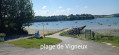
(2) At the sewage treatment works, leave the country lane and join the coastal path on the left, then follow the shoreline. The path leads to the campsite and the jetty with its pontoon.

.(3) Cross the road and join the path. The steep climb is made easier by the log steps. The path overlooks the Rance and offers fine views of the two bridges. It passes under power lines and the deck of the Chateaubriand Bridge.

(4) At the end of the path, take the steps on the left which lead down to the hamlet of Port Saint-Jean. After 50 m along Rue du Port, turn right onto Rue des Terre Neuvas. Leave this street after 150 m via the cobbled steps leading down to the road that runs along the shore (Rue des Cales).
At the end of the road, continue along the coastal path which follows the curve of the cove to the hamlet of La Chapelle Saint-Magloire.

(5) At the entrance to the hamlet, turn left onto Route de la Chapelle until you reach the T-junction. Turn left onto Route de la Ville Cadiou, which passes under the N176 and leads to the entrance to La Ville-ès-Nonais.

(6) At the entrance sign, take the path on the right which goes round some new housing estates and leads onto the village’s main street: Rue Jacques Cartier (D366).

(7) Turn left onto this road, then take a detour right onto Rue Duguesclin to pass by the church and its garden, and the town hall. You’ll come out onto Rue de la Rance; follow it to the right towards the cemetery car park (S/E).

Waypoints

  1. S/E : mi 0 - alt. 135 ft - Cemetery car park
  2. 1 : mi 0.23 - alt. 131 ft - Stele of the Virgin Mary with votive offerings
  3. 2 : mi 0.52 - alt. 36 ft - Wastewater treatment plant
  4. 3 : mi 1.01 - alt. 33 ft - Steep climb – log steps
  5. 4 : mi 1.69 - alt. 72 ft - Concrete steps - Rance (fleuve)
  6. 5 : mi 2.91 - alt. 33 ft - Hamlet: La Chapelle Saint-Magloire
  7. 6 : mi 3.58 - alt. 125 ft - Sign for Ville-ès-Nonais
  8. 7 : mi 3.94 - alt. 141 ft - Rue Jacques Cartier
  9. S/E : mi 4.55 - alt. 138 ft - Cemetery car park

Notes

- The route is signposted in yellow and red.
- Public toilets are located next to the church.

Worth a visit

La Ville-es-Nonais takes its name from the presence of a community of Benedictine nuns, whose convent was closed in 1621. It was not until 1850 that the commune became independent; previously, its parish had been attached to Saint-Suliac.

The Pont Saint Hubert, a 173-metre suspension bridge designed in 1901 and completed in 1928, brought an end to the reliance on ferry crossings – the only means of connecting the two banks of the Rance. Destroyed by Allied bombing in June 1944, it was subsequently rebuilt.
The Pont Chateaubriand (1991), which runs parallel to it, is a single-arch concrete bridge with a span of 250 metres. It is the first bridge of its kind in Brittany.
Well worth a visit is the village of Saint-Suliac, one of the most beautiful villages in France.

Always be cautious and plan ahead when you're outdoors. Visorando and the author of this route cannot be held responsible for any accidents occurring on this route.

The GR® and PR® markings are the intellectual property of the Fédération Française de Randonnée Pédestre.

Reviews and comments

4 / 5
Based on 2 reviews

Reliability of the description
4 / 5
Ease of following the route
4 / 5
Route interest
4 / 5
Isa35
Isa35

Overall rating : 4 / 5

Date of your route : Apr 04, 2026
Reliability of the description : ★★★★☆ Good
Ease of following the route : ★★★★☆ Good
Route interest : ★★★★☆ Good
Very busy route : No

A lovely, easy walk with stunning views of the Rance.
The descent down the sunken path at the start can be tricky after wet weather.

Machine-translated

jacdav35
jacdav35
• Edited:

Overall rating : 4 / 5

Date of your route : Oct 13, 2024
Reliability of the description : ★★★★☆ Good
Ease of following the route : ★★★★☆ Good
Route interest : ★★★★☆ Good
Very busy route : Yes

A easy route with lovely views over the Rance; have a picnic near the Vigneux slipway – tables are available
between point (5) and point (6); please be aware of heavy traffic
A lovely walk

Machine-translated

Other walks in the area

For more walks, use our search engine .

The GPS track and description are the property of this route's author. Please do not copy them without permission.