


Refine your search for walks in Guagno
Guagno walks


 Monte Tretorre from Guagno
 Visorando Member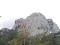
 6.93 mi
 +2,825 ft
 -2,815 ft
 5h 40
5h 40
 Difficult
 Departure from Guagno (Corse-du-Sud)
This walk leads to the unusual Monte Tretorre (1,506 m), a geological rarity comprising a trifid summit (three sugar loaves) of syenite. This summit offers a superb vantage point, overlooking a dense forest. To the west, Monte Cervellu (1,624 m) towers above.
Lake Creno from Orto
 4.60 mi
+1,683 ft
-1,683 ft
3h 35
Difficult
Departure from Orto (Corse-du-Sud)
4.60 mi
+1,683 ft
-1,683 ft
3h 35
Difficult
Departure from Orto (Corse-du-Sud)
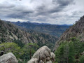
Walk from Orto to Lake Creno. 360° views of the region.
Soccia at Lake Creno
 4.02 mi
+1,004 ft
-997 ft
2h 45
4.02 mi
+1,004 ft
-997 ft
2h 45
 Easy
Departure from Soccia (Corse-du-Sud)
Easy
Departure from Soccia (Corse-du-Sud)
One of the most beautiful hikes in Corsica. The path is pleasant, with part of it in the woods. The arrival at the lake is a magical moment. The lake appears in a setting, even if there are a few people around, the place is conducive to quiet conversation.
A very beautiful place for a picnic.
Vasques du Ziocu in Soccia
 2.48 mi
+495 ft
-495 ft
1h 35
2.48 mi
+495 ft
-495 ft
1h 35
 Moderate
Departure from Soccia (Corse-du-Sud)
Moderate
Departure from Soccia (Corse-du-Sud)
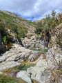
The Ziocu pools are situated both below and above the footbridge where canyoners set off.
Please note: do not undertake this hike in the event of a thunderstorm, as flash floods are possible, as seen during Cévennes-style downpours. The pools are at an altitude of approximately 1,005 to 1,110 metres.
Manganu – Vergio Pass
9.43 mi
+1,588 ft
-2,267 ft
5h 45
Moderate
Departure from Orto (Corse-du-Sud)
Stage8, travelling from south to north. One of the quietest stages.
From the Manganu refuge to the Onda refuge
 Association / Club / Walk leader
 9.30 mi
+4,186 ft
-4,724 ft
7h 55
Difficult
Departure from Orto (Corse-du-Sud)
9.30 mi
+4,186 ft
-4,724 ft
7h 55
Difficult
Departure from Orto (Corse-du-Sud)
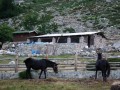
Our seventh stage ofthe GR®20. This route consists of two stages, the first to the Petra Piana refuge, and the second via the ridge variant.
Punta Sant’Eliséo
 4.73 mi
+1,978 ft
-1,965 ft
3h 55
Moderate
Departure from Salice (Corse-du-Sud)
4.73 mi
+1,978 ft
-1,965 ft
3h 55
Moderate
Departure from Salice (Corse-du-Sud)
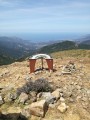
This summit offers a fantastic vantage point over the gulfs of Ajaccio and Sagone, as well as three of the island’s major mountains – a fabulous 360° view.
Please note: some sections require you to use your hands as well as your feet.
Punta Sant'Eliseu from the Col de Tartavello
 4.15 mi
+1,660 ft
-1,660 ft
3h 20
Moderate
Departure from Salice (Corse-du-Sud)
4.15 mi
+1,660 ft
-1,660 ft
3h 20
Moderate
Departure from Salice (Corse-du-Sud)
Through the Corsican vegetation of tree heath, arbutus and pine trees, the discreet path leading to Punta Sant'Eliseu is sometimes peaceful, sometimes challenging. The arrival at the summit offers a superb panoramic view of the bays of Sagone, Liscia and Ajaccio to the west and Monte Renoso and Monte D'Oro to the east. Closer by, below, the villages highlight the gentleness of the Gravone valley.
Circular loop at Le Corbu
 1.81 mi
+587 ft
-610 ft
1h 20
Moderate
Departure from Bocognano (Corse-du-Sud)
1.81 mi
+587 ft
-610 ft
1h 20
Moderate
Departure from Bocognano (Corse-du-Sud)
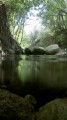
A walk through the pine trees. From the top, you can see the village of Bocognano.
The A Tanedda Glacier
 6.16 mi
+3,343 ft
-3,343 ft
5h 45
6.16 mi
+3,343 ft
-3,343 ft
5h 45
 Very difficult
Departure from Bocognano (Corse-du-Sud)
Very difficult
Departure from Bocognano (Corse-du-Sud)
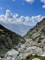
A hike leading to the A Tanedda glacier (or more precisely, the snowfield). This site was used fromthe 17th to the early19th century for the ice trade. After extraction, the ice was transported to Ajaccio. A beautiful ascent, alternating between shaded and sunny areas, which will give you a sense of the harshness of life in days gone by.
Circular Ricchiusa
 3.38 mi
+1,699 ft
-1,696 ft
3h 00
Moderate
Departure from Bocognano (Corse-du-Sud)
3.38 mi
+1,699 ft
-1,696 ft
3h 00
Moderate
Departure from Bocognano (Corse-du-Sud)
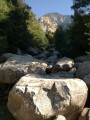
At an altitude of 850 metres, there is a view of Bocognano and the Gravone valley.
u Muricintu sheepfold
 4.96 mi
+2,031 ft
-2,001 ft
4h 05
Moderate
Departure from Bocognano (Corse-du-Sud)
4.96 mi
+2,031 ft
-2,001 ft
4h 05
Moderate
Departure from Bocognano (Corse-du-Sud)
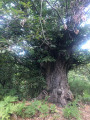
A walk through the hills above Bocognano to reach the u Muricintu sheepfold. After a long climb through chestnut and beech woods, followed by a section along the ridge, you will reach the sheepfold beside a stream and in the cool shade of the alders.
The Voile de la Mariée waterfall from Bocognano
 4.90 mi
+1,135 ft
-1,145 ft
3h 15
Moderate
Departure from Bocognano (Corse-du-Sud)
4.90 mi
+1,135 ft
-1,145 ft
3h 15
Moderate
Departure from Bocognano (Corse-du-Sud)
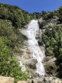
Walk under the oak trees connecting the village of Bocognano to Piscia di Tavera Vechja, also known as the "Voile de la Mariée" waterfall.
The Ciamburanesi fountains
 1.44 mi
+246 ft
-249 ft
0h 55
Easy
Departure from Bocognano (Corse-du-Sud)
1.44 mi
+246 ft
-249 ft
0h 55
Easy
Departure from Bocognano (Corse-du-Sud)
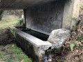
A family walk starting from Bocognano, taking you back in time to the village of yesteryear.
Lake Oriente and the Timozzu sheepfolds
 5.88 mi
+3,527 ft
-3,501 ft
5h 45
Difficult
Departure from Corte (Haute-Corse)
5.88 mi
+3,527 ft
-3,501 ft
5h 45
Difficult
Departure from Corte (Haute-Corse)
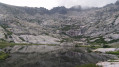
A challenging hike to one of Corsica’s most beautiful lakes, at an altitude of over 2,000 metres.
Please note: read the latest review dated August 2024.
Punta Capiteddu as seen from Bocognano
 5.57 mi
+3,366 ft
-3,360 ft
5h 30
Very difficult
Departure from Bocognano (Corse-du-Sud)
5.57 mi
+3,366 ft
-3,360 ft
5h 30
Very difficult
Departure from Bocognano (Corse-du-Sud)
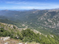
A 1,000-metre ascent, above the village of Bocognano, with some steep sections, awaits hikers on this route. The path is sometimes tricky due to frequent fallen trees, which occasionally alter the route. Markings become sparser in the final third. The use of a GPS and walking poles is strongly recommended.