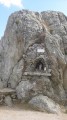
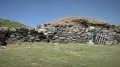
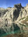
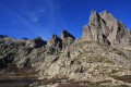
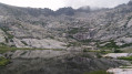
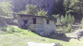
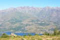
The Cappelaccia and Alzo sheepfolds as seen from the Frasseta Bridge

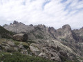
You’ll be delighted by the unique view of the Cappelaccia sheepfolds. We are now at the highest point of the vast Alzo plateau and can enjoy a magnificent panoramic view stretching from Rotondo to Cinto, via Punta Artica and Paglia Orba. A large sign and red markings show us the way forward.

Details

843126
Creation:
Last update:
Last review:
  • Walking
    Activity: Walking
  • ↔
    Distance: 6.61 mi
  • ◔
    Average duration: 5h 20 
  • ▲
    Difficulty: Moderate

  • ⚐
    Back to start: Yes
  • ↗
    Ascent: + 2,641 ft
  • ↘
    Descent: - 2,644 ft

  • ▲
    Highest point: 5,407 ft
  • ▼
    Lowest point: 2,995 ft

Photos

Description of the walk

Reach the Restonica Valley via the D623. Park in the free car park at Pont de Frasseta. Please note: limited spaces.

(S/E) Follow the D623 for about fifty metres.

(1) A large sign and red markings show you the path to take, which is on the right. You’ll pass a cistern (reservoir), then the path winds its way uphill.

(2) After about 15 minutes, the path branches off to the left, but ignore this and turn right (signposted ‘Bergerie des Grotelles / Refuge de la Sega’). This is followed by a fairly long traverse across the hillside, from where you can see Pic Lombarducio at the far end of the Restonica Valley. Further on, the well-maintained path, marked in red, is clearly visible.

(3) Cross the first stream (Funtana Bianca) and then a second one about 200 metres further on.

(4) Continue climbing the winding path towards the Cappellaccia sheepfolds, which you’ll soon come to see. Turn right to reach them.

(5) Cappellaccia sheepfolds (1,650 m). Here, we can take a break; there is a water source (well).
Resume the path to reach, not far from here, the unusual sheepfolds of Colletta.

(6) Continue down the red-marked path towards the high plateau to reach the Alzo sheepfold. You can buy some cheese here, and do make sure you have a chat with Joseph the shepherd’s father – he’ll be delighted.

(7) Follow the same route back to the starting point at the Pont de la Frasseta (S/E).

Waypoints

  1. S/E : mi 0 - alt. 2,999 ft - Pont de Frasseta car park
  2. 1 : mi 0.05 - alt. 3,018 ft - Signpost and red markings, to the right
  3. 2 : mi 0.51 - alt. 3,376 ft - Junction, turn right
  4. 3 : mi 1.64 - alt. 4,767 ft - Funtana Bianca stream
  5. 4 : mi 2.23 - alt. 5,066 ft - Hairpin bends leading to the sheepfold
  6. 5 : mi 2.53 - alt. 5,407 ft - The Cappelaccia sheepfolds, 1,650 m
  7. 6 : mi 2.74 - alt. 5,361 ft - The unusual sheepfolds at Colletta
  8. 7 : mi 3.35 - alt. 5,194 ft - The Alzo sheepfold
  9. S/E : mi 6.61 - alt. 2,995 ft - Pont de Frasseta car park

Notes

Sturdy walking boots, walking poles and warm clothing. Good physical fitness.

Route recorded using a Twonav Sportiva 2 GPS.

(5) Water source (well) at the Cappelaccia sheepfolds.

(6) Those wishing to continue the adventure will come across the Alzo forest lodge shortly after passing a mountain hut. From there, the well-marked path to the left leads to the Refuge de la Sega.

Worth a visit

(2) Photo of Pic Lombarducio to be taken.

(5) Magnificent view of Paglia Orba (see my photos). Paglia Orba is a mountain peak in the Cinto massif in Corsica. It rises to an altitude of 2,525 metres, at the upper junction of the Golo (in the Niolo) and Cavicchia (in the Filosorma) valleys. Relatively isolated, this peak—remarkable for its distinctive tooth-shaped silhouette—dominates the Fango valley and the island’s western coast.
Straddling the municipalities of Albertacce and Manso, Paglia Orba is the second-highest peak in the central range and the Filosorma range, after Punta Minuta (2,556 m).

Cheese is sold in season at the Alzo sheepfolds.

(7) Meet Joseph Sabiani’s father, the shepherd from Corte: it’s well worth a visit; indeed, a fine book published by Desjobert is dedicated to him. It is entitled*In Joseph’s Footsteps* and traces Joseph Sabiani’s life over four seasons.

Reviews and comments

4.2 / 5
Based on 3 reviews

Reliability of the description
3.3 / 5
Ease of following the route
4.7 / 5
Route interest
4.7 / 5
Monique Schmitt
Monique Schmitt

Overall rating : 5 / 5

Date of your route : May 31, 2026
Reliability of the description : ★★★★★ Very good
Ease of following the route : ★★★★★ Very good
Route interest : ★★★★★ Very good
Very busy route : No

Hike taken on 22 May in glorious weather. The route is stunning all the way along, with beautiful flora at this time of year, and opens up to a 360-degree panorama at the sheepfolds where we had a picnic. There were very few people about, as most hikers head towards the Grotelle sheepfolds and the lakes. We much preferred this walk to the one to Lake Mélo for the scenery, as it is set in a more enclosed valley

Machine-translated

Incantesimu
Incantesimu

Hello,
The distances recorded by my GPS (Twonav Sportiva 2) come to 12.17 km – a slight discrepancy compared to yours. I don’t know why there’s this discrepancy (10.64 km) on Visorando; you’ll have to check with them. In any case, the distances recorded by our GPS devices aren’t very different. As for the elevation gain, I recorded 1,109 metres uphill and 1,114 metres downhill – another unexplained discrepancy. The time taken for this hike, according to my GPS, is still 6 hours 20 minutes, including a 2-hour break, which is roughly in line with your time. This isn’t the first time comments have been made on this subject; for more information, ask them what they think so you can get to the bottom of it. Welcome to Corsica
Incantesimu

Machine-translated

abalmas
abalmas

Overall rating : 3.7 / 5

Date of your route : Apr 12, 2023
Reliability of the description : ★☆☆☆☆ Very disappointing
Ease of following the route : ★★★★★ Very good
Route interest : ★★★★★ Very good
Very busy route : No

A steady climb all the way
A stunning view as you reach the plateau
The distances and elevation gains are incorrect: measured on Garmin: 12 km and 800 m, with a walking time of 4 hours 30 minutes

Machine-translated

cavallier8301
cavallier8301

Overall rating : 4 / 5

Date of your route : Dec 03, 2017
Reliability of the description : ★★★★☆ Good
Ease of following the route : ★★★★☆ Good
Route interest : ★★★★☆ Good

It’s a real classic in this area. Even with a bit of snow, it’s lovely! It doesn’t take much effort, and there’s a real sense of satisfaction at the end of the walk! I’ll be back soon. If you carry on a bit further to the forest lodge, you can have lunch on the grass (what’s left of it) and out of the wind!

Machine-translated

Other walks in the area

For more walks, use our search engine .

The GPS track and description are the property of this route's author. Please do not copy them without permission.