Refuge A Sega – Corte

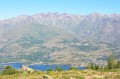
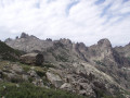
The second stage of the “Circular Tour of Two Vallées” takes you into one of Corsica’s wildest and best-preserved valleys: the Tavignanu Valley.

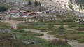
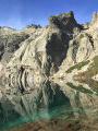
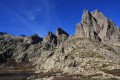
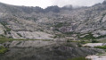
From the A Sega mountain hut, situated on the banks of the Tavignanu, the path follows the river and descends gradually through a dense forest where Laricifolius pines and holm oaks grow side by side. Along the way, you’ll enjoy numerous viewpoints over the steep-sided gorges and pools of crystal-clear water that dot the river. Halfway along the route, you can stop for a break at the Rossulinu Footbridge before continuing on the less steep but equally spectacular section of the trail, which will gently lead you towards Corte.

This walk is part of a multi-day hike: La boucle des deux vallées de la Restonica au Tavignanu

Details

69179083
Creation:
Last update:
Last review:
  • Walking
    Activity: Walking
  • ↔
    Distance: 7.71 mi
  • ◔
    Average duration: 4h 35 
  • ▲
    Difficulty: Moderate

  • ⚐
    Back to start: No
  • ↗
    Ascent: + 1,171 ft
  • ↘
    Descent: - 3,501 ft

  • ▲
    Highest point: 3,839 ft
  • ▼
    Lowest point: 1,480 ft
  • ⚐ Country: France
  • ⚐ City: Corte (20250)
  • ⚑
    Start: N 42.286855° / E 9.037992°
  • ⚑
    End: N 42.308584° / E 9.146608°
  • ❏
    IGN map(s): Ref. 4250OT, 4250OTR, 4251OT, 4251OTR
  • Hour-by-hour weather

Description of the walk

(S) From the Refuge A Sega, cross the river via the footbridge and follow the path to the left, which begins a gentle descent, winding through a magnificent forest of Laricio pines. This first section is particularly pleasant, offering numerous views of the Tavignanu Gorges, whose crystal-clear waters contrast with the rocky cliffs. After about two hours’ walk, you’ll reach the Rossulinu footbridge.

(1) Cross this lovely wooden suspension bridge to get over the river. Halfway through the walk, this spot marks an important milestone where you can take a break by the river and top up your water supplies at the spring. Then continue along the path, which gradually descends towards the stream and the little cottage at Antia. The landscape changes gradually, with the Laricifolium pine forest giving way to more Mediterranean vegetation, dominated by holm oaks and maquis shrubs. You’ll reach the stream and Antia’s cottage after about an hour and a half’s walk.

(2) Continue along the path, which becomes wider and more peaceful as you approach the town. In the distance, you’ll be able to see the Citadel of Corte perched on its rocky outcrop. You’ll arrive in Corte not far from the Citadel’s car parks (E).

Waypoints

  1. S : mi 0 - alt. 3,822 ft - Starting point: Refuge A Sega - Refuge A Sega
  2. 1 : mi 3.86 - alt. 2,487 ft - Rossulinu Footbridge – Source
  3. 2 : mi 5.62 - alt. 2,001 ft - Antia Stream and Cottage
  4. E : mi 7.71 - alt. 1,490 ft - Arrival in Corte, near the Citadel - Tavignano (fleuve)

Worth a visit

For your information: the name ‘A Sega’ derives from the forestry activities that once took place in this region. In Corsican, ‘sega’ means ‘saw’, referring to the sawmills that were set up in the Tavignanu Valley.

This area was exploited for its timber, particularly the Laricio pine, a valuable species characteristic of Corsica’s mid- and high-mountain forests. The felled timber was then transported along the mule track that descends to Corte. This path was essential not only for transporting timber but also for trade between the villages and the pastoral areas of the Rotondu massif.

With the decline of traditional forestry activities, A Sega has lost its original economic role and has become a popular spot for walkers. Today, the Refuge de la Sega, situated near the lake of the same name, is an unmissable stopover for those walking the Mare a Mare Nord or the circular route of the Deux Vallées.

This historical and natural heritage lends the hike a cultural dimension, highlighting the importance of Corsican forests and the ancient skills that once shaped the lives of the mountain’s inhabitants.

Reviews and comments

5 / 5
Based on 2 reviews

Reliability of the description
5 / 5
Ease of following the route
5 / 5
Route interest
5 / 5
rando_gs
rando_gs

Overall rating : 5 / 5

Date of your route : Oct 06, 2025
Reliability of the description : ★★★★★ Very good
Ease of following the route : ★★★★★ Very good
Route interest : ★★★★★ Very good
Very busy route : Yes

A beautiful route that follows the Tavignano from pool to pool and also overlooks it.
It gets busy towards the end as you approach Corte, which is to be expected!

Machine-translated

PierrePaul1951
PierrePaul1951

Overall rating : 5 / 5

Date of your route : Jul 21, 2025
Reliability of the description : ★★★★★ Very good
Ease of following the route : ★★★★★ Very good
Route interest : ★★★★★ Very good
Very busy route : No

Very beautiful route. The first part is in the forest with a swimming spot, and the last part is at the footbridge when you cross to the north bank of the Tavignano to descend to Corte. The path is more exposed to the sun.

Machine-translated

Other walks in the area

For more walks, use our search engine .

The GPS track and description are the property of this route's author. Please do not copy them without permission.