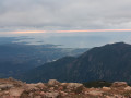
Punta Sant’Eliseu from Tavaco

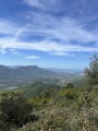
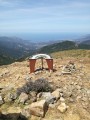
This walk starts in the heart of the village of Tavaco, situated in a lush green valley surrounded by imposing mountains, and leads to Punta Sant’Eliseu and its orientation table.

Details

48913537
Creation:
Last update:
Last review:
  • Walking
    Activity: Walking
  • ↔
    Distance: 4.85 mi
  • ◔
    Average duration: 4h 30 
  • ▲
    Difficulty: Moderate

  • ⚐
    Back to start: Yes
  • ↗
    Ascent: + 2,582 ft
  • ↘
    Descent: - 2,595 ft

  • ▲
    Highest point: 4,157 ft
  • ▼
    Lowest point: 1,562 ft
  • ⚐ Country: France
  • ⚐ City: Tavaco (20167)
  • ⚑
    Start/End: N 42.036348° / E 8.89631°
  • ❏
    IGN map(s): Ref. 4151OT, 4252OT, 4252OTR
  • Hour-by-hour weather

Photos

Description of the walk

Please note that the village streets are narrow, so make sure you park properly, for example at the cemetery at the very top.

(S/E) Continue to the end of the road.

(1) Turn right onto the path that climbs and runs alongside the small stream (if there’s still water in it) on your right.

(2) Carry on along the path, which is cleared, passable and easy to walk on.

(3) Enter the woodland and carry on.

(4) Emerge from the woodland, turn right and reach the first ridge.

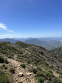
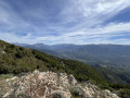
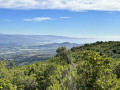
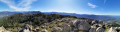
(5) Carry on, enjoying the view, until you reach the southern shoulder of Punta Sant’Eliseu, which offers a magnificent panoramic view.

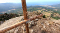
(6) Turn right: your final destination is now in sight. Continue along the ridge towards the solar panels and the aerial visible on the high point. Reach the summit.

(7) Follow the ascent route in reverse to return to the car park next to the cemetery (S/E).

Waypoints

  1. S/E : mi 0 - alt. 1,575 ft - Cemetery
  2. 1 : mi 0.05 - alt. 1,572 ft - Start of the trail, signpost
  3. 2 : mi 0.44 - alt. 2,024 ft - Continue along the path
  4. 3 : mi 0.67 - alt. 2,333 ft - Entering the woodland
  5. 4 : mi 1.49 - alt. 3,524 ft - Walk through the woodland
  6. 5 : mi 1.71 - alt. 3,638 ft - First ridge
  7. 6 : mi 2.06 - alt. 3,868 ft - Second ridge
  8. 7 : mi 2.45 - alt. 4,114 ft - Pointe San Eliseu
  9. S/E : mi 4.85 - alt. 1,562 ft - Cemetery

Notes

Take plenty of water with you; the elevation gain is significant.
Make sure you’re wearing good walking shoes, as the path is very stony.
Take regular breaks and stay hydrated.

Reviews and comments

4.8 / 5
Based on 2 reviews

Reliability of the description
5 / 5
Ease of following the route
5 / 5
Route interest
4.5 / 5
User 30389201

Overall rating : 5 / 5

Date of your route : Aug 24, 2026
Reliability of the description : ★★★★★ Very good
Ease of following the route : ★★★★★ Very good
Route interest : ★★★★★ Very good
Very busy route : No

What a hike! A bit of a workout, but the scenery was breathtaking!
We came across a herd of goats and a few wild boars.

Machine-translated

User 3827151

Overall rating : 4.7 / 5

Date of your route : Oct 01, 2025
Reliability of the description : ★★★★★ Very good
Ease of following the route : ★★★★★ Very good
Route interest : ★★★★☆ Good
Very busy route : No

A beautiful hike, completed in 2.5 hours by walking really fast and taking only a short break at the summit. The path is easy to follow but extremely rocky, so be sure to wear sturdy shoes for the descent. The climb is really steep with almost no flat areas, like a real staircase. Superb 360° view from the top

Machine-translated

Other walks in the area

For more walks, use our search engine .

The GPS track and description are the property of this route's author. Please do not copy them without permission.