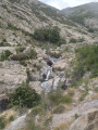
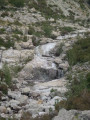
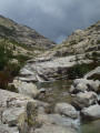
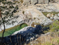
Vasques du Ziocu in Soccia

The Ziocu pools are situated both below and above the footbridge where canyoners set off.
Please note: do not undertake this hike in the event of a thunderstorm, as flash floods are possible, as seen during Cévennes-style downpours. The pools are at an altitude of approximately 1,005 to 1,110 metres.

Details

4387511
Creation:
Last update:
Last review:
  • Walking
    Activity: Walking
  • ↔
    Distance: 2.48 mi
  • ◔
    Average duration: 1h 35 
  • ▲
    Difficulty: Moderate

  • ⚐
    Back to start: Yes
  • ↗
    Ascent: + 495 ft
  • ↘
    Descent: - 495 ft

  • ▲
    Highest point: 3,619 ft
  • ▼
    Lowest point: 3,278 ft
  • ⚐ Country: France
  • ⚐ City: Soccia (20125)
  • ⚑
    Start/End: N 42.195893° / E 8.917077°
  • ❏
    IGN map(s): Ref. 4251OT, 4251OTR
  • Hour-by-hour weather

Photos

Description of the walk

Park at the car park at the start of the Lac de Creno walk: please note that you’ll need to get there very early in July and August.

(S/E) Take the access path to Lac de Creno for about a hundred metres until you reach the donkey and horse hire place. 50 metres further on, leave the Lac de Creno access path, turn left uphill and take the track that runs on level ground for 15 to 20 minutes.

(1) Beneath the huge chestnut trees, look for a path below the track that winds more or less in zigzags down through the bramble thickets to the stream. Turn right and follow it upstream for a few minutes, then rejoin the track, which you follow to the footbridge where canyoning enthusiasts set off.

(2) Cross the footbridge and walk upstream along the right bank of the stream, then move closer to it.

(3) A sloping rock slab with a waterfall, pools and hanging gardens: you’re in paradise.
You can follow the stream upstream as far as the bend and probably beyond.

(4) The return journey follows the same route back to the car park (S/E).

Waypoints

  1. S/E : mi 0 - alt. 3,333 ft - Lac de Creno car park
  2. 1 : mi 0.5 - alt. 3,409 ft - Large chestnut trees – Fork in the path
  3. 2 : mi 0.86 - alt. 3,428 ft - Footbridge where the canyoners set off
  4. 3 : mi 1.1 - alt. 3,527 ft - Sloping slab
  5. 4 : mi 1.24 - alt. 3,619 ft - End of the ascent up the stream
  6. S/E : mi 2.48 - alt. 3,333 ft - Lac de Creno car park

Notes

Warning: below the point where you reach the stream, the slope isn’t very steep, but very quickly the Ziocu narrows into a canyon. Do not enter the canyon without a guide or escort: you can find several companies offering this service in the car park.

Do not approach the stream in the event of thunderstorms, even if they are distant: unfortunately, there is a risk of flash floods.
Check the weather forecast and the fire risk map: this map shows, on a daily basis, which mountain ranges are off-limits or subject to restrictions; it isn’t very well known but is well worth a look: http://emz.pont-entente.org/maps/2A/.

At around 1,100 m, there used to be a mirror-like pool, a pool that overflowed. But it seems to have drained away from below.
The area is splendid: as you climb, you can see the path leading up to Lac de Creno on your right, with hundreds of people on it, whilst you’re probably on your own.

You should probably be able to climb higher still. It’s possible to cut across to rejoin the path to Lac de Creno, but sometimes making your way through the vegetation – even the low-lying kind – isn’t straightforward, and you risk disturbing the herds.

Reviews and comments

3.3 / 5
Based on 7 reviews

Reliability of the description
3.1 / 5
Ease of following the route
2.6 / 5
Route interest
4.1 / 5
User 10280836

Overall rating : 5 / 5

Date of your route : Oct 06, 2025
Reliability of the description : ★★★★★ Very good
Ease of following the route : ★★★★★ Very good
Route interest : ★★★★★ Very good
Very busy route : Yes

A truly beautiful place.

Machine-translated

ROUX Bruno
ROUX Bruno

Hello, unfortunately for you: yes, there is a wire fence to prevent swimming at the water intakewater intake, but on the right bank, so on the left as you head upstream along the stream. At one point, you’ll need to move away from the fence by about thirty metres – these are paths used by cows or goats, so they can change from one year to the next – but a little further up from where the fence ends, there are some superb pools. I’d need to go back there to record a new route
Enjoy your stay in Corsica

Machine-translated

harmonobe
harmonobe

Overall rating : 3.3 / 5

Date of your route : Sep 12, 2024
Reliability of the description : ★★★☆☆ Average
Ease of following the route : ★★☆☆☆ Disappointing
Route interest : ★★★★★ Very good
Very busy route : No

To get to the pools, it’s best to follow the path marked on this route (Point 1: turn at the large chestnut trees) and enjoy the area. To reach the canyoners’ footbridge, stay on the main path. To go any further, the path is closed; and further up, on both the right and left banks, the area is fenced off, making access to the pools impossible. Today, it’s impossible to find a proper path (nature is reclaiming its rights) to reach Points 3 and 4. Apparently, this area is off-limits to protect the natural environment and the water catchment!

Machine-translated

fafa2b
fafa2b

Hello,
this confirms that I couldn’t go on that hike when we were there. Nature is reclaiming its territory. It’s a shame, as the pools must be beautiful.

Machine-translated

Mathieu82
Mathieu82

Overall rating : 1.7 / 5

Date of your route : Jul 22, 2024
Reliability of the description : ★☆☆☆☆ Very disappointing
Ease of following the route : ★☆☆☆☆ Very disappointing
Route interest : ★★★☆☆ Average
Very busy route : No

After the footbridge, it was impossible to follow a path. There were brambles everywhere; we tried for 30 minutes but it was impassable every time. A shame. There were quite a few cows on the path and beyond the footbridge.

Machine-translated

lmrcho49
lmrcho49

Overall rating : 4 / 5

Date of your route : Jun 13, 2024
Reliability of the description : ★★★★☆ Good
Ease of following the route : ★★★☆☆ Average
Route interest : ★★★★★ Very good
Very busy route : No

An interesting trail. However, the route can be difficult to find at times, BUT IT IS POSSIBLE. You’ll need to follow the comments to find your way. At point 1 on the route, do not follow the track shown on the map through the scrub, but follow the path to the footbridge where the canyoners set off. Please note: it can be difficult to find the path above the footbridge. Follow the start of the path and continue straight ahead. Once you reach the rocky outcrop, move 15 metres away from the fence and find the path that allows you to continue on your way.

Machine-translated

fafa2b
fafa2b

Thank you for your reply.
Kind regards.

Machine-translated

ROUX Bruno
ROUX Bruno

Hello, just beyond the footbridge, the path is passable for about a hundred metres
At one point, after passing some large trees, it does indeed come close to the fence protecting the cattle’s water intake.
And there you have to climb onto the slab along an unmarked and unsignposted path – as it’s on the granite slab – which I estimate to be barely fifty metres from the fence as the crow flies. Then, once past the slab, it’s a faint track, or rather a cattle track, through the vegetation. There are no signposts and no marked path with signposts. At one point, the path descends slightly into a hollow which must in fact cross a spring.
In fact, if you stick to the fence, it’s very difficult to get through.
This ‘vague path’, which leads to some beautiful pools and granite slabs carved by the water, should therefore only be taken if you have an adventurous and persevering spirit. If you’re looking for a well-marked, clear path, you should head to Lake Crenu further up, rather than taking this walk.
Have a lovely day

Machine-translated

fafa2b
fafa2b

Hello Mr Roux, could you explain the route you took to get to point 4 shown on the map for this walk?
We wanted to do it this weekend but we followed the protective fencing around the water catchment area for a bit, along a path that was muddy at first and then better marked, but after that it became too risky to carry on. Please tell me how you managed it and which route you took – I’m trying to understand.
Thank you

Machine-translated

fafa2b
fafa2b

So you weren’t able to do it either. This hike is not recommended for inexperienced walkers as it is risky.
Kind regards.

Machine-translated

BAMX
BAMX
• Edited:

Fafa2b, there was indeed the protective fence around the water intake just above the footbridge. We tried climbing up onto the slabs to get back onto the path, but after a while it became too risky and we turned back. And yet I did see some walkers who’d managed to get past, but without any landmarks it’s difficult.

Machine-translated

fafa2b
fafa2b

Overall rating : 3 / 5

Date of your route : Nov 01, 2022
Reliability of the description : ★★★☆☆ Average
Ease of following the route : ★★☆☆☆ Disappointing
Route interest : ★★★★☆ Good
Very busy route : No

Hello, when you went on that walk, was there a wire fence running alongside the river? (to protect the water catchment)
We did the walk this weekend; the path was muddy and then the wire fence stopped us from carrying on after 10 minutes – it was impossible to continue without taking risks.
Which route did you take?
Many thanks,

Machine-translated

BAMX
BAMX
• Edited:

I’ve been criss-crossing Corsica for 11 years now; I know the tracks through the maquis and the difficult paths, but this time it was two of your walks that caused me problems one after the other.

Machine-translated

ROUX Bruno
ROUX Bruno

Hello
Yes, I’m sorry to hear that, but the paths in Corsica are sometimes just vague tracks and are a far cry from the paths in the Compiègne Forest, for example
Bruno

Machine-translated

BAMX
BAMX

Overall rating : 2 / 5

Date of your route : Oct 07, 2022
Reliability of the description : ★★☆☆☆ Disappointing
Ease of following the route : ★☆☆☆☆ Very disappointing
Route interest : ★★★☆☆ Average
Very busy route : No

No signposts, the path was too vague – we had to give up. Very disappointed.

Machine-translated

Other walks in the area

For more walks, use our search engine .

The GPS track and description are the property of this route's author. Please do not copy them without permission.